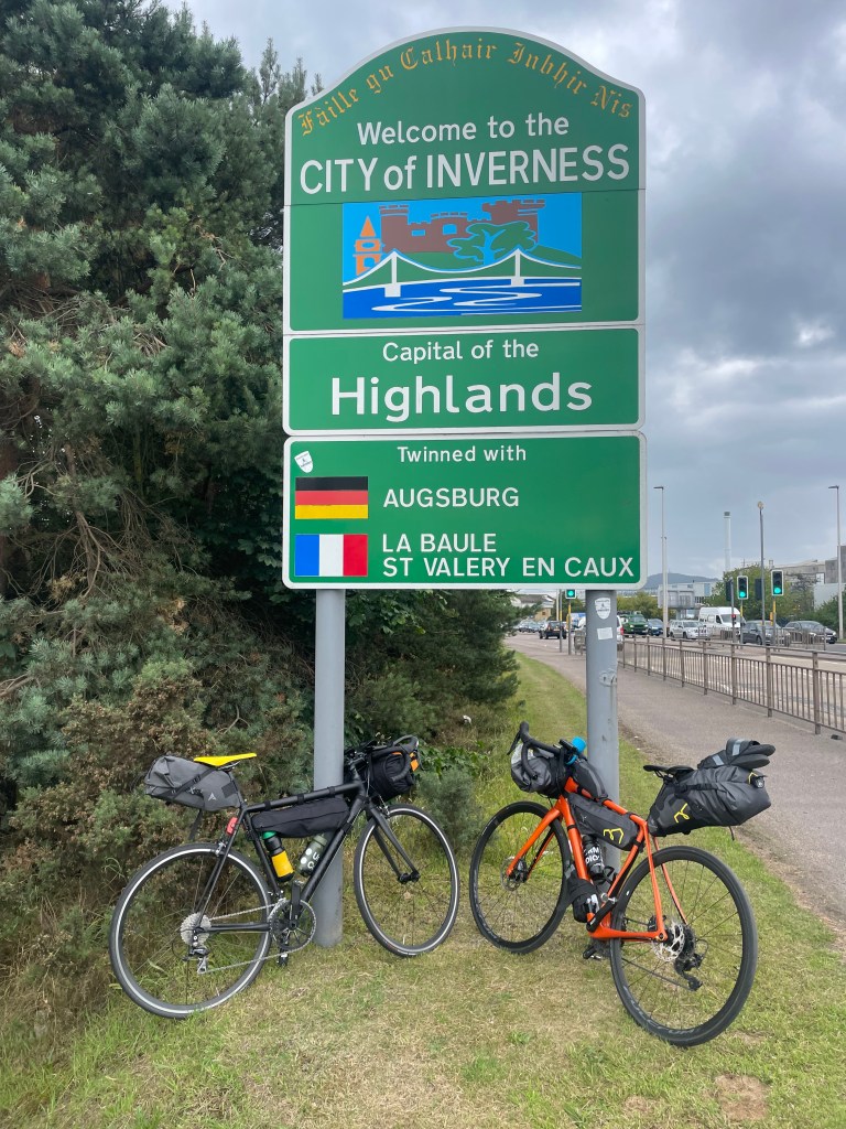
We had just finished ride 6 of 8 from our North Coast 500 tour, having ridden 650km around the coast of Scotland, with another 180km to go before we were to reach Inverness. We visited a bistro on Ebenezer Place in Wick, a street that happens to be the shortest in the world, according to Guinness World Records. There, we ended up timidly talking about our next challenge, if there was ever to have one, and how it would might feel swapping our road bikes for mountain bikes.
Previously, aside from a 5-day, 500km Brighton to Cornwall ride, our cycling experience was mostly confined to day-rides around the South Downs in Sussex, and a couple of days in the French Alps. Josh had been riding bikes for most of his life. I started during lockdown. I had never had any intention to make it a thing. If anything, all my life I am known as the least sporty person. I was never into football, basketball or whatever; neither the gym, or running for that matter, and my physique kinda showed. After that first crazy ride to Cornwall in 2021, I felt that there was an indication, you know, “I can do this!”, or “I can keep doing this!”; and our ride around North Coast of Scotland had assuredly validated this. Besides, I was fortunate to have close friends who were willing participants. And Josh was there from the start.
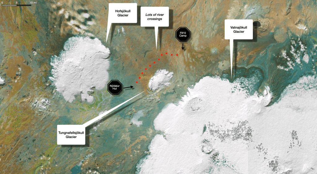
Back at Ebenezer Place, after some mild brainstorming, we started looking at ultra-light sleeping bags and tents as this would have been our first bikepacking experience also. I was always infatuated with Iceland, having been there once before for a 2100km road trip, and I thought we’d try something there. Since the main ring road was a bit too much, i.e. over 1300km, and that was obviously a trip for a road bike, Josh conjured up on his phone some websites on the Divide, a north-to-south route crossing Iceland’s highlands, which would have been ideal for a mountain bike.
Nothing had been decided yet. We didn’t even know we would finish NC500, never mind plan the following year’s tour! Although personally I usually need no more nudging to get me going when I am excited; even a hint of acquiescence to a vague notion of a suggestion, I immediately find myself already mid-way planning in my head. On that account, I had already started thinking, even as Josh was barely showing me some random ultralight tents on a website…
…”Iceland Divide, here we come”…
Planning
Researching blogs and websites on bike-packing in Iceland was an obvious start. Deciding on the actual route, the gear, and the bikes was next. There is no widely established route, so we ended up getting inspiration from a few of blogs. Some had completed the Divide from Akureyri to Reykjavik, others from Akureyri to Vik. We aimed for the latter, having read the info on bikepacking.com and marvelled at Natt Williams’ account from his blog; he is someone evidently more experienced and with sportier disposition, but we thought, what the heck. Let’s do it.
The research for our camping equipment and other gear meant that we’d read an inordinate amount of reviews for every single item, and then, when we’d settled on the best choice, and considering we had ample time until the trip, we would bookmark the website and wait until it’d gone on sale. I do like me a bargain.
To buy or not to buy
The logistics around getting bikes from the UK to Iceland seemed too complicated, so we initially started making inquires about renting mountain bikes from Reykjavik. After several attempts, during which the lovely people from the rental companies were trying to dissuade us from doing something seemingly dangerous on the bikes they had on offer (they even appealed to us to pay for the modifications their bikes needed to withstand the toils of crossing the various lava fields), we ended up entertaining the idea buying our own mountain bikes instead, and transporting them over there.
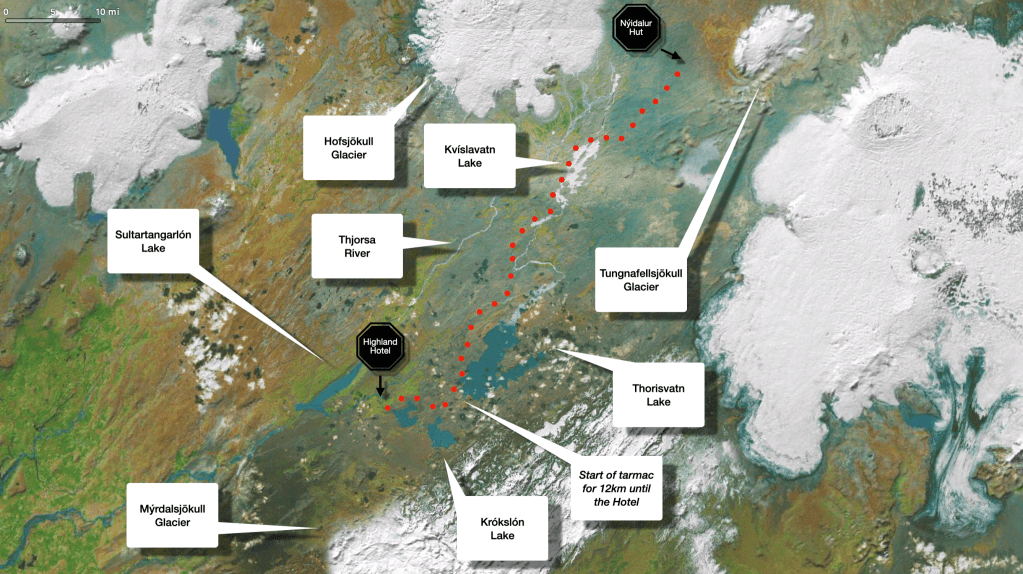
Further research led to doing just that, so thereafter we got ourselves deep into the logistics of the tour. Flying there with the bikes is one thing; getting all the stuff we needed for the tour from Reykjavik in the east to Akureyri in the north, and then after the end of the ride, from Vik in the south, back to Reykjavik? Oh dear. Some blogs mentioned we could rely on buses, some others said not to count on them. Anyhow, in the end, we went along on our own in terms with that part of the planning, involving hiring a car from Reykjavik to Akureyri, and after concluding the tour, getting another car from Bakki airport, 75km west of Vik, to get us back to Reykjavik (there were no companies to hire a car at Vik).
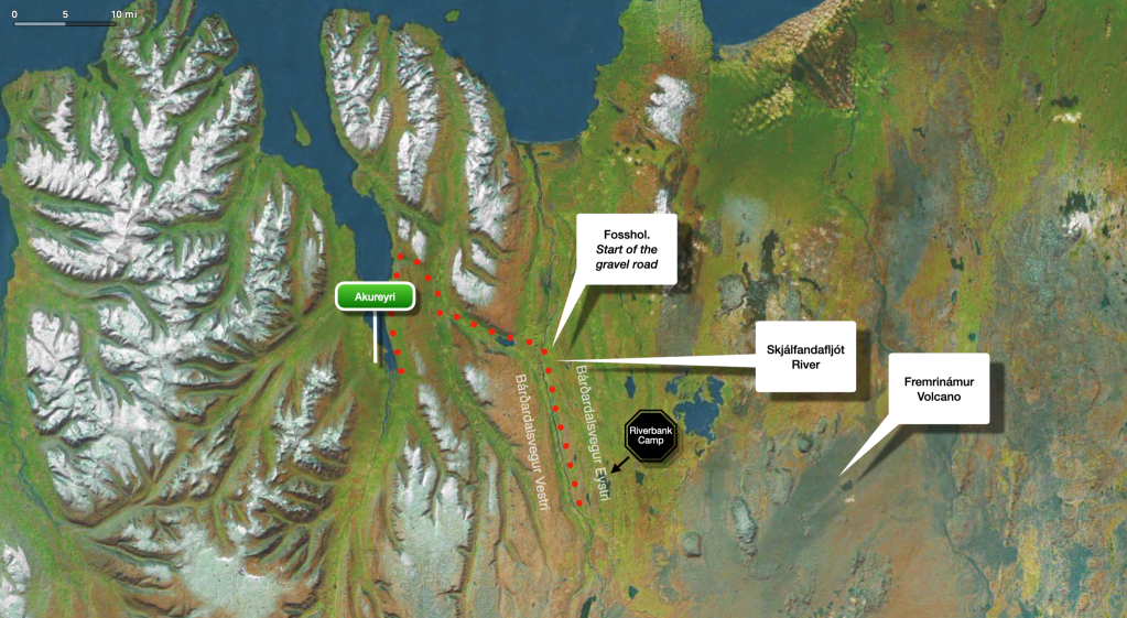
Our planned tour, including the car journey (in black).
Having acquired our own bikes and having done some riding with them we realised, thank fuck for opting to buy our own, because obviously, it was a rather dumb idea to not having experienced mountain-biking in your life, and then do it for the first time as you are touring in Iceland, of all places. We did two mini excursions in Stanmer and West Dean woods in Sussex to try out the mountain bike tracks there, and then two additional day-rides in New Forest and South Downs Way to also get an experience in camping in organised campsites and in the wild respectively. During those two bike-packing rides we also got to try riding with 80% of our Iceland gear, to get a taste of the efficacy of our bags’ setting.
Every part of those test rides, i.e. prepping for them, being on the bike, and camping, would be greatly appreciated when in Iceland.
In terms of our actual tour, we aimed to anticipate all of those situations that could go wrong and prepare for them as much as possible, but also minimise any small nuisances that might in isolation mildly inconvenience us, yet accumulatively could greatly frustrate us instead. In general, our filter was, as outlined in The Gear section in more detail: in a worst-case scenario, what could we do to anticipate it?
Pre-ride Day
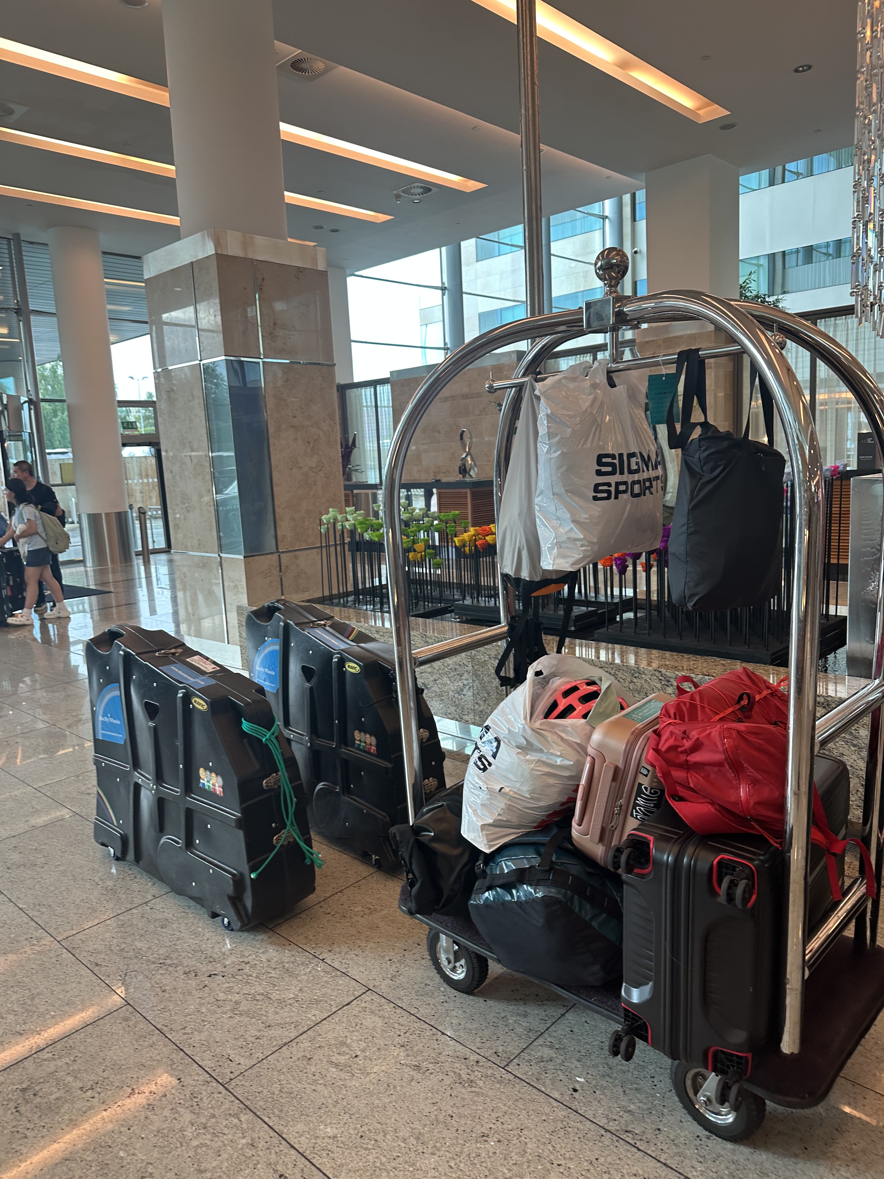
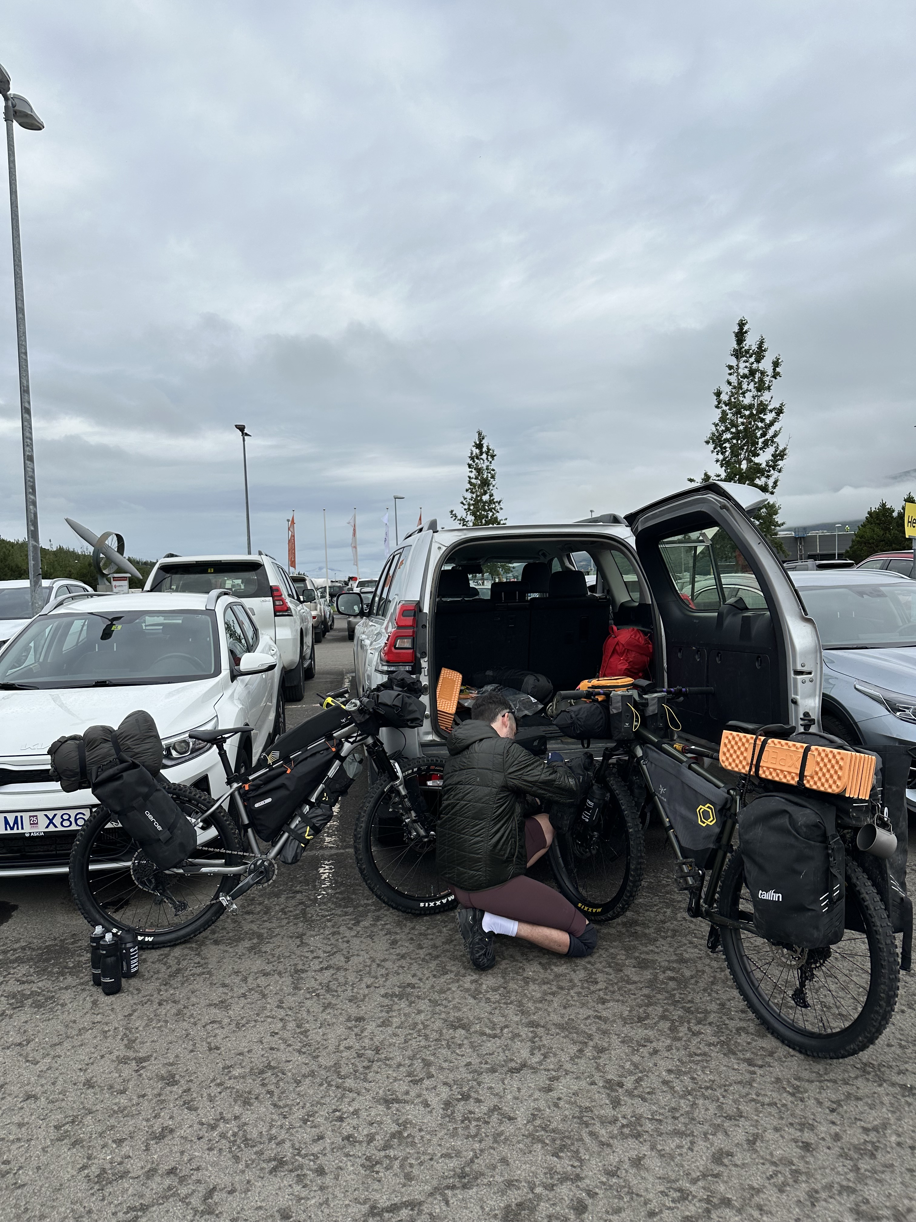
The logistics of carrying our stuff to Iceland was probably as complicated as planning the bloody trip. I arrived with
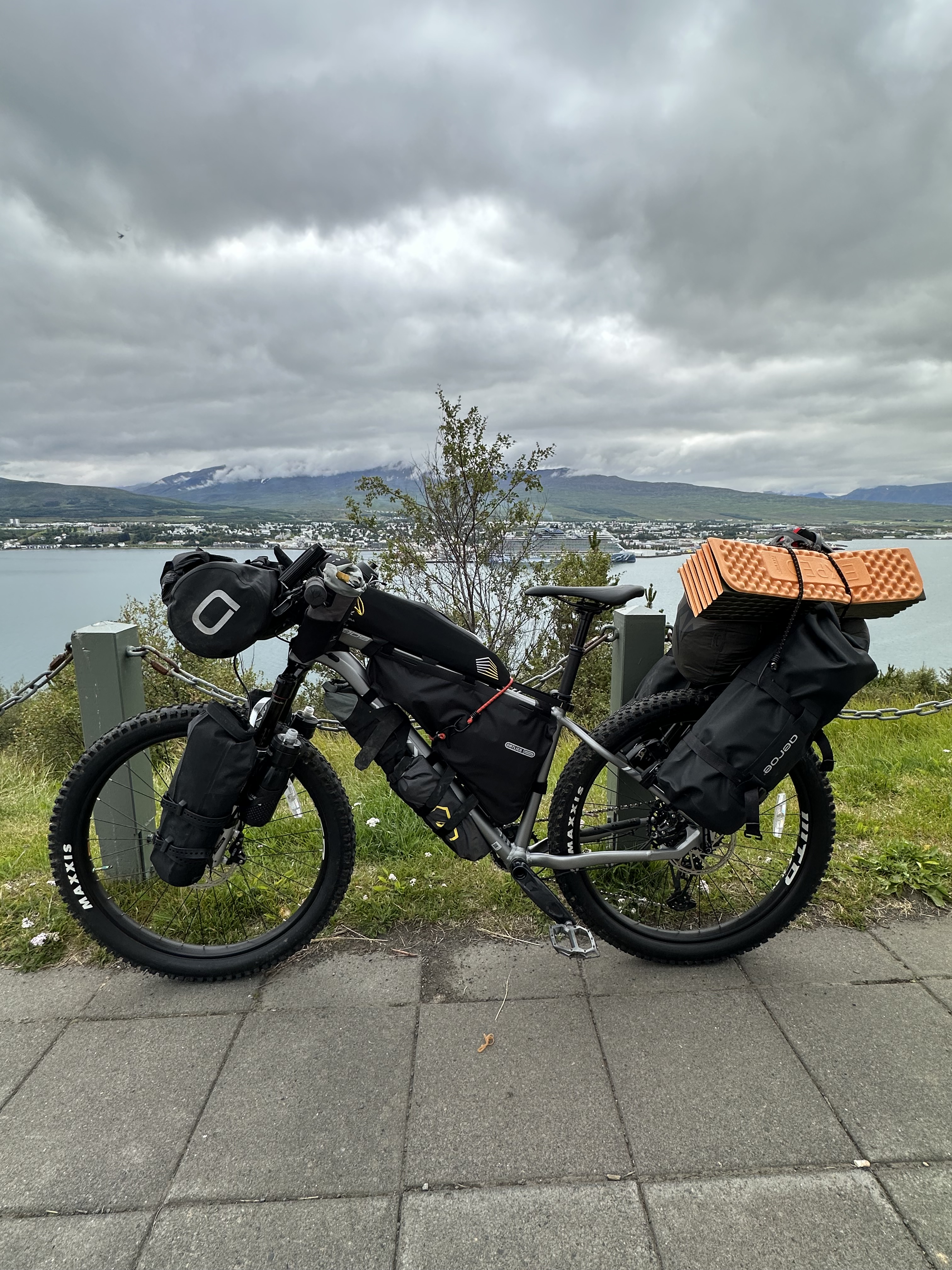
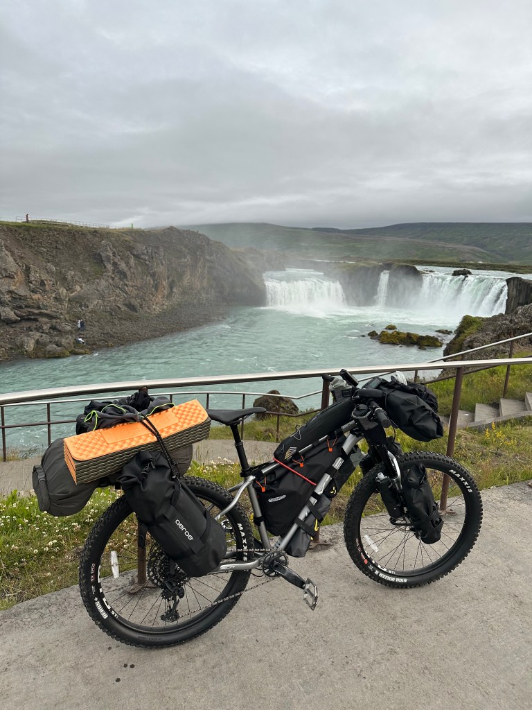
Bike box (32kg): bike, floor pump, cable ties, duck tape, big tools.
Suitcase, checked-in (23kg): casual clothes and bike bags, prepared as we would carry them on the bike.
Duffle bag, cabin (15kg): battery chargers, electronics, more clothes, helmet.
Tote bag, cabin (3kg): more battery packs, Fujifilm camera, essentials.
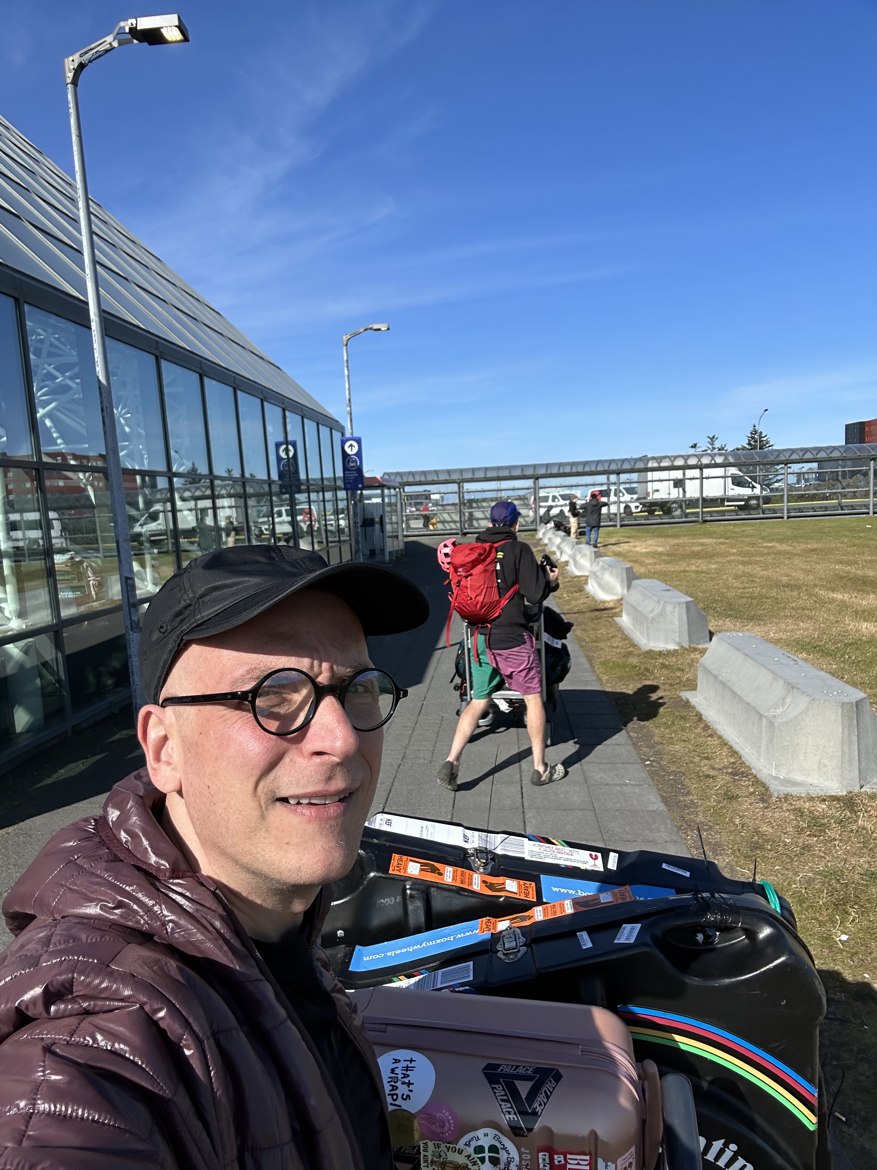
Josh had similar setting, albeit he was also carrying his professional videography stuff, i.e. camera, GoPro, drone, and all the relevant paraphernalia, tripod, batteries, bless him. We flew to Keflavik, loaded our hired car at the airport and headed to Reykjavik. There we had arranged to leave the “empty” bike boxes and suitcases in the hotel which we had booked to stay on our way back, 8 days later.
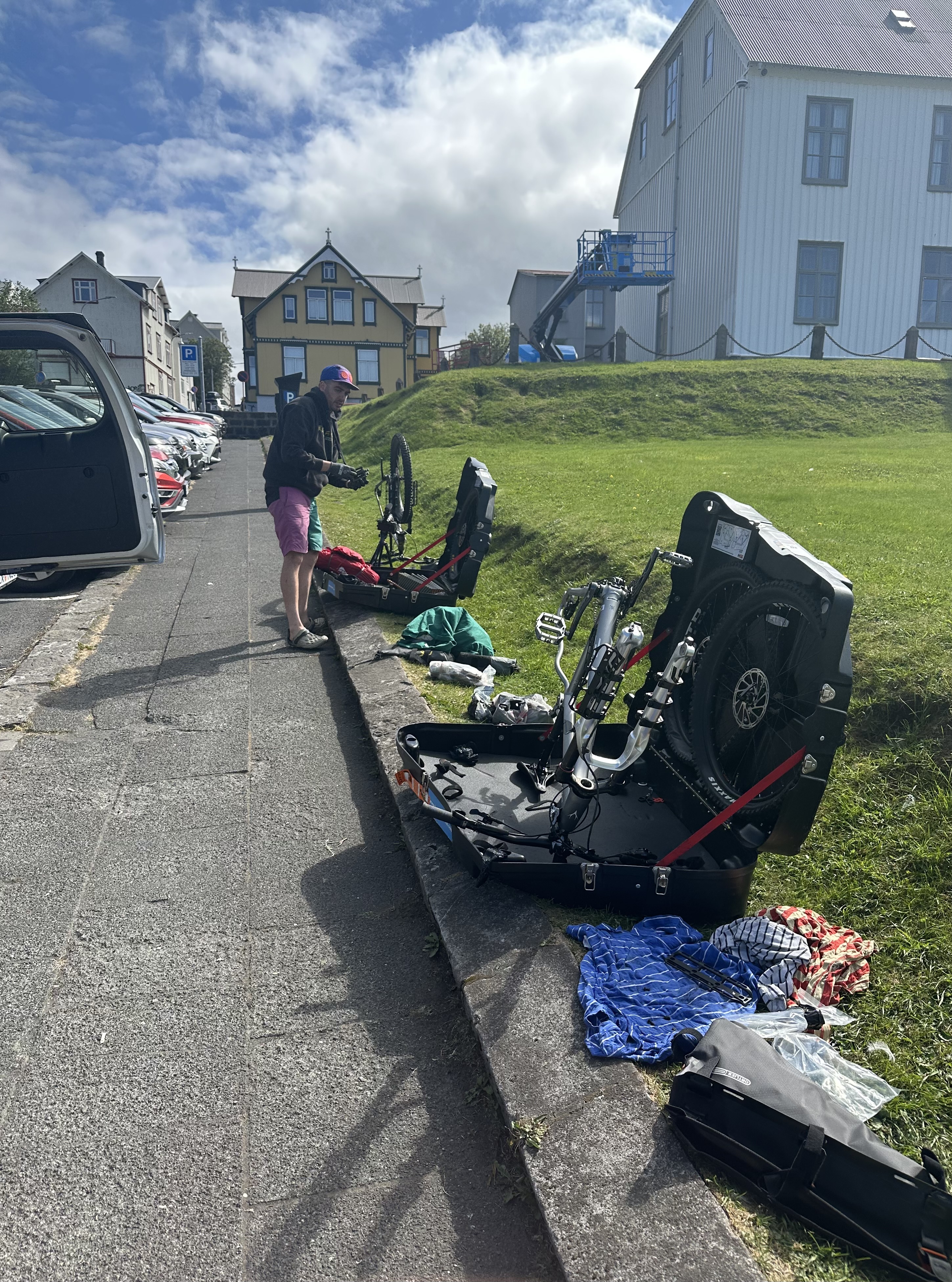
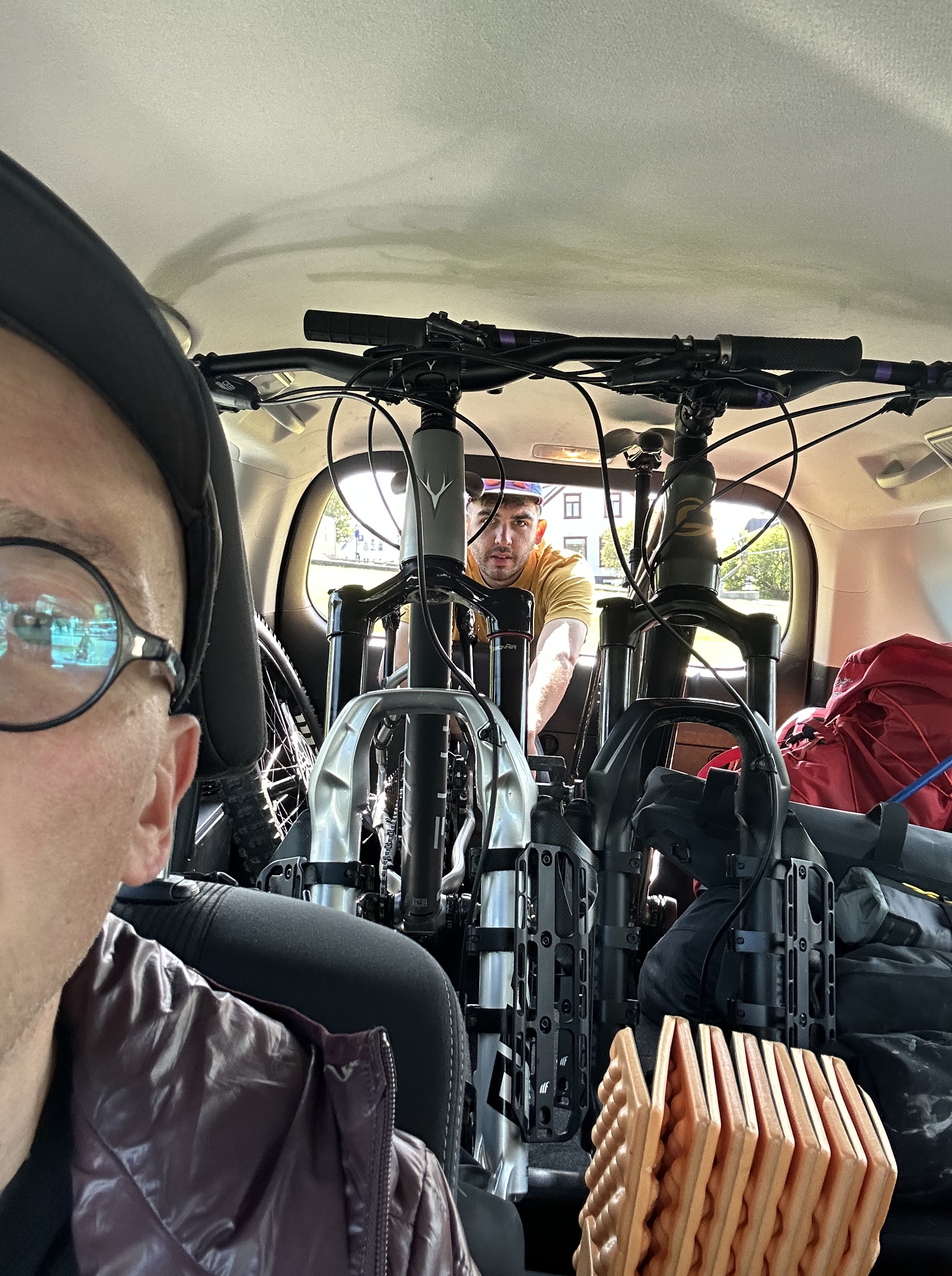
We then assembled the bikes on the pavement next to our parked car, separated our clothes and gear, before we dropped off the stuff at the hotel. In the suitcase we left some fresh clothes for our Reykjavik stay on the way back, along with the floor pump and bigger tools, as well as more cable tyres and duck tape for securing the bike boxes on our flight back. With regards the car…Is it really worth it to have a big 4×4? Yes it is.
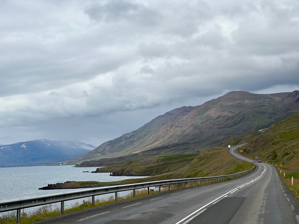
We then set off for Akureyri – 4.5hrs trip. I felt a bit guilty ’cause I do not drive, and Josh had to do the whole trip at the wheel, despite being equally knackered as I was. We both had tough weeks at our respective jobs, and had slept very little.
At Akureyri
We arrived at Akureyri, dropped the bags at E18 apartment (lovely) and went for dinner, our last proper supper! Strangely enough, nothing had gone wrong so far. No bags were lost, no bike parts were broken during our flight, no one cared about the load of batteries at the airport security (I did worry about that, considering what I was carrying).
Akureyri is the second largest town of Iceland with 19,000 inhabitants and lies in Eyjafjörður (Eyjafjordur), one of Iceland’s longest fjords. There were settlements since the 9th century, although not permanently until 1778, and according to the Icelanding saga Landnámabók (Landnamabok) we actually have a name for its founder, one half-Irish, half-Norse Helgi Magri Eyvindarson; and if you really wanna know, he was slim, hence the additional sobriquet, “the slim”.
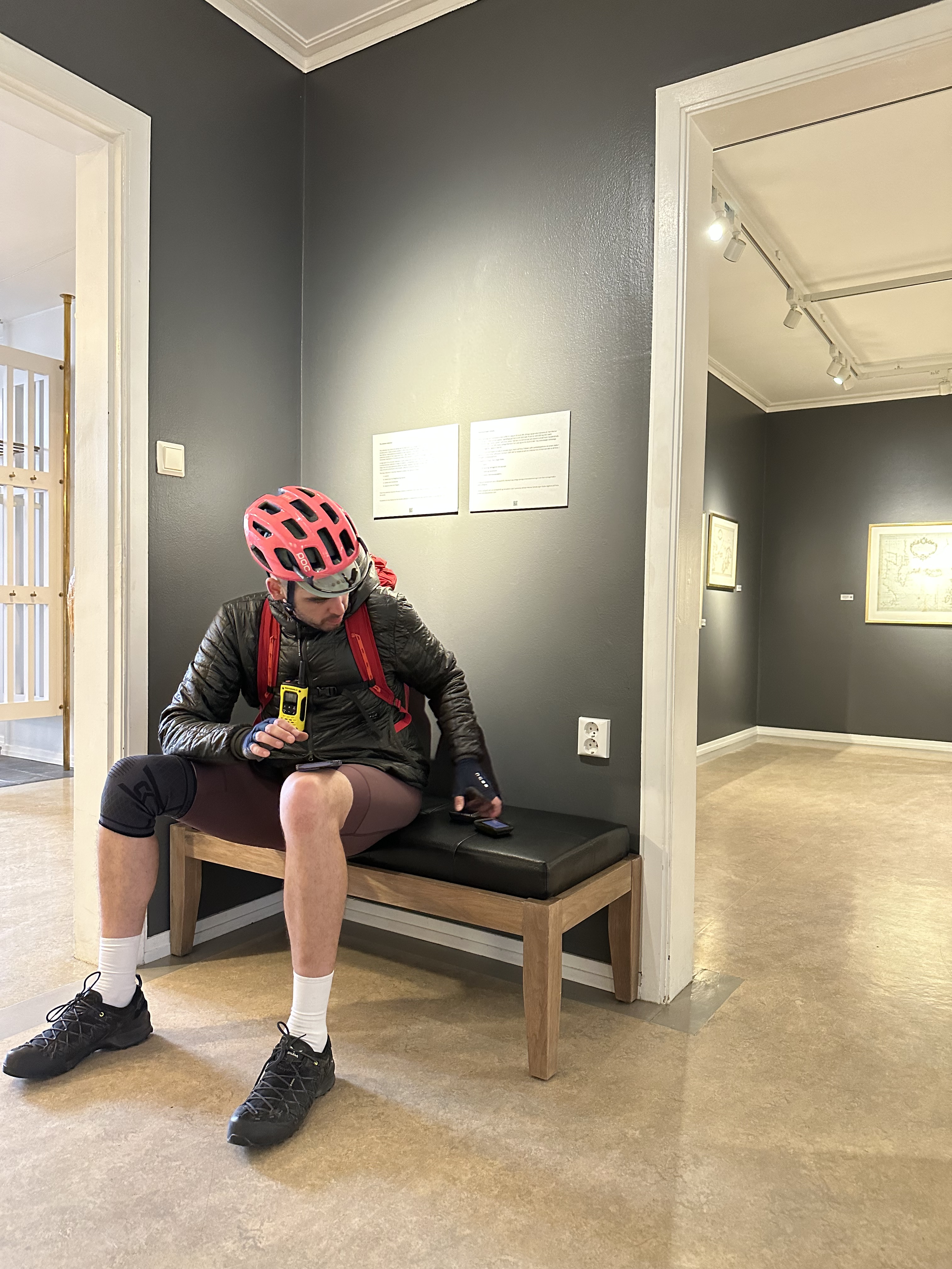
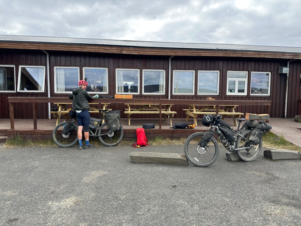
The following day, we first went for some lovely breakfast at Kaffi Ilmur where the people of Iceland reaffirmed their reputation for incredible hospitality and non-nonsense approach to life. The owner gave us some free cakes, and proceeded to not charge us for our second coffees, seemingly for being impressed with our intentions for the impending expeditionary attempt. We then dropped the car at Akureyri airport, having first prepared the bikes at the car park there.
And so it began…
Postscript
Why have I written this blog?
Well, for self-indulgence, first and foremost. It’s mostly a storytelling exercise. It includes some pompous prose, profanity, and tangents. Therefore if you are looking for a succinct list of dos and donts, look away now. Conversely, I am trying to do something a tad useful, in my own naive way. When we were in the planning process, we researched extensively for crossing Iceland’s highlands, and we could have used some additional info pertinent to the success of the journey. Although, I hear you say, do I really need to know that Helgi Magri (the slim), an adopted Irishchild from the Hebrides happened to come over all the way to North Iceland to built a farm in a fjord, which ended up to become Akureyri? Oh, don’t be a philistine. Anyhow, another reason for telling this story is because we took a different route than the one we had planned for, ending our trip in Hella, rather in Reykjavik or Vik, so there is something out there for people to consider as an alternative option. Also, do consider we are not exactly top-notch athletes or even overly experienced in such tours; far from it. Therefore I wish to highlight that if a non-athletic type, middle-aged person like me can do this, probably most can. You just need to have previously experienced some touring, preferably on gravel.
But of course, if you do it and die in the process, it’s entirely not my fault. This is a disclaimer, indeed. Please sign on the dotted line.
Day 1
Sat 29th July – Akureyri to Skjálfandafljót riverbank (80km, 687m elevation)
Will we ever?
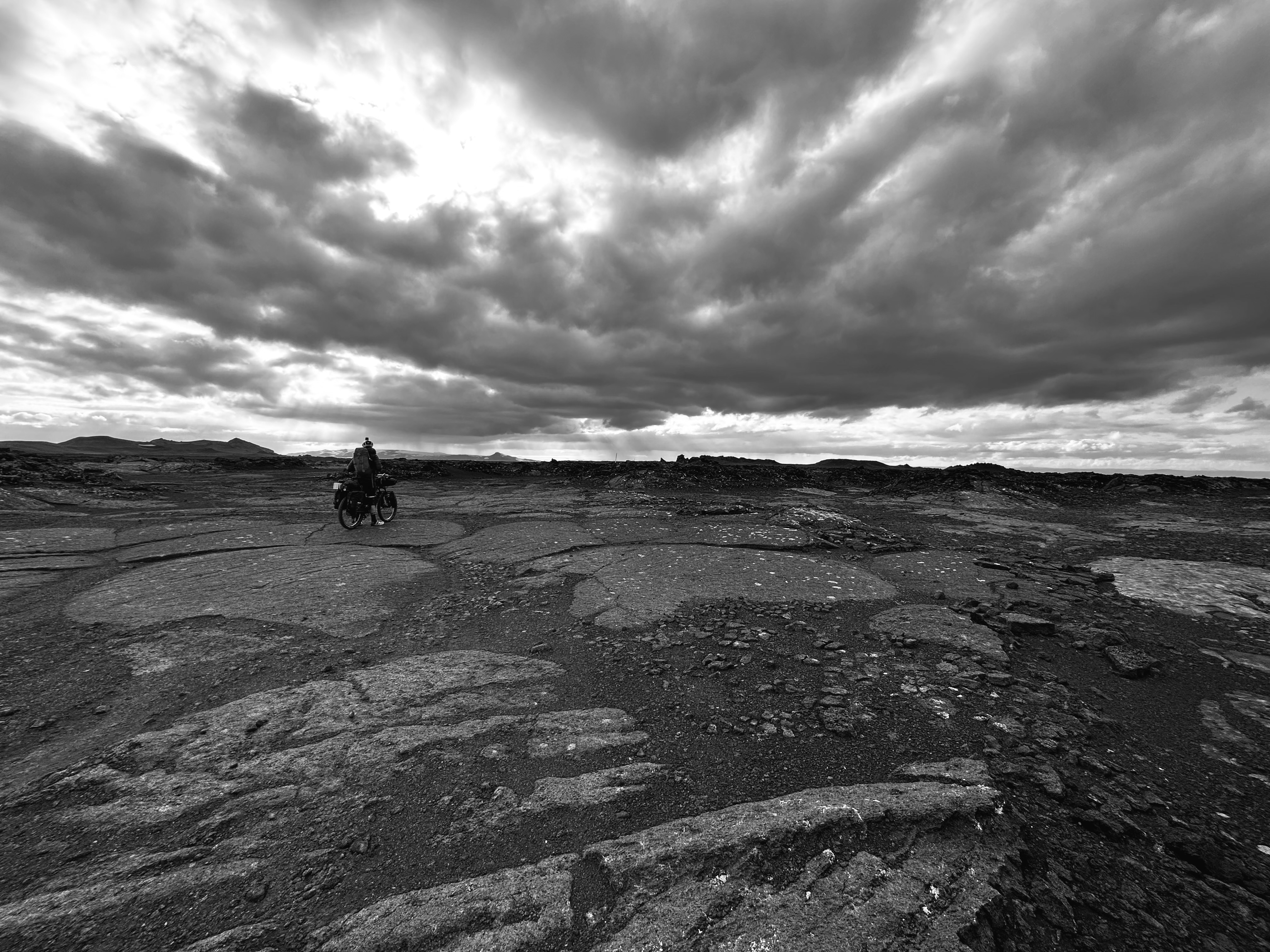
Our test rides back in the UK had given us a confidence boost concerning the handling of the weight load carried on our bikes. Since then, Josh had redistributed the weight on his in a way that stopped wobbling. I had somehow managed to do the reverse. I set off from Akureyri with a much heavier back wheel with respect to the front, so at times it would feel slightly unsteady. Further into our day, I had to rearrange things yet again to remedy that.
I remember how well I was able to handle my Cannondale Synapse road bike on our first day into Scotland’s NC500, to my surprise, despite I had loaded it up with 15kg of bags. I was worried how heavy it might have been, especially going up the hills. Similarly, when we set off on our trip this time, my Whyte 909 did just fine with a 35kg load, and somehow, once I was on it and started turning those pedals, the damn thing carried me regardless: going up the hills or over some pretty rough terrain, lava fields and whatnot, with everything rattling disconcertingly at times, yet confidently notwithstanding. Now, now…pushing the bike up the hills, it’s certainly another matter.
Back at the start though, when we were ready to roll!
Oh, but wait, no journey could start without sorting out Josh’s dropper seat, which would activate all by itself. Off we went, back and forth around town to find an open bike-shop, and then, et voila, the seat shorted itself out, somehow, and behaved admirably ever since. And now we thought, we can set off!
Oh no, fuck that. Let’s find a place with wifi to download Iceland maps onto our GPS, since we belatedly realised Josh had a different GPS than the one he had prepared for. Earlier on the day, during breakfast, we had to deal with the consequences of my customary absentmindedness when I had to use the wifi at the cafe and stay there much longer to download the maps onto my GPS, ‘cause similarly I was not prepared. This time, we were at the town’s outskirts, and after looking around, the good people at Akureyri museum let us use their wifi. And then off we went. For real. We meant to set off 8-9am; we did so around 2pm…
Out of Akureyri
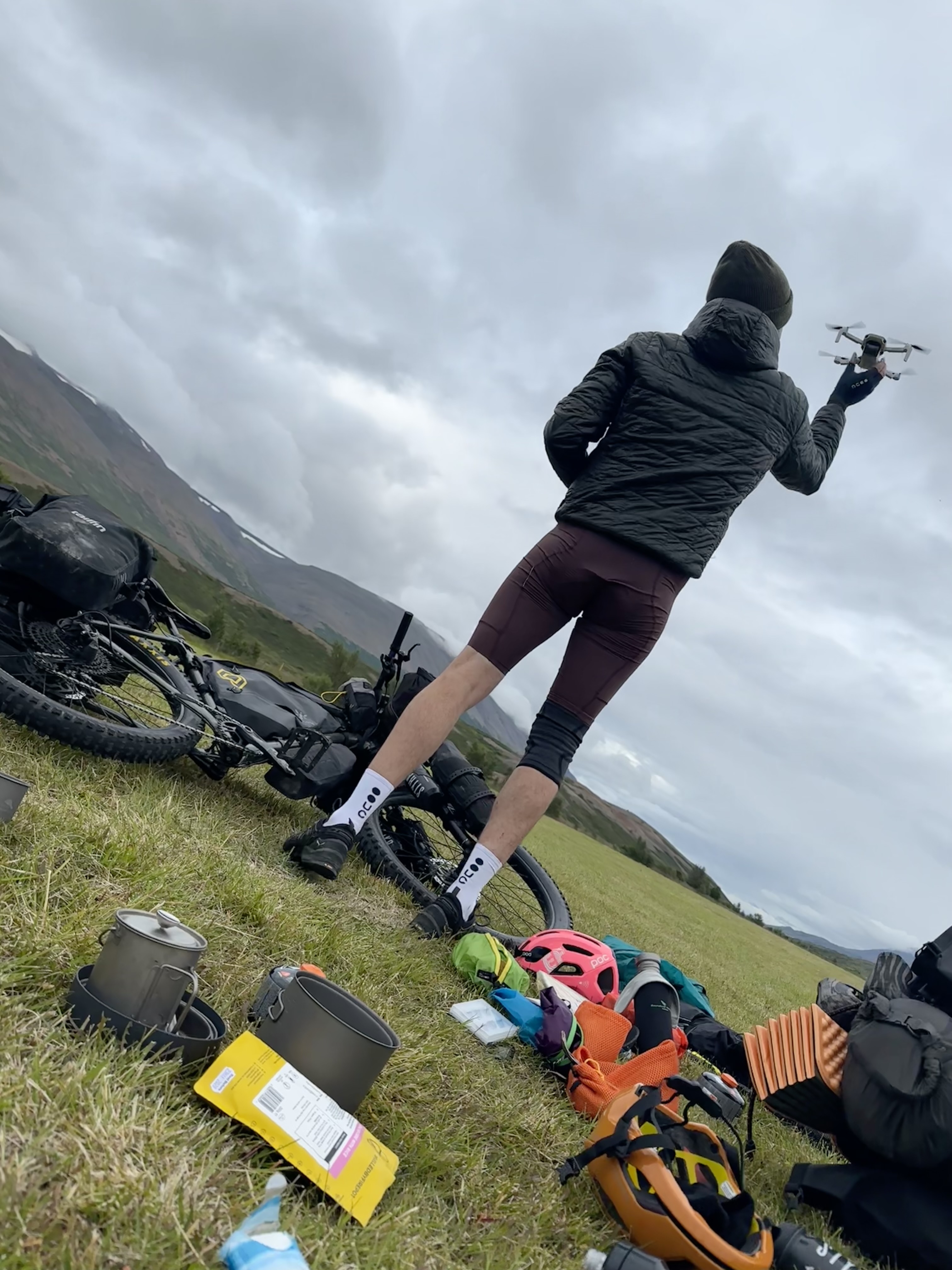
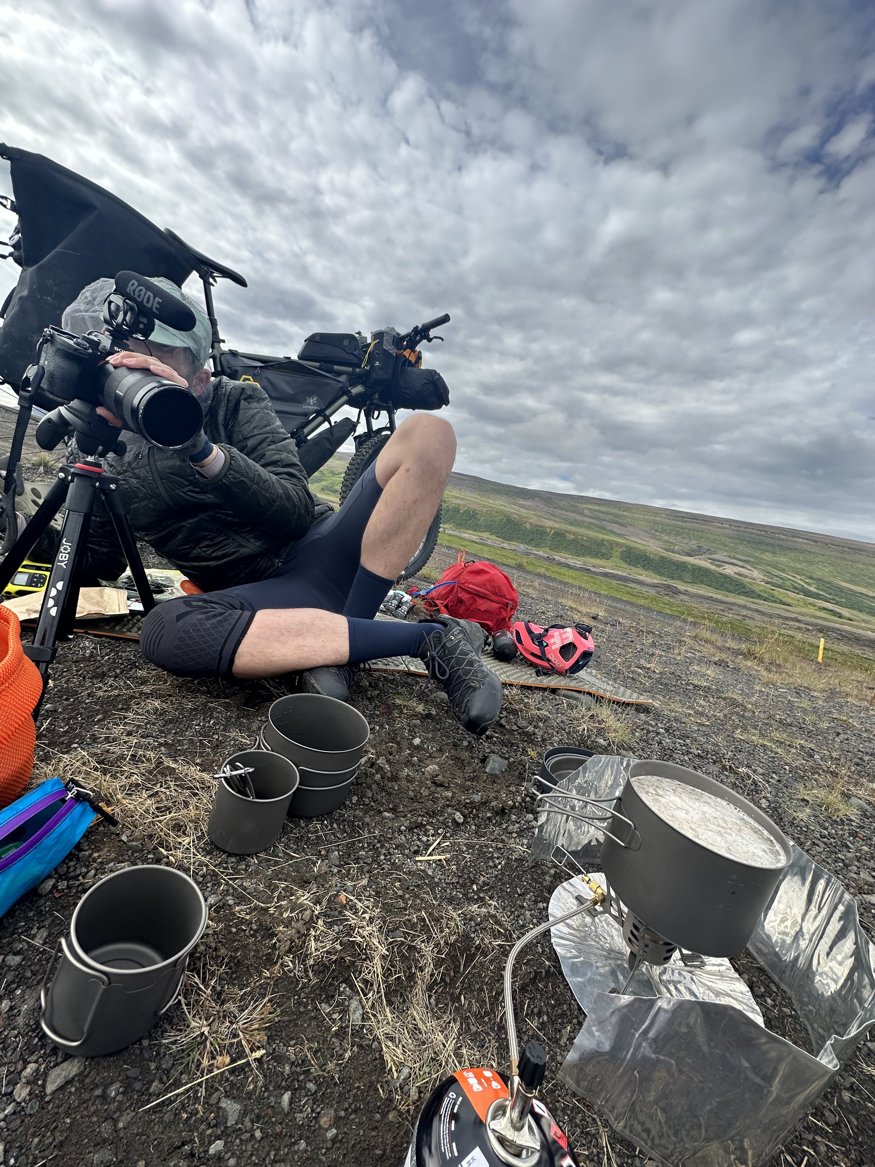
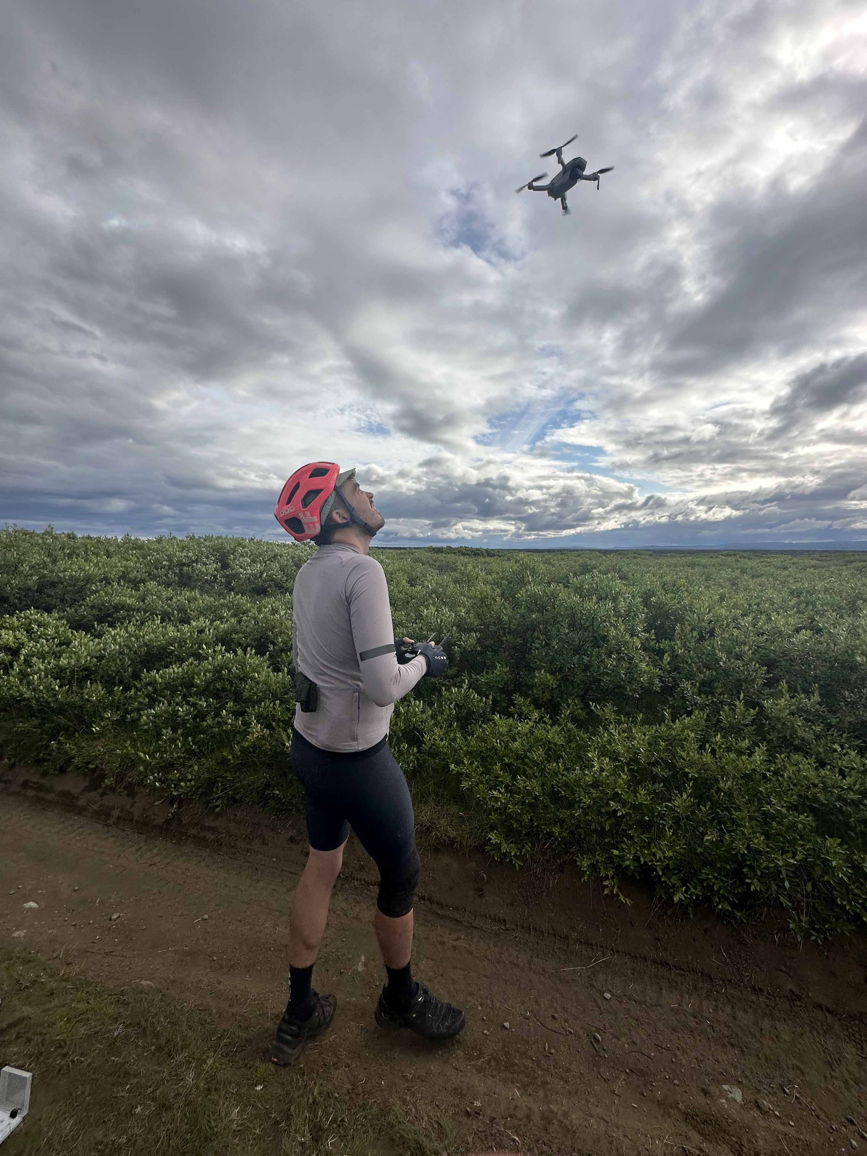
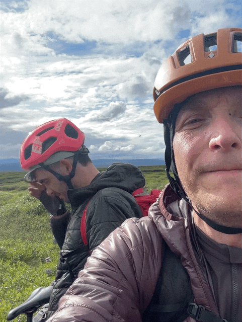
There are couple of roads (821, 829) leading out of Akureyri directly to the south towards one of the largest valleys and agricultural regions in Iceland, Eyjafjarðardalur. Instead, we crossed the bridge to the east side of Eyjafjörður, then ventured north for 16km, before climbing a 5.5km hill as we turned to South-East towards Fosshol. When we reached the top, Josh took advantage of the views over the fjord and used his drone.
Throughout our journey we would take some time for filming, which was super cool, and I was particularly chuffed to play a small part in his project. More than he understood. How unfavourably I might appear in lycra in a real-life setting would only transpire once his film is out there, so my confidence was still somewhat intact (holding my stomach in is a regular occurrence when a lens points towards my direction in most scenarios, but it ain’t my main consideration when I’m hyperventilating on the bike).
We sat for lunch on a lovely green patch, at the junction with 836. Another chance for the drone to fly!
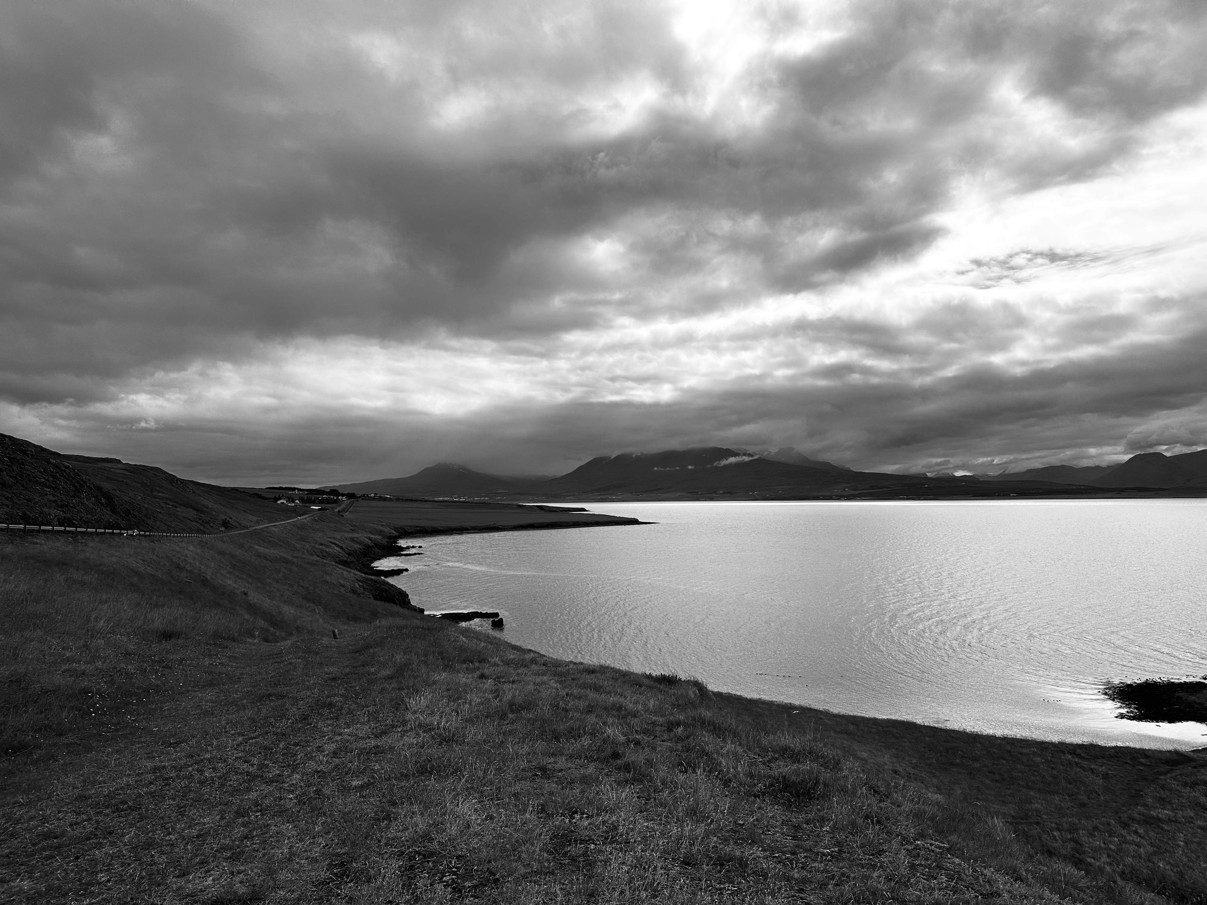
Further out, and for most of the ride, we were still in civilisation, including passing through the only touristic spot of our entire tour, Goðafoss (Godafoss) Waterfall! Iceland is famous for its waterfalls, and although I had previously experienced Selfoss and its neighbour, the powerful Dettifoss (both situated further eastwards, but near where we were), it was well worth it seeing the often-lauded Goðafoss. We could not do much exploring though, considering the bikes and all that.
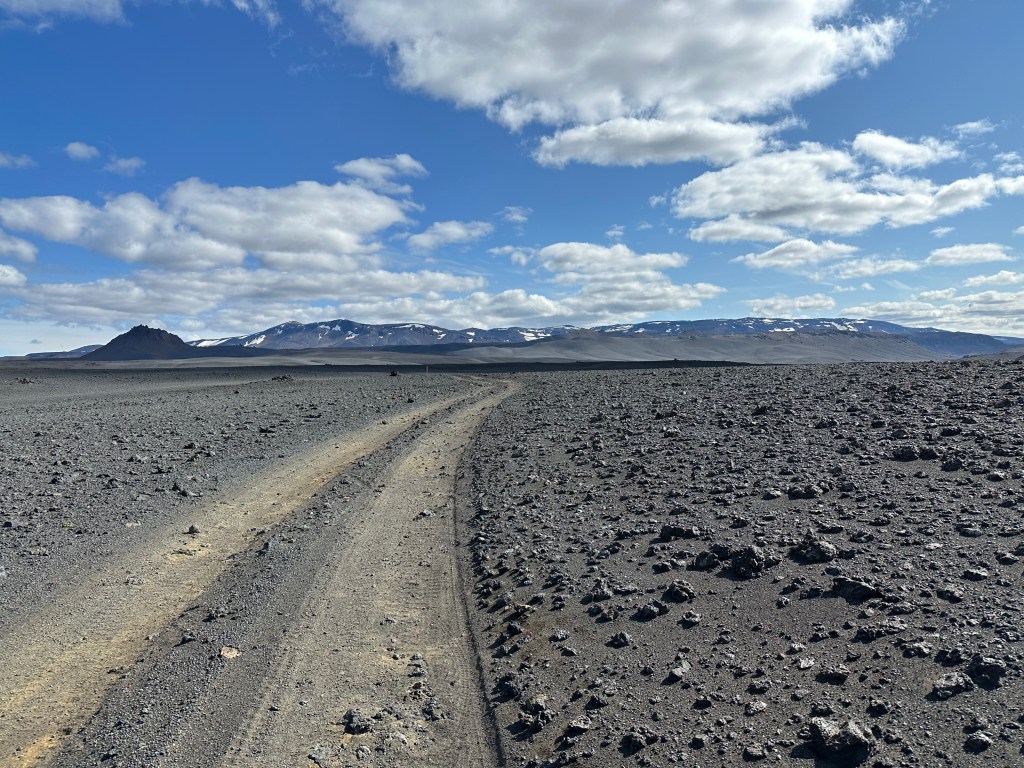
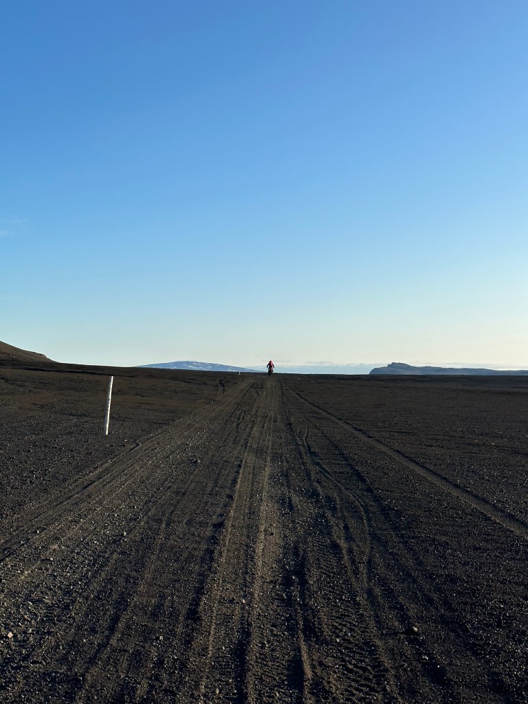
On The Dirt Road
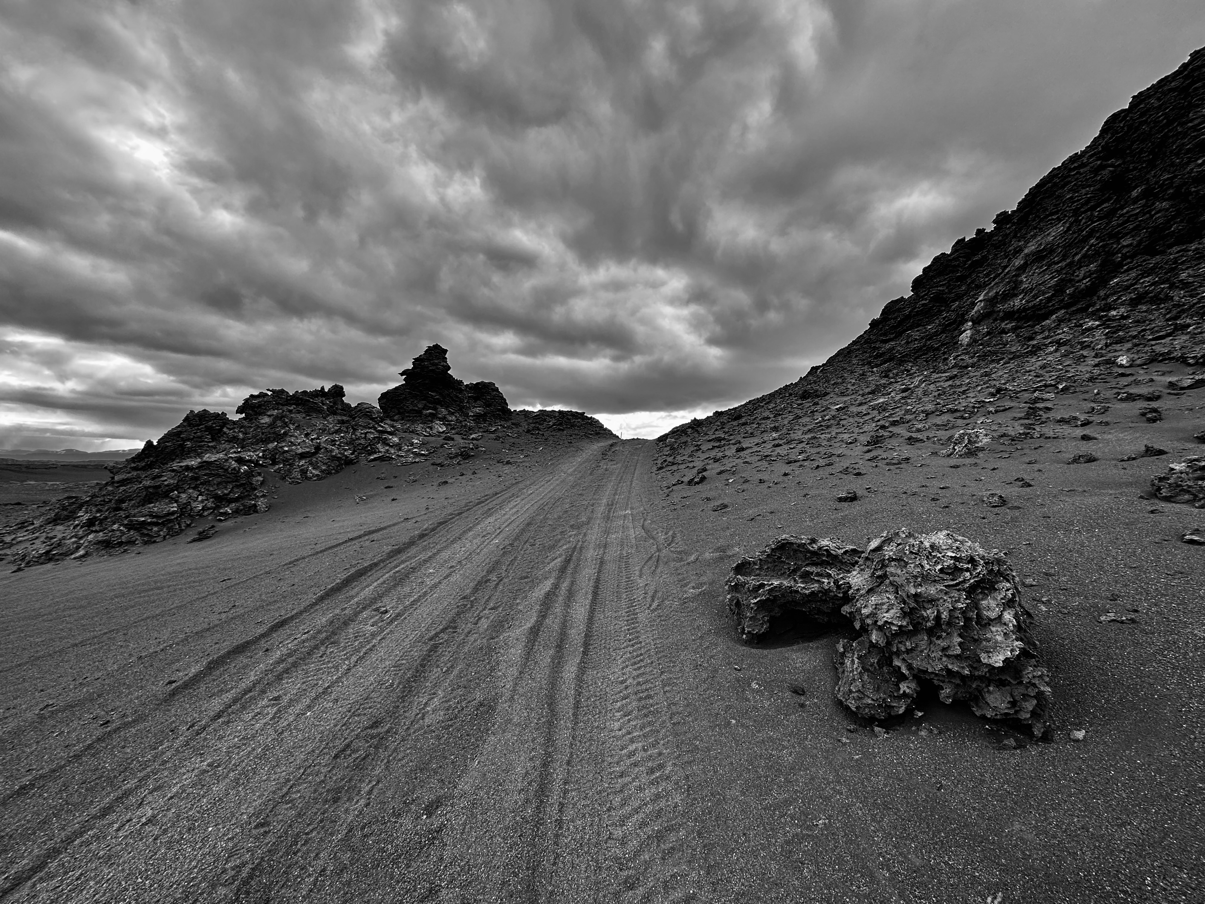
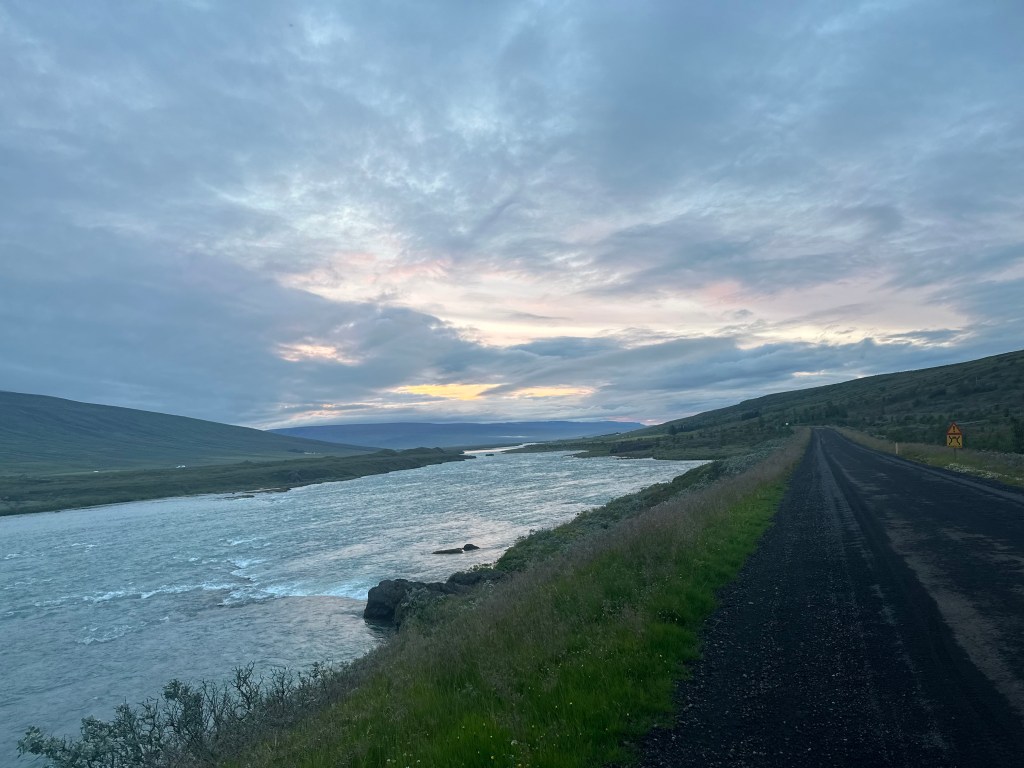
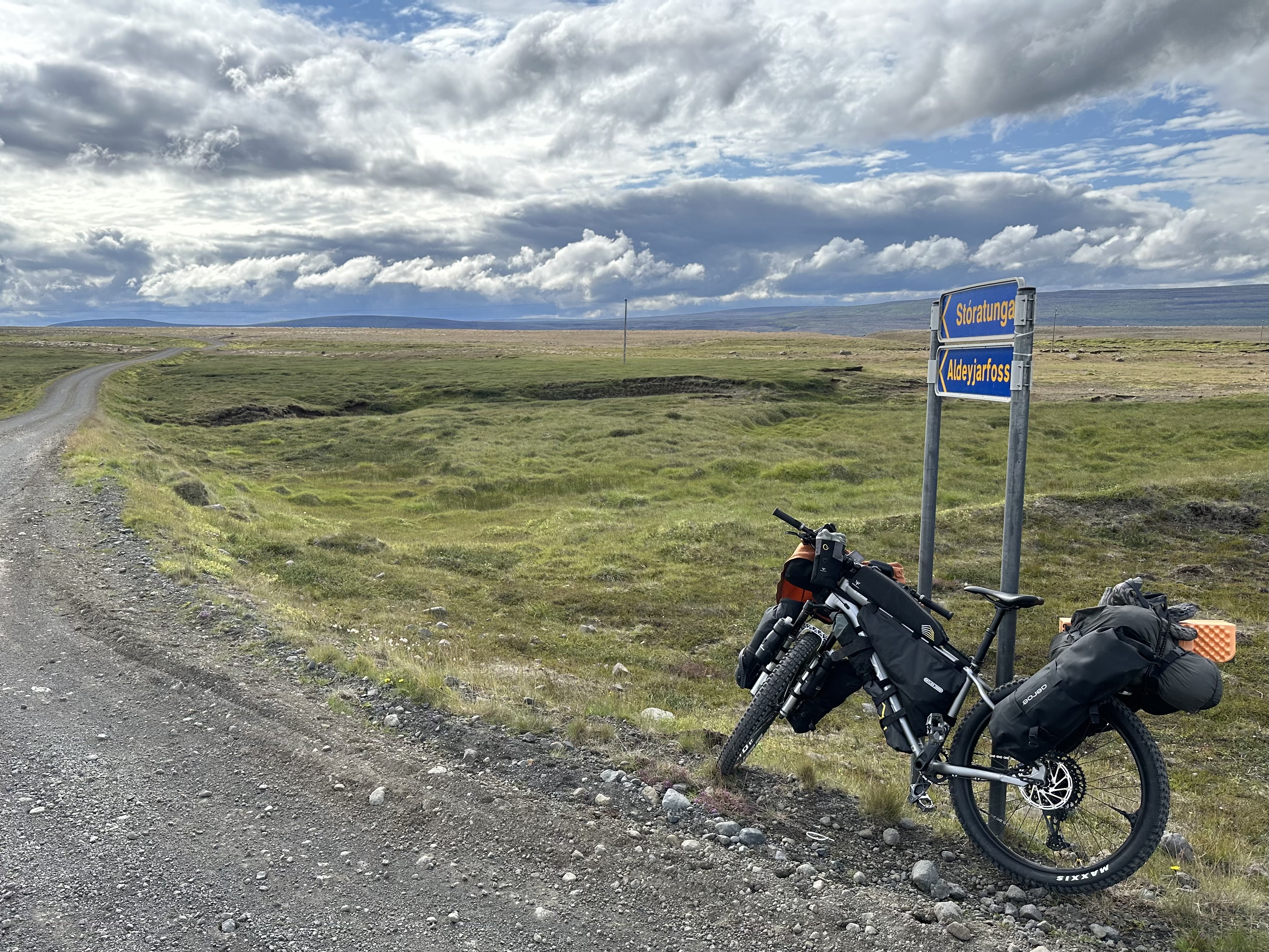
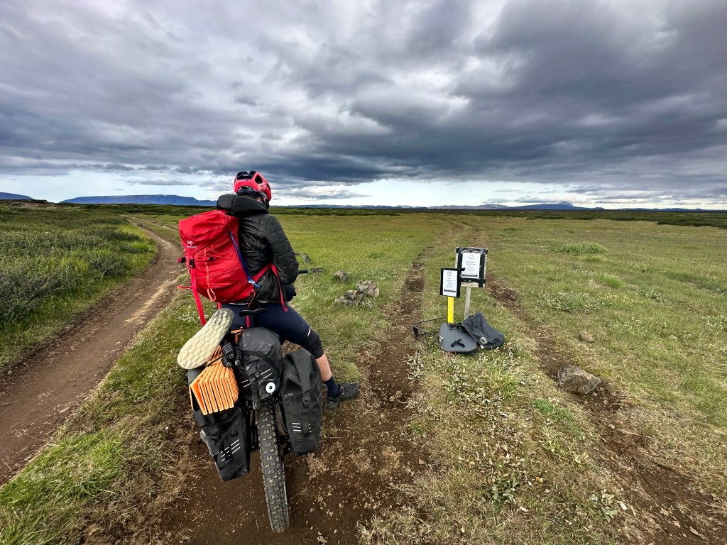
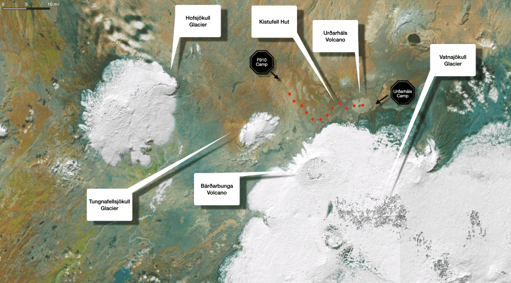
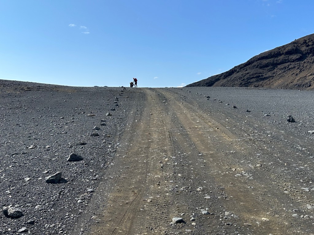
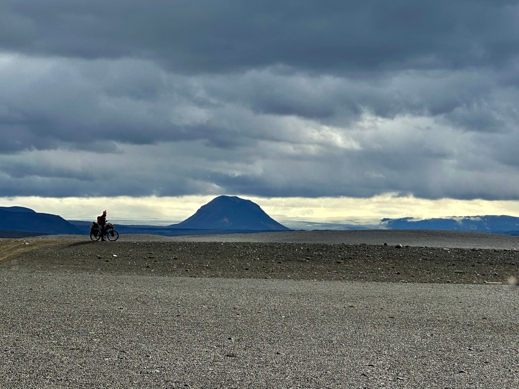
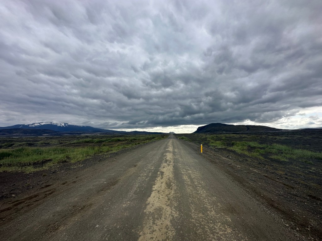
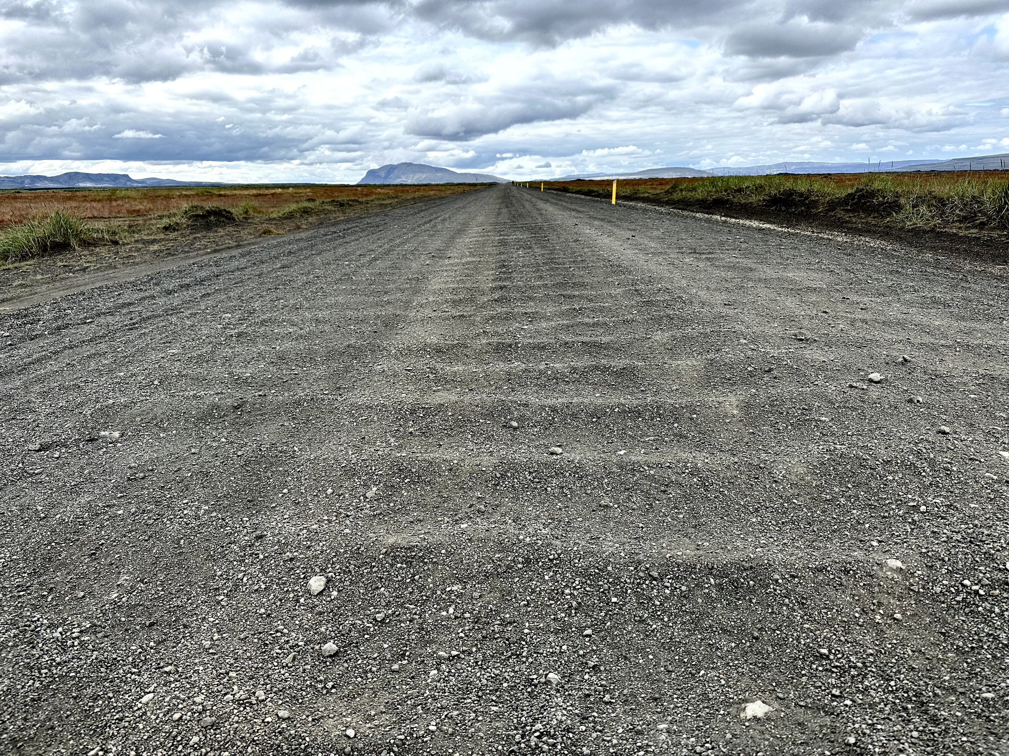
In Fosshol, a tiny community built around the waterfall, around 50km since we had set off, we turned south from the main ring road (Route 1, Þjóðvegur, Pjodvegur), and into Bárðardalsvegur Eystri (844), where our tarmac turned into dirt. The 842 road on the other side of the river (Bárðardalsvegur Vestri), which runs in parallel for some time with ours, turns into the F26 34km south, which then continues towards south-west. Our road would take us to somewhat wilder paths towards south-east.
That moment in Fosshol when we made a turn, felt like it was the real beginning of our trip. We were leaving behind humans and traffic, however scarce these were in the first place, and we were heading towards the highlands, a mainly uninhabited area, whose access via a system of highland roads is mostly prohibited in the months outside of summer. There are tracks that vehicles cannot cross them, and further inwards, there is a sparse network of roads (F-roads, abbreviation for fjall-roads, i.e. mountain-roads) which only 4x4s can handle and legally allowed on.
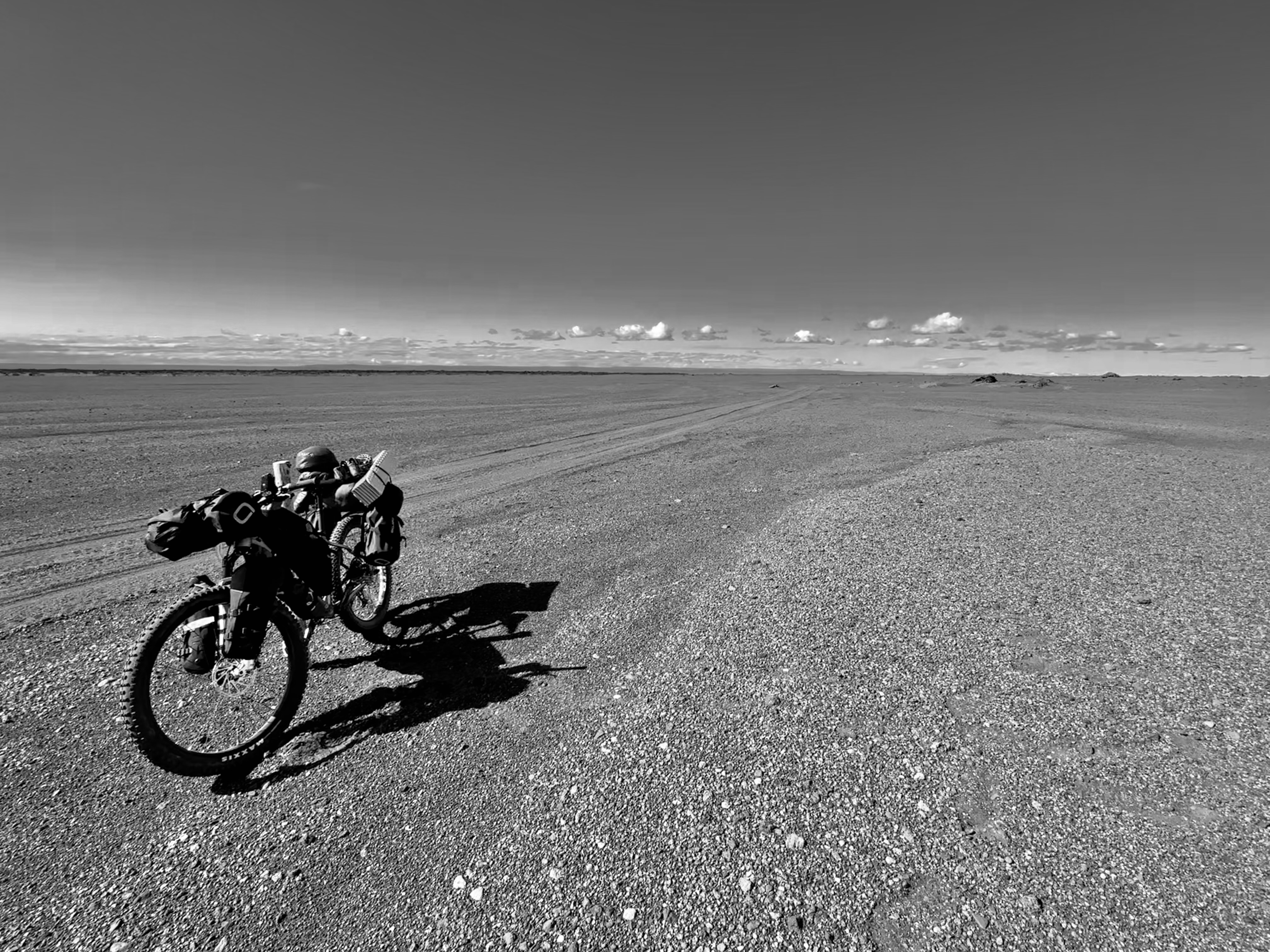
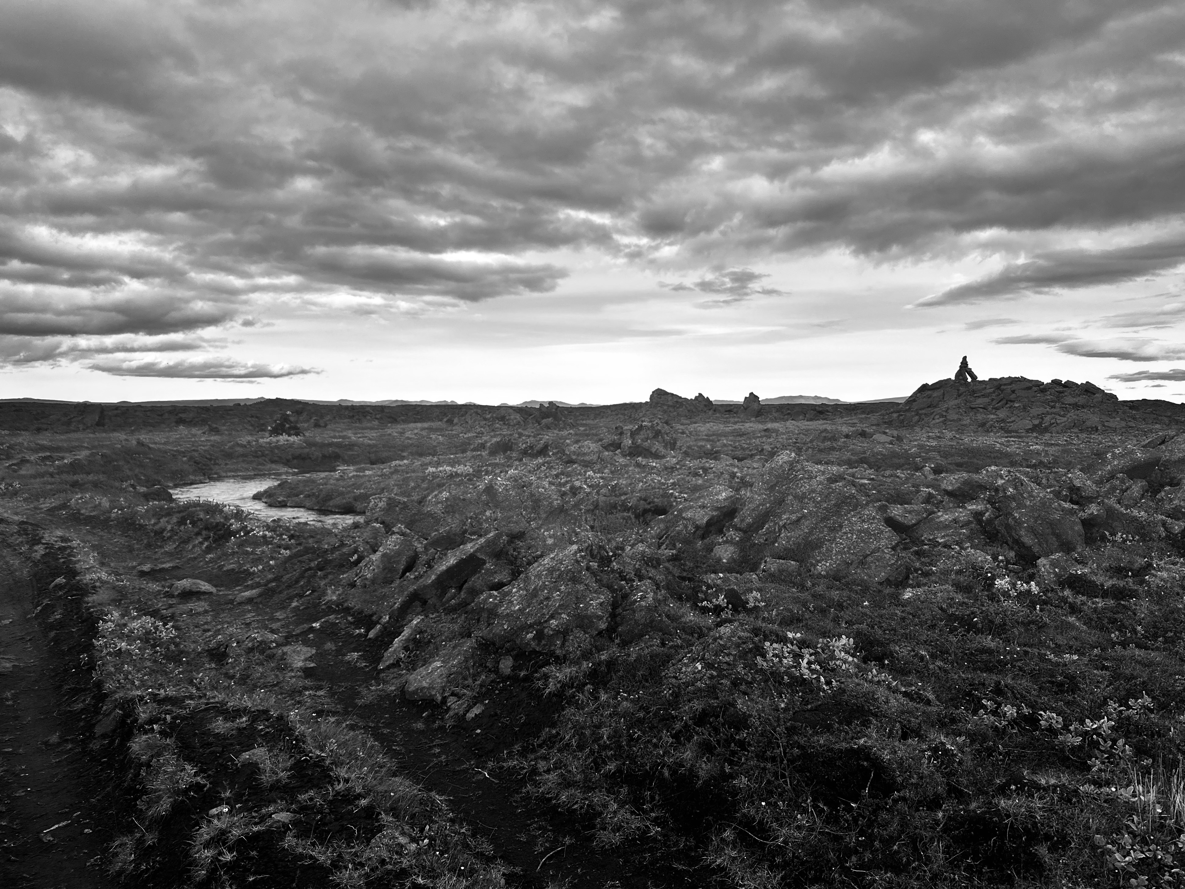
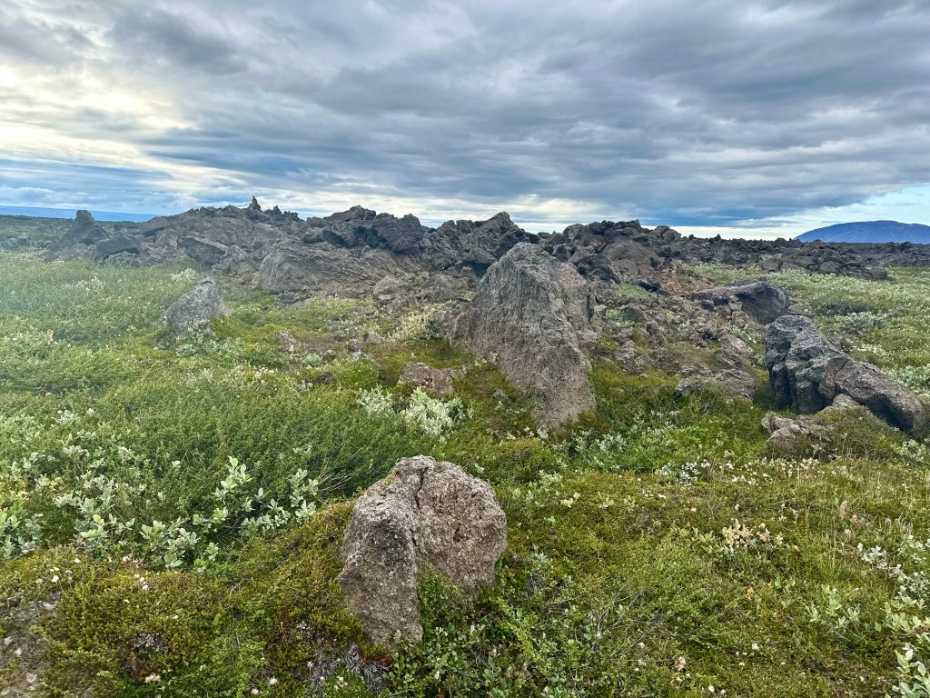
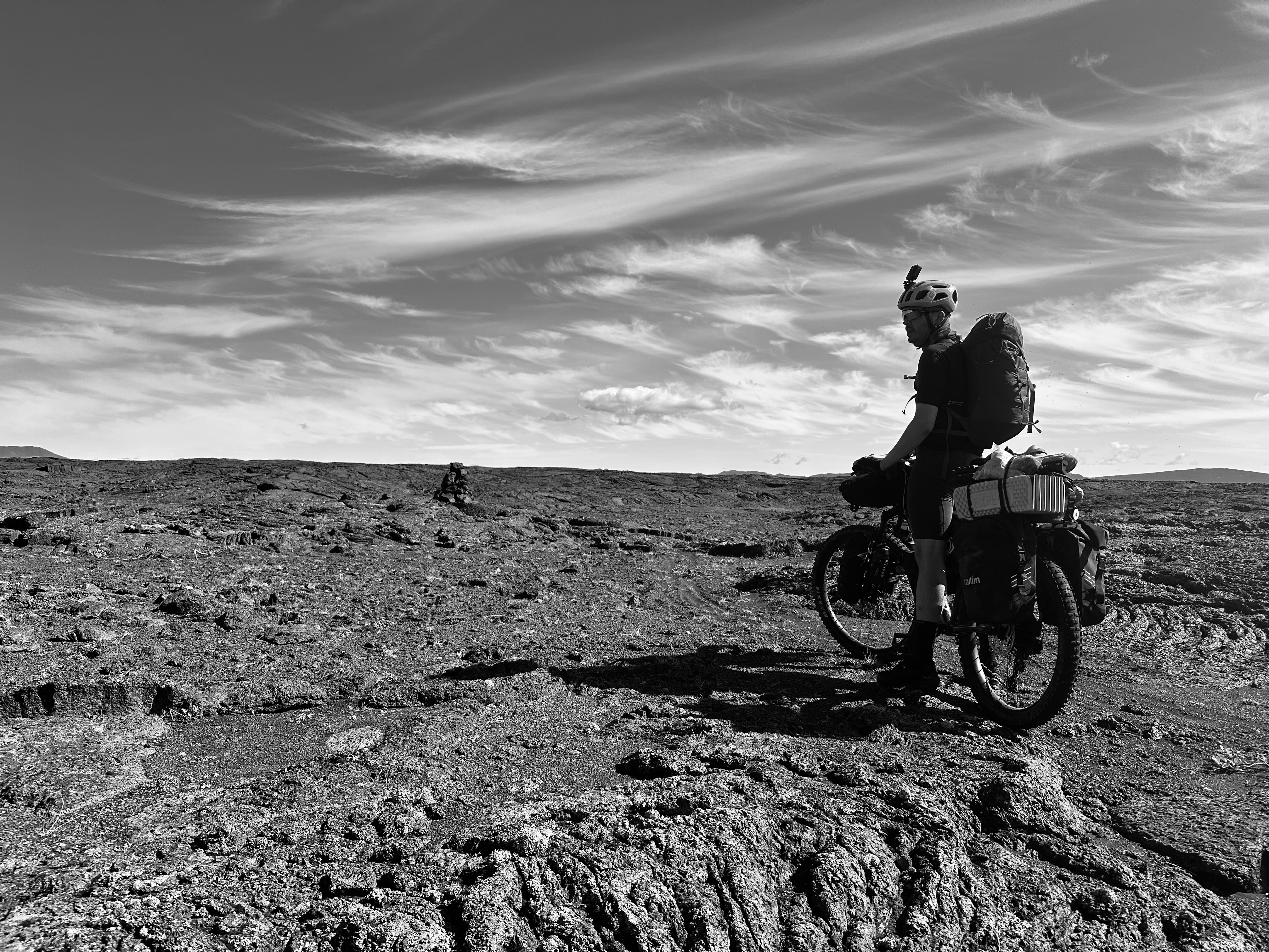
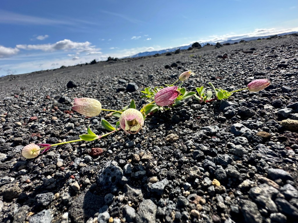
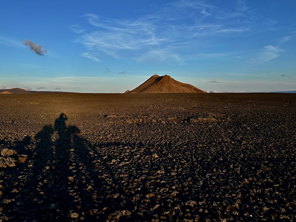
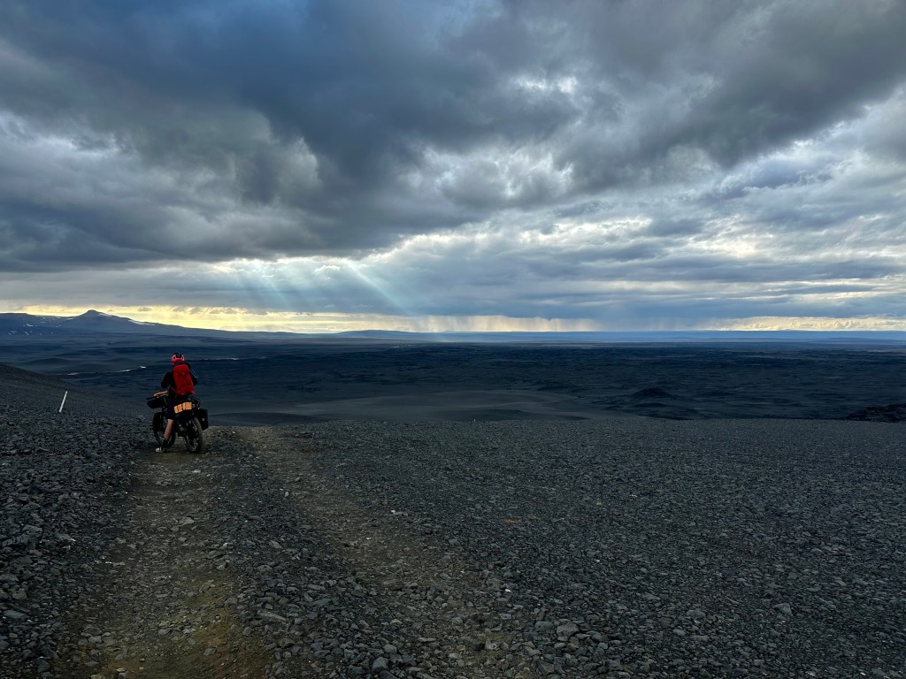
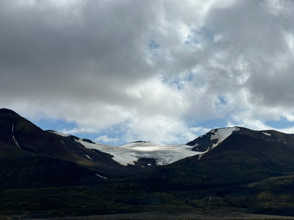
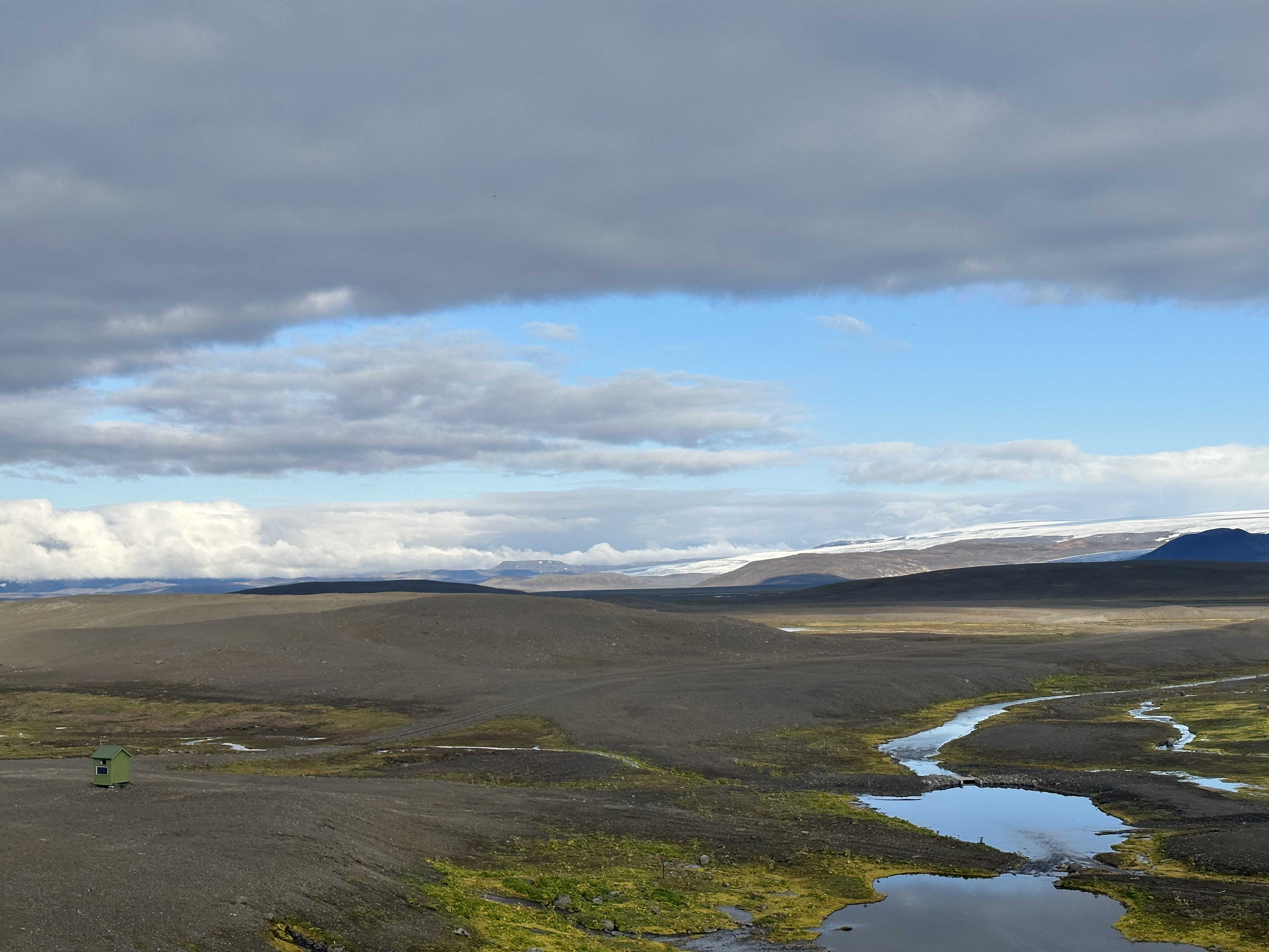
We were heading towards the land of lava and sand, with minimal fauna and flora. Considering Iceland has hundreds of volcanoes, of which around 30 are active, the types of topography we would encounter would vary, and subsequently, so our challenges. Lava fields of different classifications would prevail, depending on when and from where the lava was spewed, and to what degree glacial erosion had played a part in their subsequent formation. In addition, a big part of such terrain would be determined whether there was a passable track running through it, usually sandy or gravel. In fact, my biggest regret was, as I belatedly had the epiphany on day 7, that I had not meticulously captured the various sizes of gravel and rock along our route, in order to map out the terrain from a cyclist’s perspective, including the corresponding pain chart.
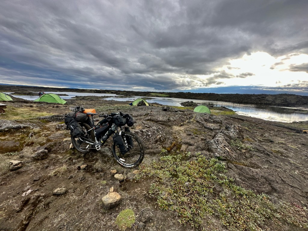
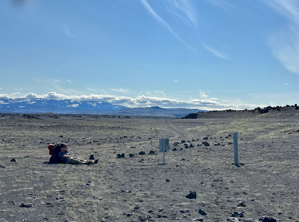
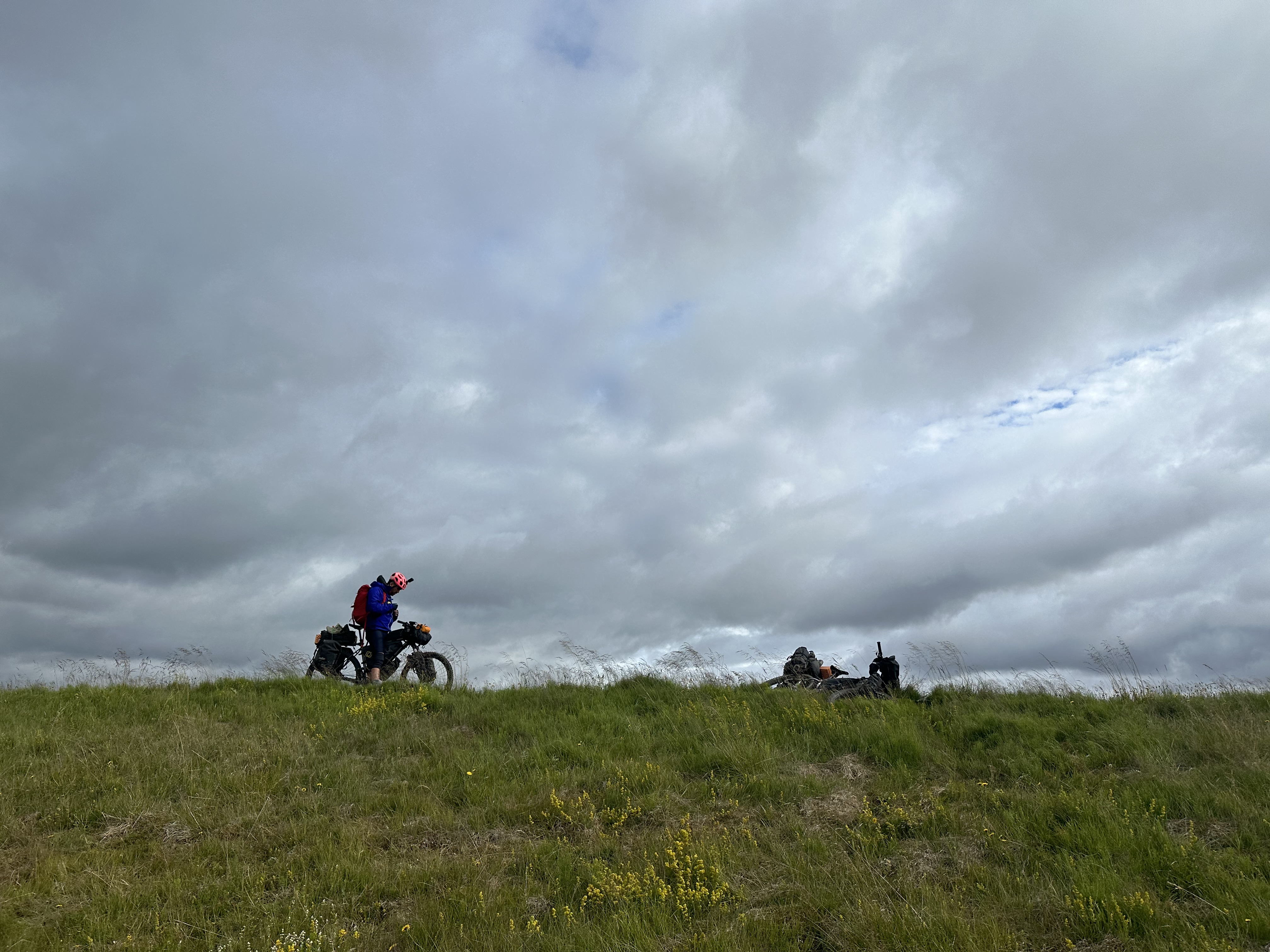
We continued with some trepidation as we were gradually accepting the fact that we would not make it to our destination. The area was very quiet and we were gradually acclimatising to the new norm of being alone on the road. After further 25km of riding next to Skjalfandafljot river, we camped on its bank soon after 1am. Although it was twilight, we were not using lights during our ride, leaving our eyes to adjust in the dark. Looking back at it now, I think of us a tad disillusioned to envisage ourselves getting to Botni Hut on the first day, having left Akureyri so late in the afternoon. Going over the lava fields at Botni in the dark would have been interesting, to say the least.
Some Soul-Searching
All things considered, my instinctive reaction when faced with seemingly insurmountable odds is to stay positive and crack on, my one redeeming quality in such trips. Somehow Josh compliments that trait by nudging me towards some logical appraisal of the situation, which usually leads further to some short of decision-making. The way he does that usually is to get grumpier by the hour, until I kinda have to react. Hitting that balance between “I will not give up” vs “need to make a decision” was probably a theme permeating our tours. In these situations, my ADHD compels me to insouciantly push the proverbial can down the road, “oh, don’t worry old boy, it’ll be fine” – precisely the same personality trait that urges me to avoid all important decision in my life, until it’s almost too late, just by the precipice, facing some sort of disaster.
The difficult part was how to also ensure that we weren’t changing our minds about our course ahead in response to our challenges, because conversely this stubbornness and perseverance had served us well in the past, and would continue doing so in what lied ahead. Josh fortunately has aways been incredibly agreeable in the face of challenging fits, as well as easy-going with respect to making on-the-cuff decisions when we both felt like making one.
Sun 30th July – Skjálfandafljót riverbank to Botni Hut (34km, 332m elevation)
On the river bank
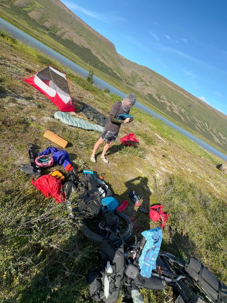
Our first camping experience in Iceland! Well, when we had set camp the previous night, all I could think of was, thank fuck for not sensing too many midges around me, being right next to a river and all that. It had taken us a while in the middle of the night to find a place that was near the water, specifically for Josh to dip his feet in the following morning and sooth his tendons, but also to make it an OK place to camp.
Anyway, the morning was hot and sunny and the midges had a fucking field day with us, but at least we had a head net, and Josh got to stand in the middle of the river thus producing one of the most memorable video from our trip, in his attempt to dissuade a swarm of midges from eating his head, like piranhas would have under the water, in some place elsewhere, in another hemisphere.
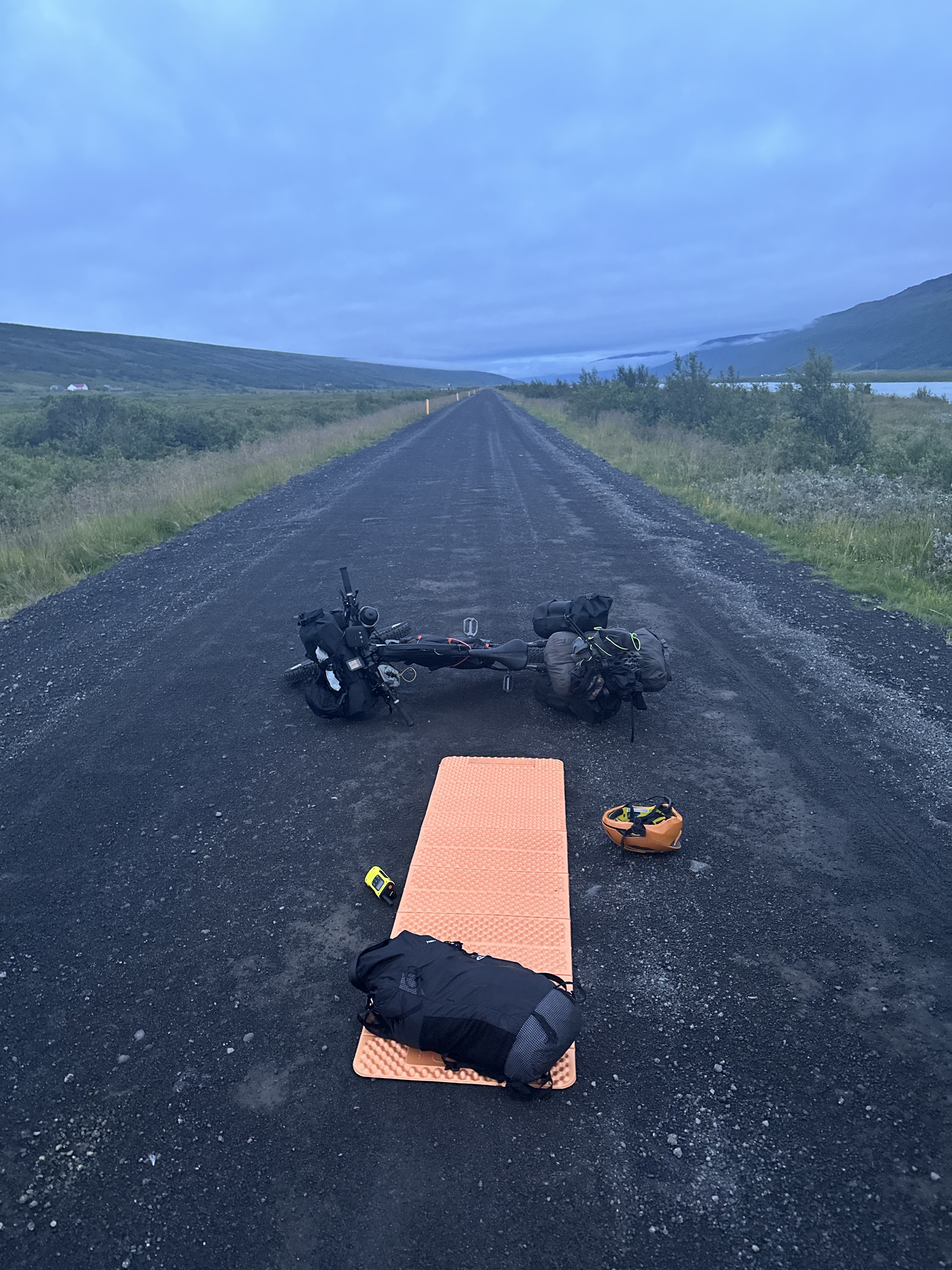
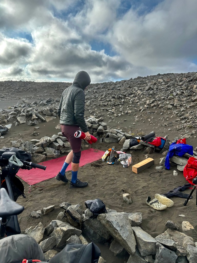
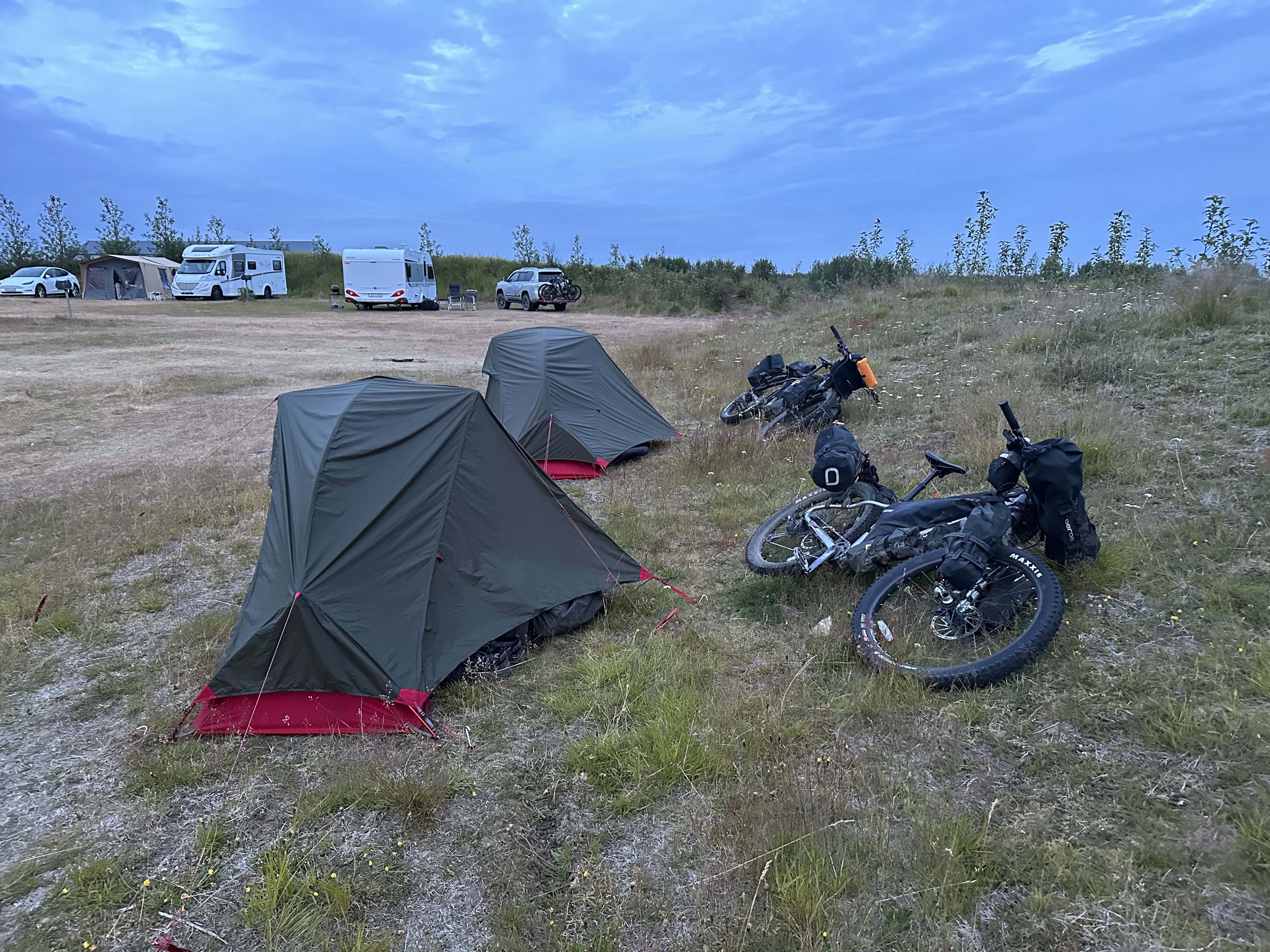
In terms of convenience, we already had an experience setting up a tent at night since our test ride back in the UK. But trying to do that at the end of a day’s ride, whilst being utterly knackered, also meant creating a huge mess the following day, bags and stuff all over the place, and more mess inside the tent. I am talking about my mess by the way. I am sure Josh’s stuff were folded up and neatly arranged by colour or something. That theme kinda continued throughout our journey, and I am personally utterly bothered by it. Have a look at the photos. You can assuredly recognise which tent is mine.
We set off without food, but barely out of sight of Skjalfandafljot river bank that we had just left behind, we stopped and cooked some breakfast. Occasionally, we found that more convenient, to get up, pack the stuff and go, and once we had covered some mileage, then have a break and cook some food.
There is more to a flat than just a hole
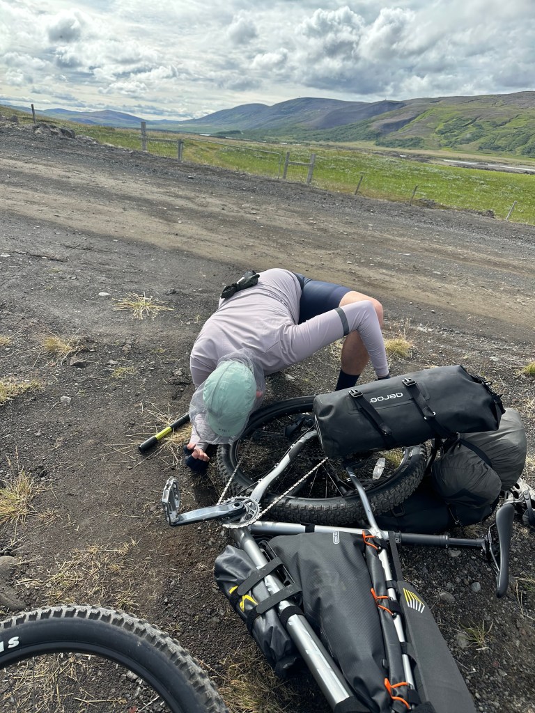
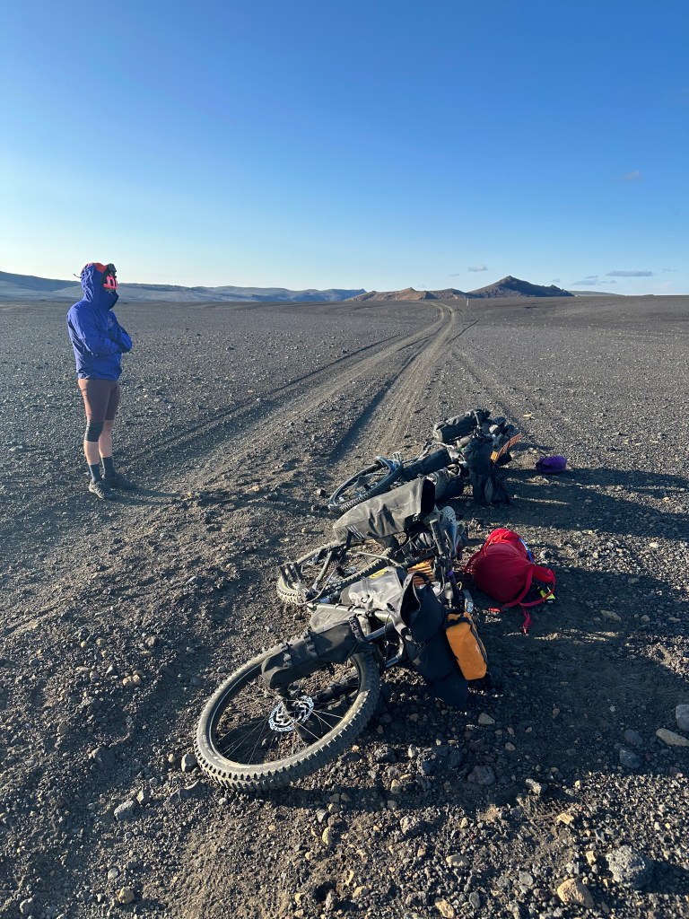
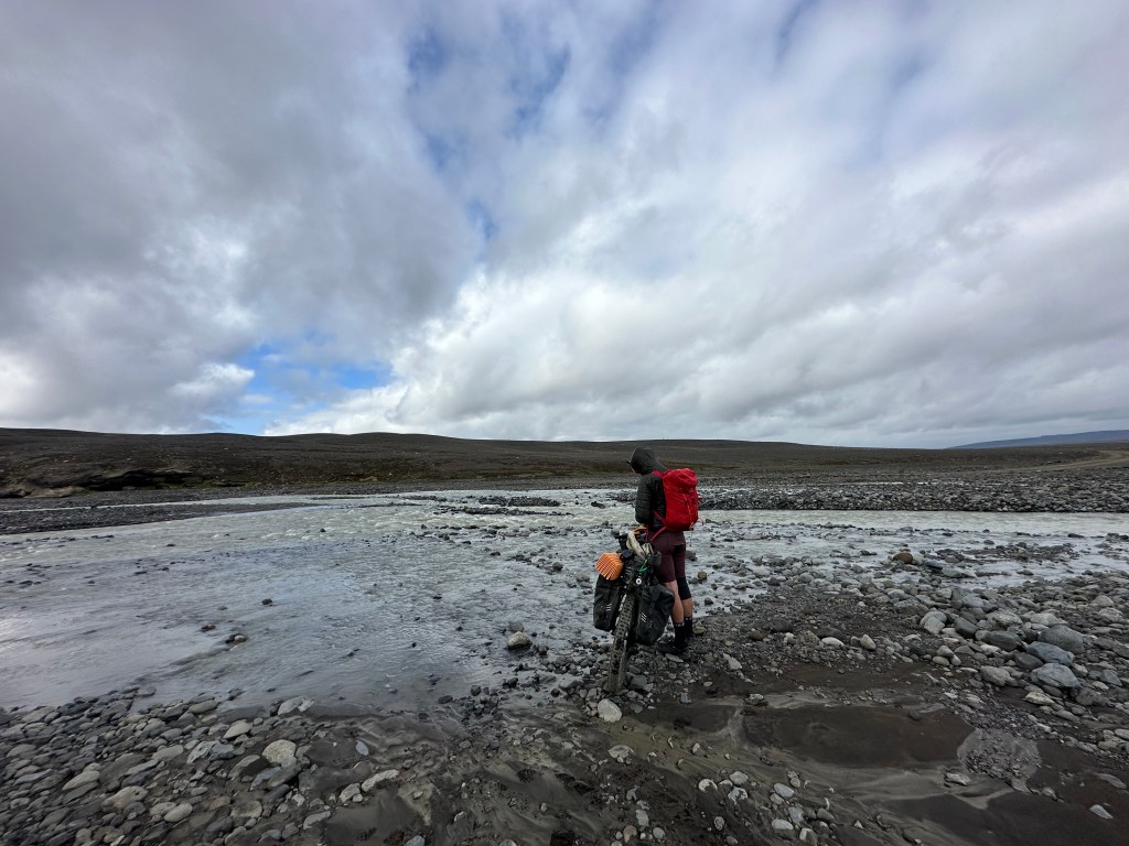
Just as we were preparing to set off, i realised the pressure issues i was experiencing with my back tyre earlier on the journey was a flat tyre after all. And not just a common tubeless flat; it was coming out of a spoke.
Josh is the handyman of the duo. Riding bikes all his life, a fact that is also paired with his baffling interest in the mechanics of all things. Adding to this, he has excellent problem-solving skills and is annoyingly laser-focused. He watches YouTube videos on the go on how to fix things, and effortlessly goes on and fixes them. What the hell. Patient, competent and dexterous.
I am diametrically the opposite in every sense. Irritable, inept and clumsy. Utterly bored almost instantaneously with any task at hand that involves “fixing”, easily distracted (“Oh, look at the cloud formations!”), and madly impatient, with myself above everything else, and then in turn, with him, when he invariably becomes annoyed because I get things wrong. If we are faced with a mechanical problem together, and when I find myself at the lower end in the scale of my mental endurance, I secretly pray he might take over, as he (mostly) did in this first serious flat I got. When I am at my best though, I will half-heartedly say “I’ll do it, as I need to learn”, as it happened in the next flat-tyre I also got. Not that I will stop him taking over eventually, when he gets frustrated with how slowly things progress.
Anyhow, back to the first tubeless flat. Every time we were attempting to fix it (duck tape around the spoke, then with superglue, etc), it meant we needed to pump it every time, check the result, before we had to start again, and then eventually put in one of the emergency tubes we brought with us. After a couple of hours, we set off stressing out how on earth we would get to Botni to essentially finish what was yesterday’s ride (34km) and then move on straight for another 70km odd. Of course, we accepted reality soon after. We lost a day but had planned for it anyway, so we’d trim a day from the end of our trip which we had saved for our Reykjavik stay.
On another note, somewhere during this part of this ride, I got the opportunity to get into the water and swim. Yes it was freezing; yes it was lovely.
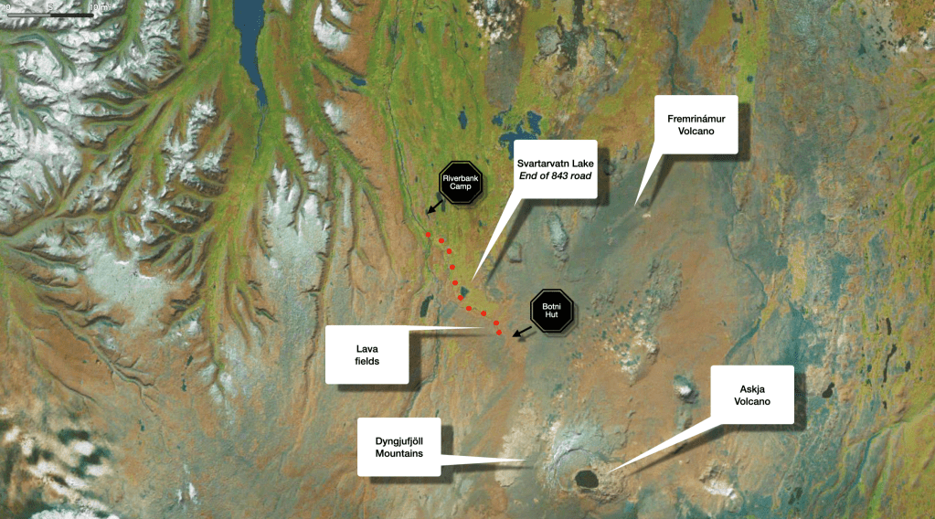
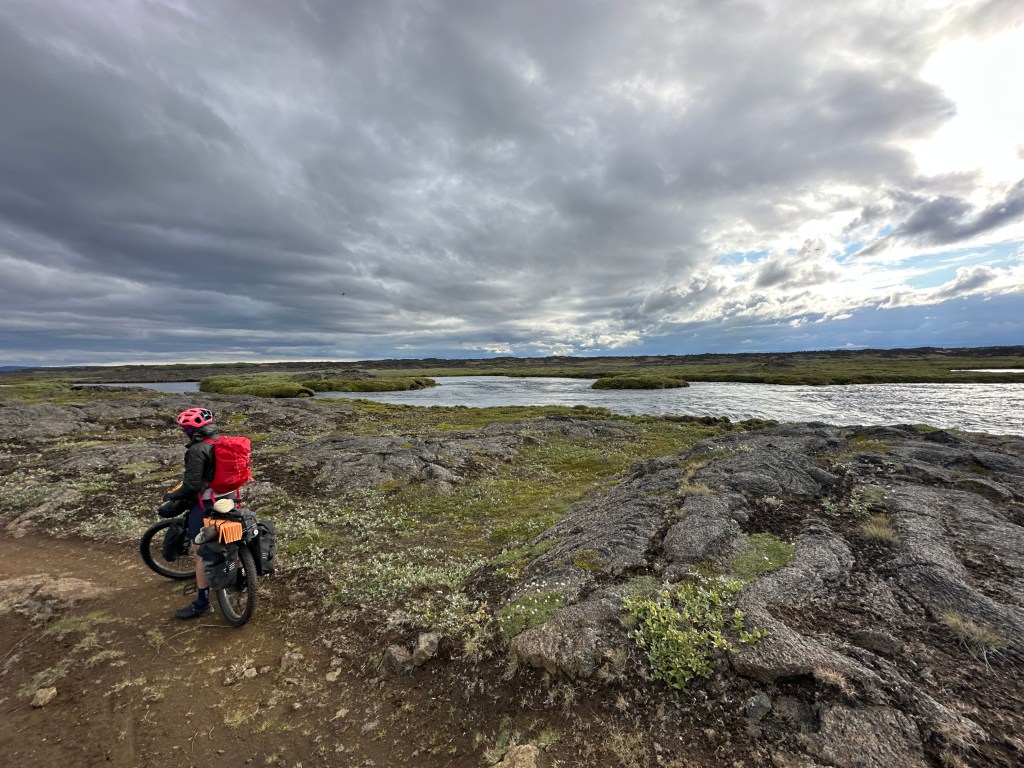
19km into our ride we reached the end of Lundarrekkuvegur road (843) by Svartбrvatn (Svartarvatn) lake; thereafter the dirt road was becoming more like a dirt path on an relatively uneven terrain. Josh did some drone filming, I took some more photos
Towards Botni
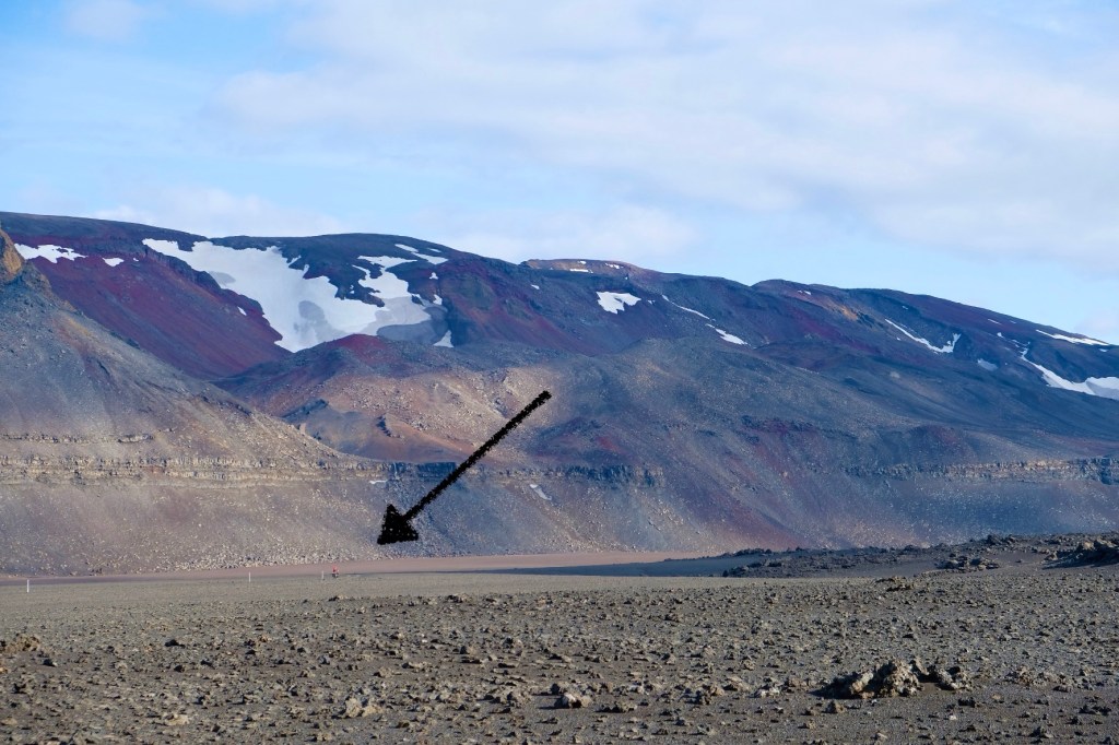
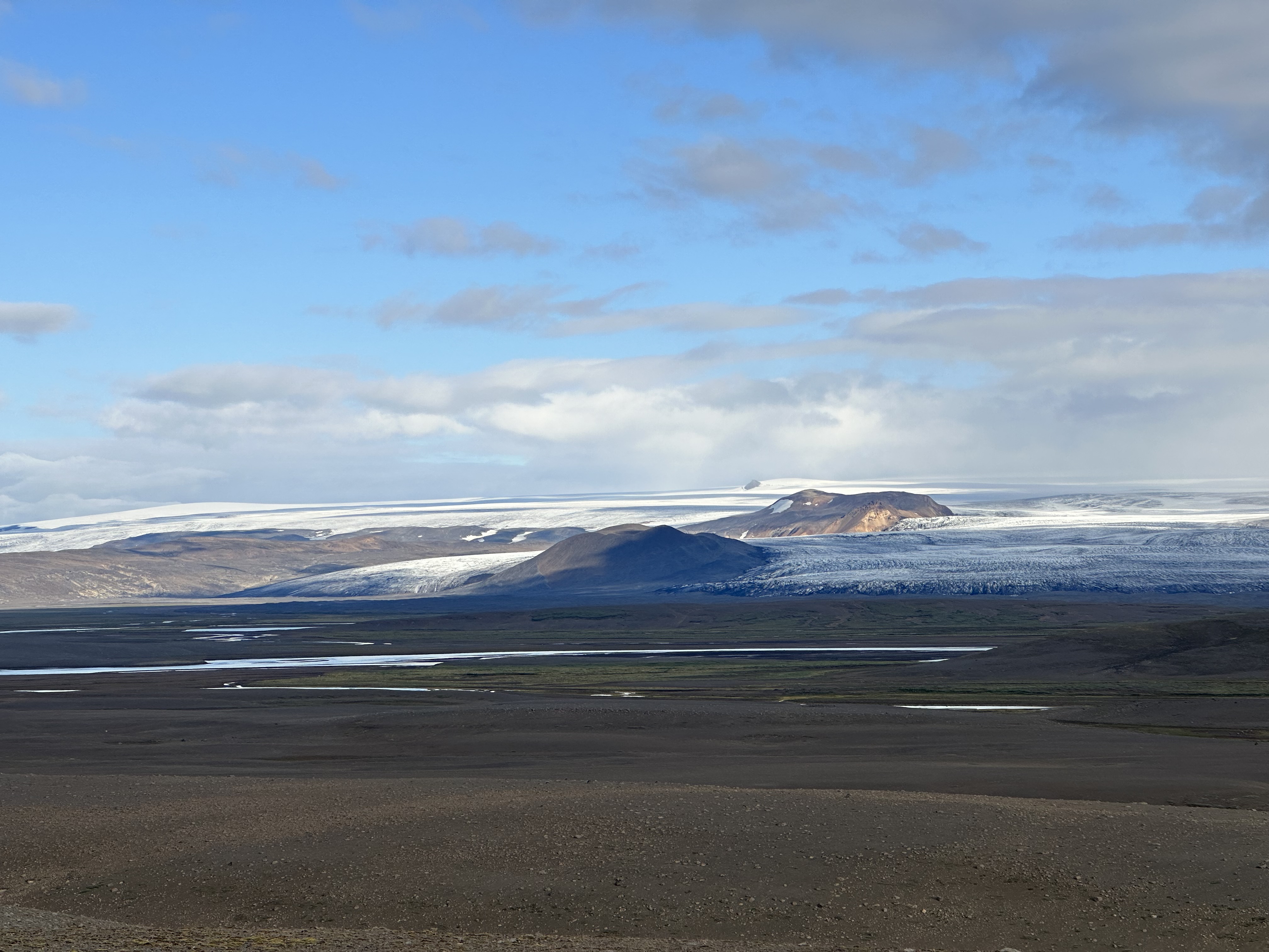
The entire area east of Skjalfandafljot, all the way to Jokulsa river is the imposing Odadahraun volcanic desert which encompasses different lava fields depending on the volcano and various eruptions. Just south of lake Svartбrvatn, the edge of Suðurárhraun fields from the west was in front of us, whilst Utbruni was lying to the east.
By the time we came across the remarkably unremarkable signposted point where the path splits into two, one for 4x4s and the other for mountain bikes, we were in a OK mood. So far, we were 26km into that day’s ride and 22km since the path deviated from the river bank.
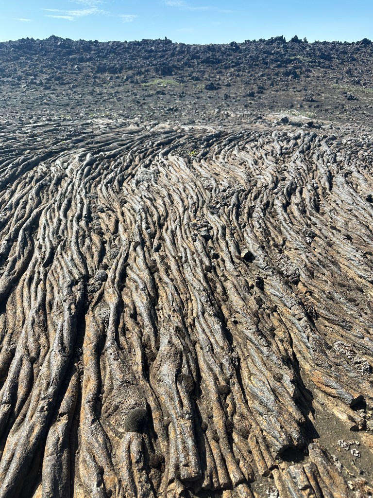
Concerning lava fields
One thing that bugged me when I was researching on Iceland to write this blog, as well as when I was there, was the lack of clarity on the different lava fields we were crossing. Every blog or website you read mentions this lava field, that lava field, but when you are on the ground, you really see some vast differences on the landscape and ground formations. So the obvious question was, when we were toiling to cross them,… which volcano was it that spewed this and when? This very moment, I have such an emotional connection with it, bound with it in suffering and existential contemplation, I wanna know which one, is this too much to ask?
Anyway, I wrote around 2/3s of this blog before I discovered this gem of a website: Catalogue of Icelandic Volcanoes. Not only it gives you the location of the volcanoes (Ok, I can get this from 100 other websites), but the precise information about everything it is known about them, researched and scientifically published, and more poignantly, it includes map layers of the lava flow post-eruption. So according to that, when I was swearing at those volcanic rocks around Botni, unbeknownst to me, I was directing them towards Fremrinámur and Bárðarbunga (Bardarbunga) volcanic eruptions. Fremrinámur is dormant and lies around 50km to the east as the crow flies from where we were. Its last eruption was more than 2,500 years ago, and its lava must have reached the edges of our path. From the west was the even larger Bárðarbunga, under Vatnajökull (Vatnajokull) glacier – one of seven volcanoes covered by it – whose most recent eruption was in 2014.
In fact, lava from Bárðarbunga eruptions (amongst others), in one form or another, would be eventually trampled over by our own humble 2.8” tyres across at some point during our subsequent rides, from the fields in Botni, to the south-east parts of Odadahraun desert, and even further south of Nýidalur (Nyidalur) valley, and along Iceland’s longest river, Þjórsá (Thjorsa) and its reservoir, lake Sultartangarlón. Now I dare you to get a paper map and run your index finger along of those locations.
Into some serious business
Difficult to convey in words the feelings and thoughts that were going through my head whilst crossing this area. A few months back, we tested our bikes in some mountain biking tracks in two different forests, and i kinda got the gist of how different it was to road cycling, both in terms of technique and muscle development. The few things i just about managed to become cognisant about, and by no means as skilful as Josh, were: when not pedalling, you better (i) have the fucking pedals resting horizontally, otherwise you’d be hitting obstacles, or rather, humongous primordial lava rocks, (ii) crouch and lean back to control the bike in descents, even in small ones, and lastly, (iii) focus on the ever changing (narrow) path, and choose that path wisely.
Those 6km from the Botni sign to the actual hut, having to navigate some extremely convoluted, winding and narrow tracks, in the heat and in pursuit by swarms of midges, constituted one of the hardest part of our trip.
Furthermore, please allow me to elaborate on what I mean by “narrow”.
I mean trying to ride a bike in between rocks with barely an inch leeway on either side of the pedals, whilst also having to calculate whether these rocks (1) were high enough to allow for the pedals to complete a full circle, (2) might just be scraped at the top by the pedals or (3) fully lock the bike by catching onto the pedals. Sometimes, I chose wisely, sometimes not. Climbing over some huge lava formations was also necessary when a path was not apparent.
Josh was at the front, sometimes carving a path out thin air, sometimes dodging obstacles. I, at the back, was focusing on staying alive, and occasionally, feeling pretty chuffed for succeeding (at staying alive). To compound things, the GPS was showing no discerning contextual information on the screen, just the route, mainly because we had to zoom pretty closely to deal with the winding nature of our path. As a consequence, when there was any slight deviation from it, that line would disappear, and due to absence of anything environmental on the screen, we sometimes had to stop and adjust it accordingly. Fun times. At least in this part of the ride, considering I had Josh to follow, those aforementioned challenges were even more pertinent to him.
At Botni
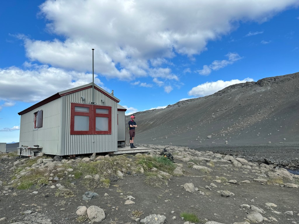
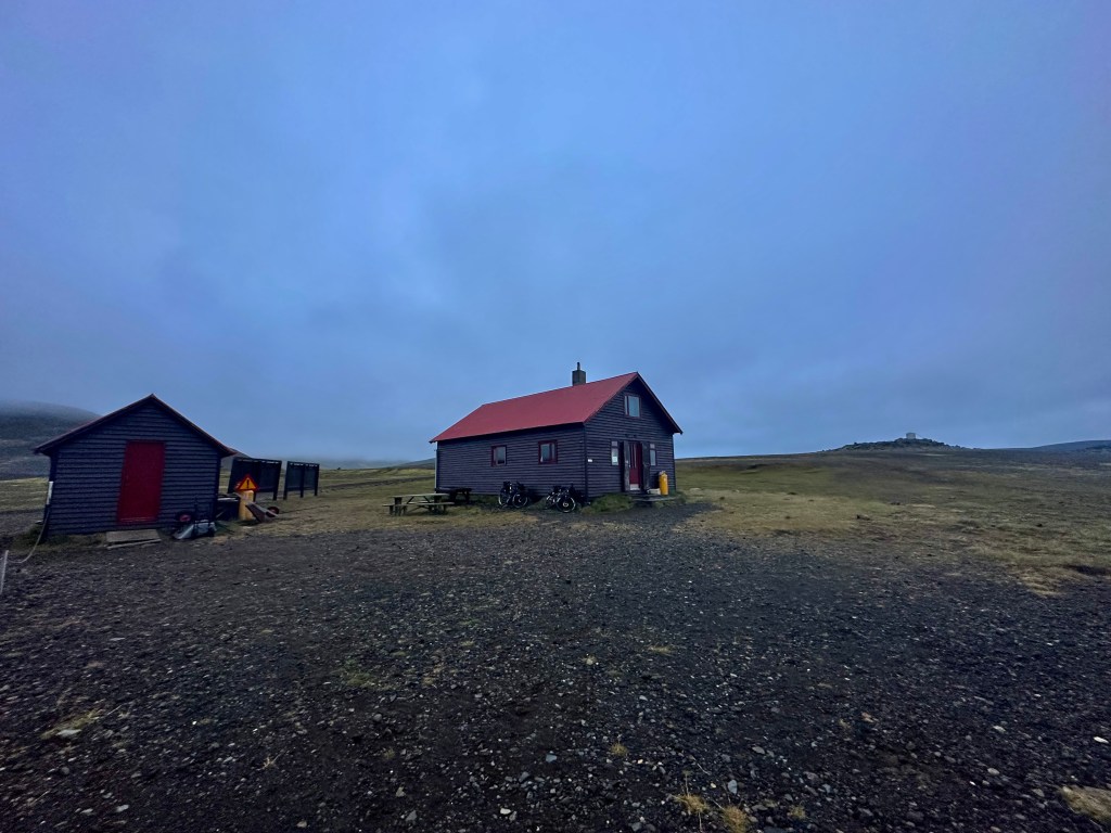
We arrived at Botni and decided to call it a day rather than carry on.
By a stroke of serendipity, they had my old booking I had made months ago, which was for Sunday rather than Saturday, so now that we were there a day late, we had to pretend that this was our plan all along. A few dozen other hikers were camping outside by the water, midges and all. In general, there was a great atmosphere. Groups of people cooking and drinking by their tents or next to the hut. The sun was setting and although the midges were still a bit annoying, it was a lovely end of the day.
It is incredible how quickly one might forget the trouble getting to such destinations, and even when we conjured up our rudimentary evening meal, and made do with the accommodation arrangements such as they were, it all felt pretty special and well worth it, a theme that would occasional resurface during our journey; we complain, we curse, and then, “aaaah, this is fucking awesome, isn’t it?”
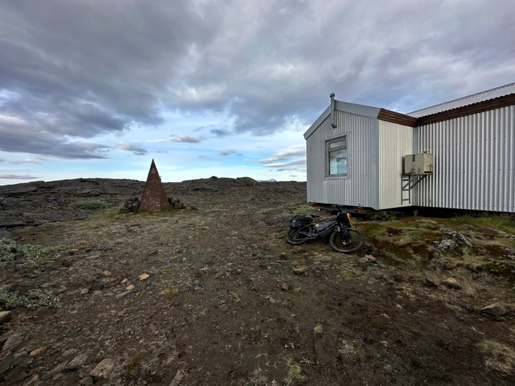
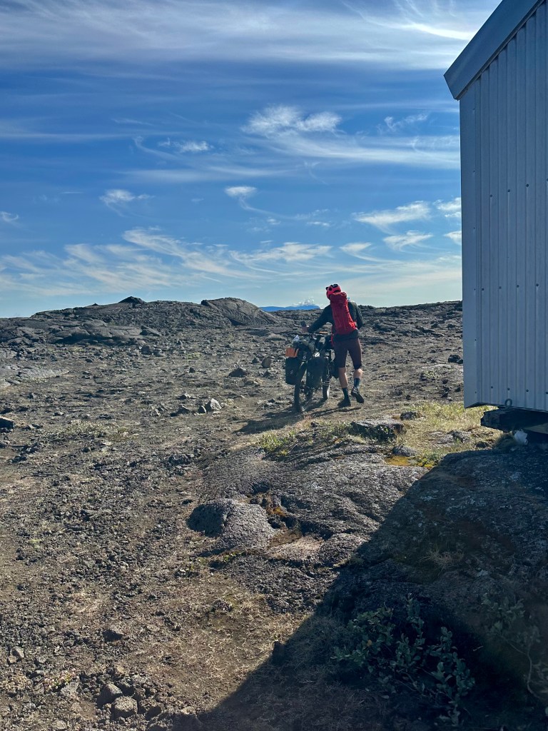
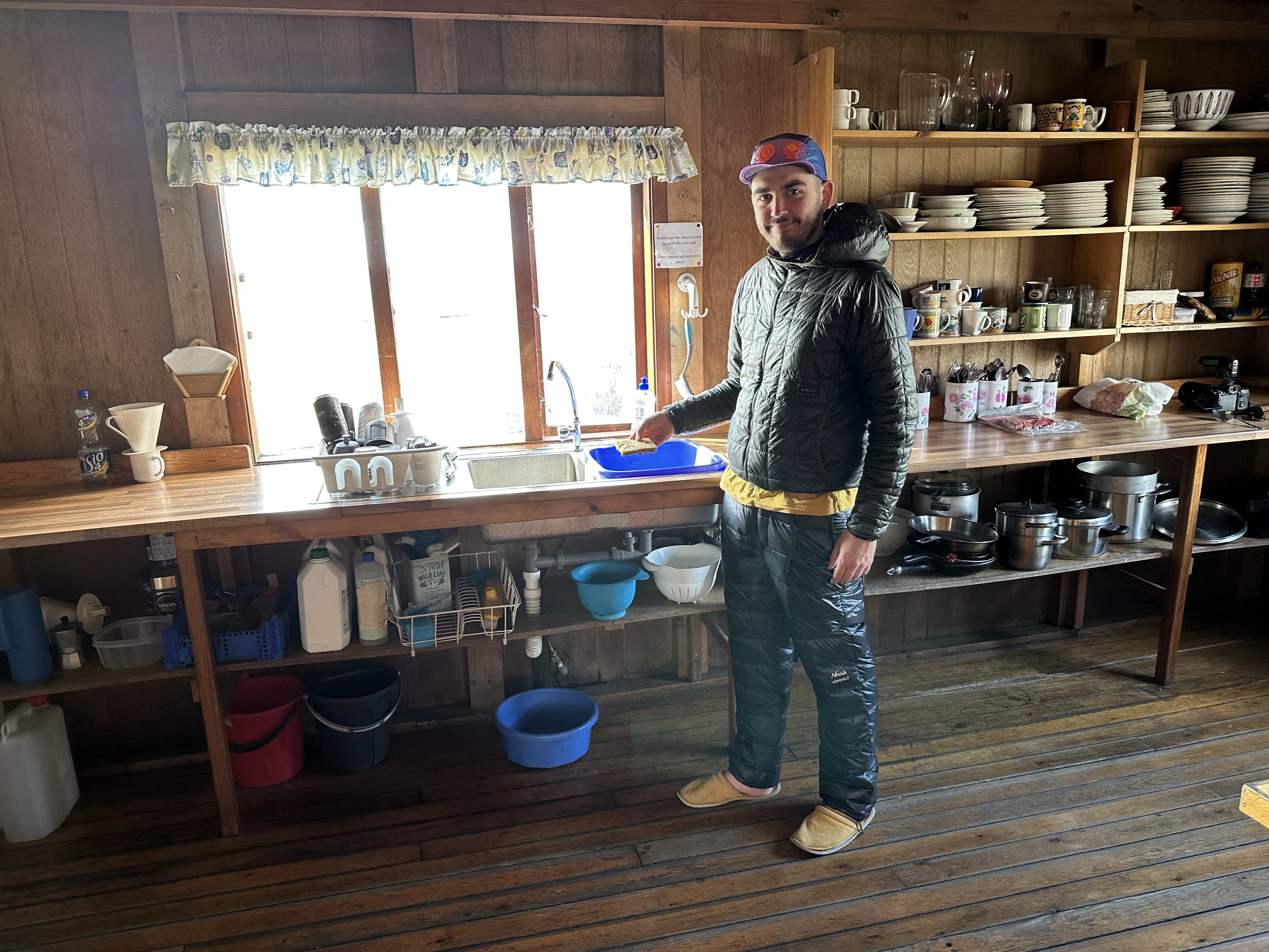
Botni was our first experience of a highland hut. It had two rooms, one being the hallway where the cooking is done, and the other the dormitory, which sleeps 16 on bunk beds, 8 on each side. Three French hikers were occupying one side, and we had the other to ourselves. The hut provided crockery, cutlery and a gas stove to cook, and no electricity or water. Other than that, it was up to everyone to make do, get their water from a stream a few hundred meters from the hut, which we did and promptly filtered. Oh, the fun times, when I was left alone, unsupervised, and ended up dropping the (only) filtration system into the very fast-moving current, and having to run along, follow its movements for some time and then jump into the water to get it back. Josh never witnessed it, thankfully. I haven’t even told him.
Oh, crap…
Now. Let’s pause. Have a seat. This is a good time to talk about what i have learned about satisfying one’s bodily functions in the wild.
I had camped a dozen times in my life before this trip, all in organised places, mostly back in Greece. I knew not much about camping in the wild; that you have a specific type of shovel (!) to make a hole on the ground to take a dump; the crouching; the awkward wipe; the fear of shit brushing against the trousers (what, is it only me thinking like that?) – all good thus far though. What else could one do? I experienced it the first night, and it worked out ok.
But then I learned about the type of loos they have in huts like Botni. Yes, yes, I know. What one to expect. I sound like a snob here, but I took one look at that triangle shed that I could barely fit inside, never mind close the door behind me, and…, nah. It wasn’t gonna happen. There was a deep hole, and a wooden medieval-type of frame where you meant to sit on. They must had been behind emptying it, probably with a B52-size vehicle, all things considered – I kid you not, the hole, this gargantuan ditch in fact, was wholly enveloped in crap. I mean a humongous pile of shit and paper, and hosts of flies feasting on it; all this, barely an inches from the surface of the wooden seat. And you want to close the door behind me, in such a small space, never mind peremptorily command my anal sphincter muscles to deliver the package? Uh-huh.
And what if it’s one of the difficult ones? You know, the ones you need to squeeze harder and harder, and for longer? All that, in there?
Anyway, an hour later, Josh did just that. The insouciance of this guy is out of this world. And I kid you not, he stayed in there, something like half hour, or it felt like it anyway, nonchalantly browsing on his phone probably, taking his time, as if nothing was out of place.
I didn’t even ponder in my case. It was an outright no. Absolutely no. Uh-huh.
But of course I did. Sigh….
I had to, later in the evening, after scouting unsuccessfully for a place to do it in the wild (too many spectators). But relax, all went well. I was expeditious as I was thorough; in and out in three minutes, done and dusted, squeaky-clean. This was the baptise of fire, like every other major challenge in this trip. I was firmly one with the gang now, with all of those wild-camping, hut-relying folks out there.
Henceforth, all triangular hut toilets were to be considered conquered. They can all go fuck right off. I am ready.
Mon 31st July – Botni hut to foothills of Urðarháls (63km, 725m elevation)
Out of Botni
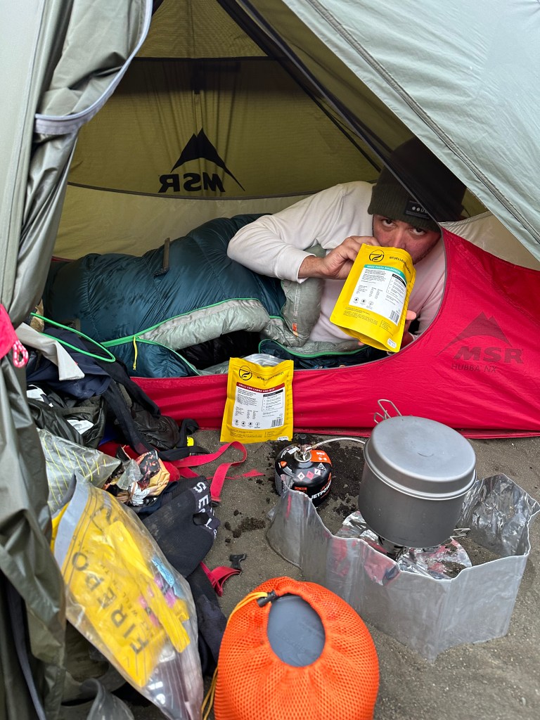
The day started with lots of hope. We got our water, filled up our bottles, cooked some porridge, we also heard how much Josh hated porridge, I took some photos of Josh being disgruntled at porridge, then some videos on how much he loathed porridge indeed, and then I totally forgot to actually ask if it was the kind of porridge, or porridge in general that he disliked, notwithstanding being British and all. Ok, this is mean. I vaguely remember it was mostly the combination of flavours in this particular one, I think.
We took our time, again, but we set off around 11am.
Despite having to ride another couple of kilometres of lava fields, as gruelling as the previous evening’s, doing it in the morning, it gives you a tad more confidence.
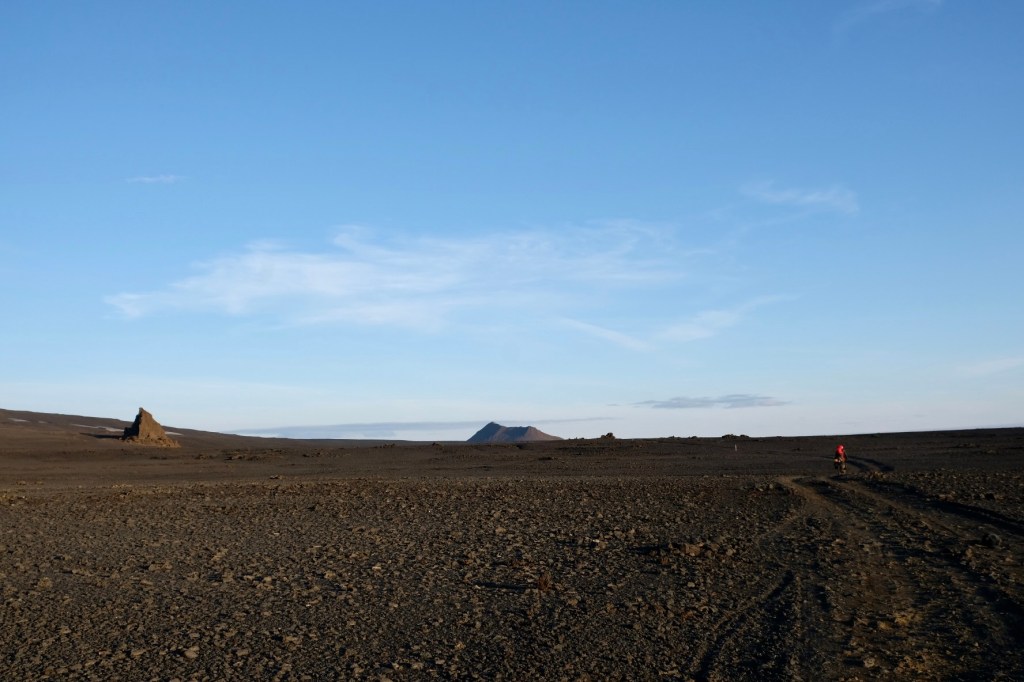
It turned out to be just fine. You kinda feel more prepared psychologically, I suppose. Fearing less for one’s life, I now marvelled at the whole scenery even more. The day was beautifully sunny again.
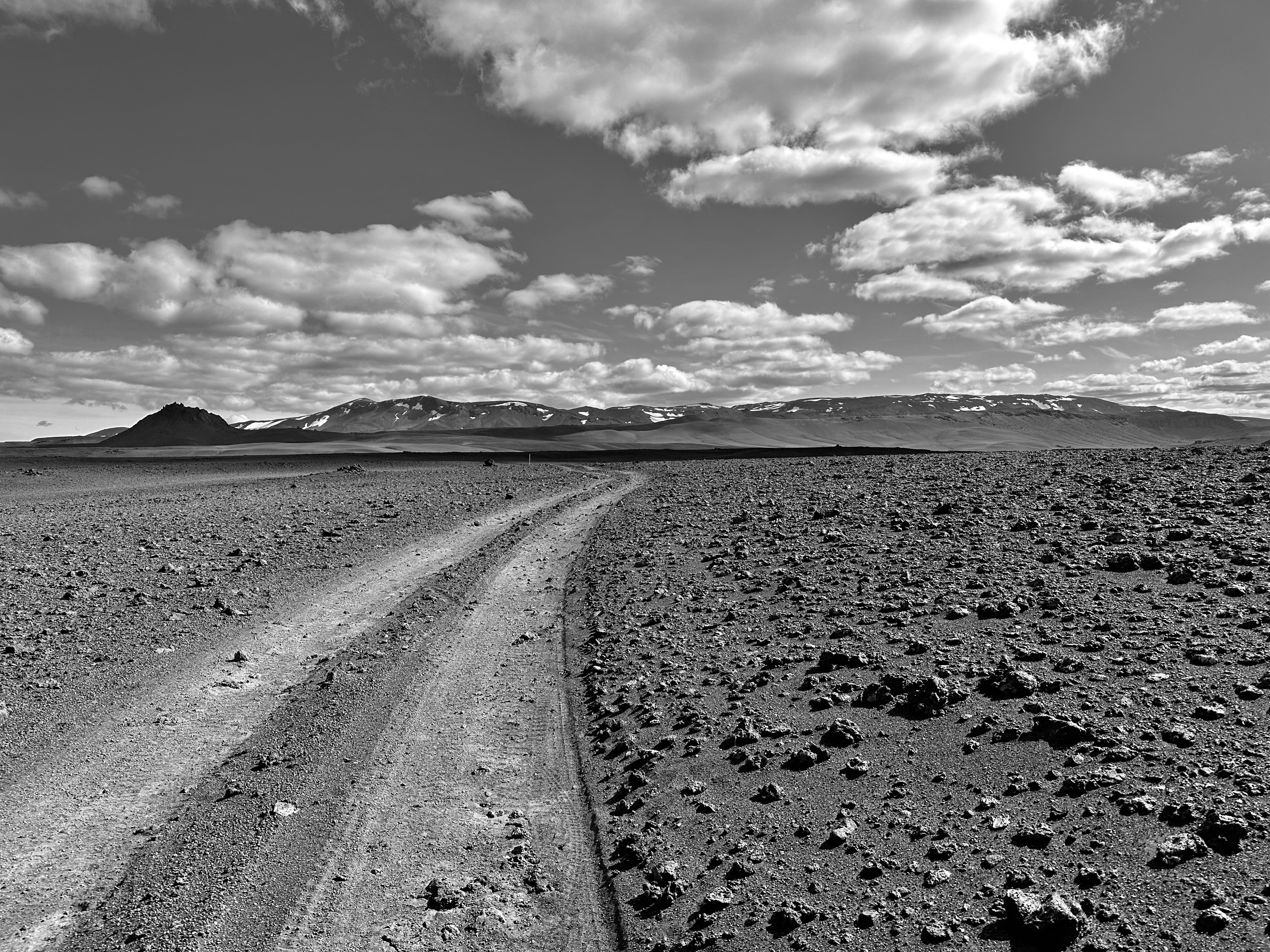
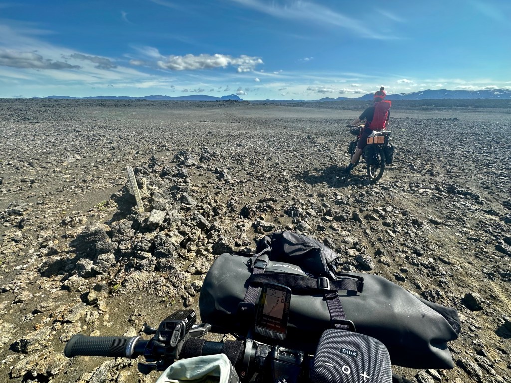
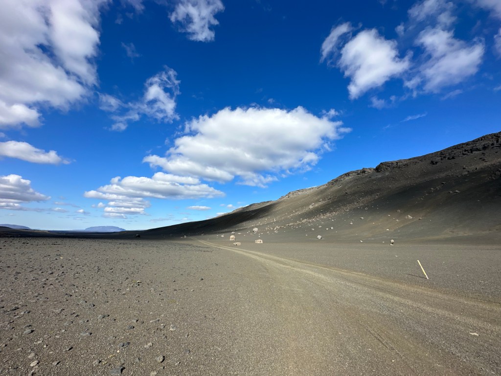
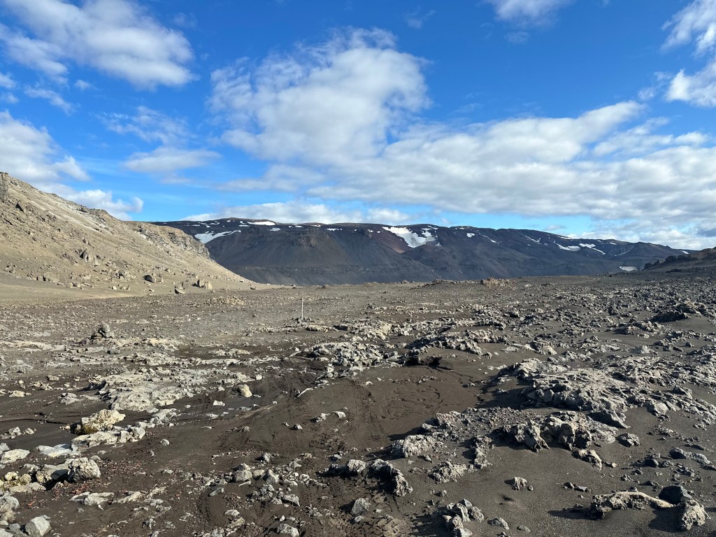
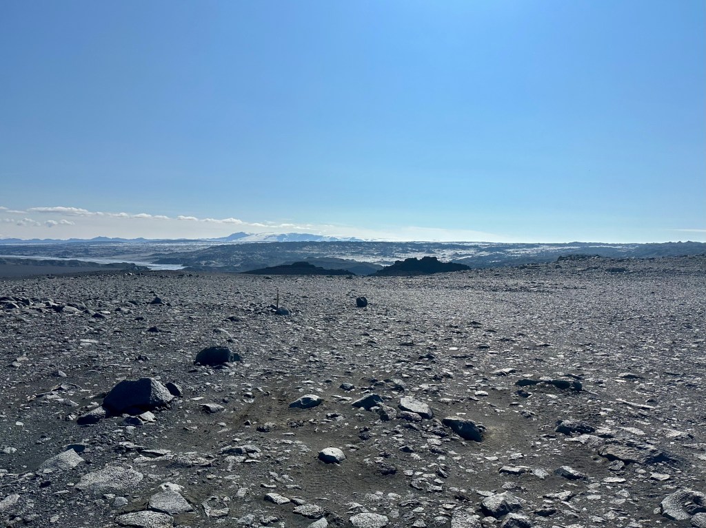
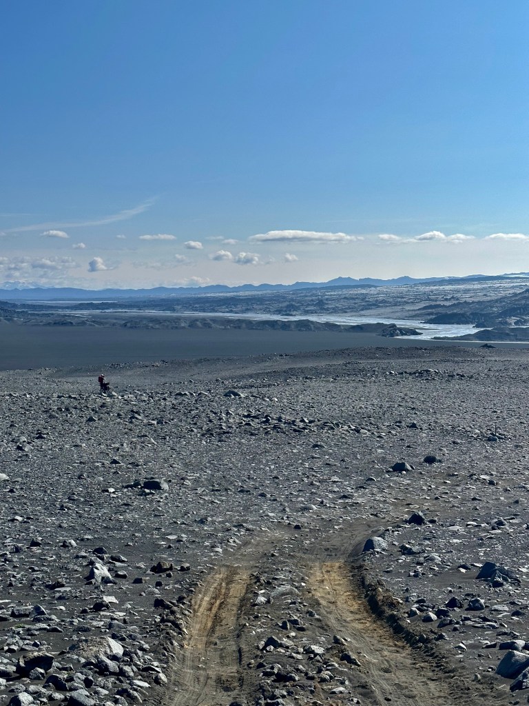
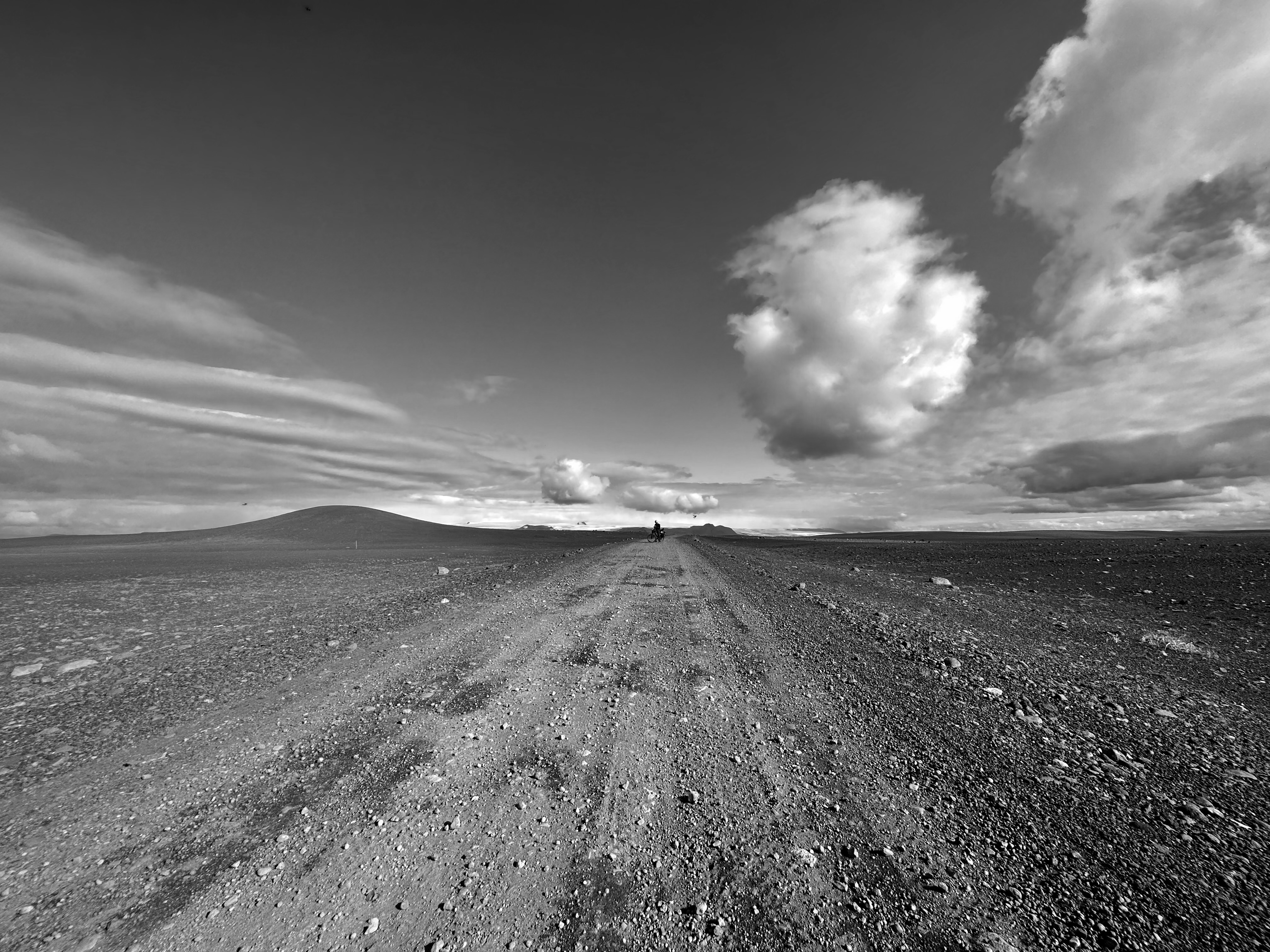
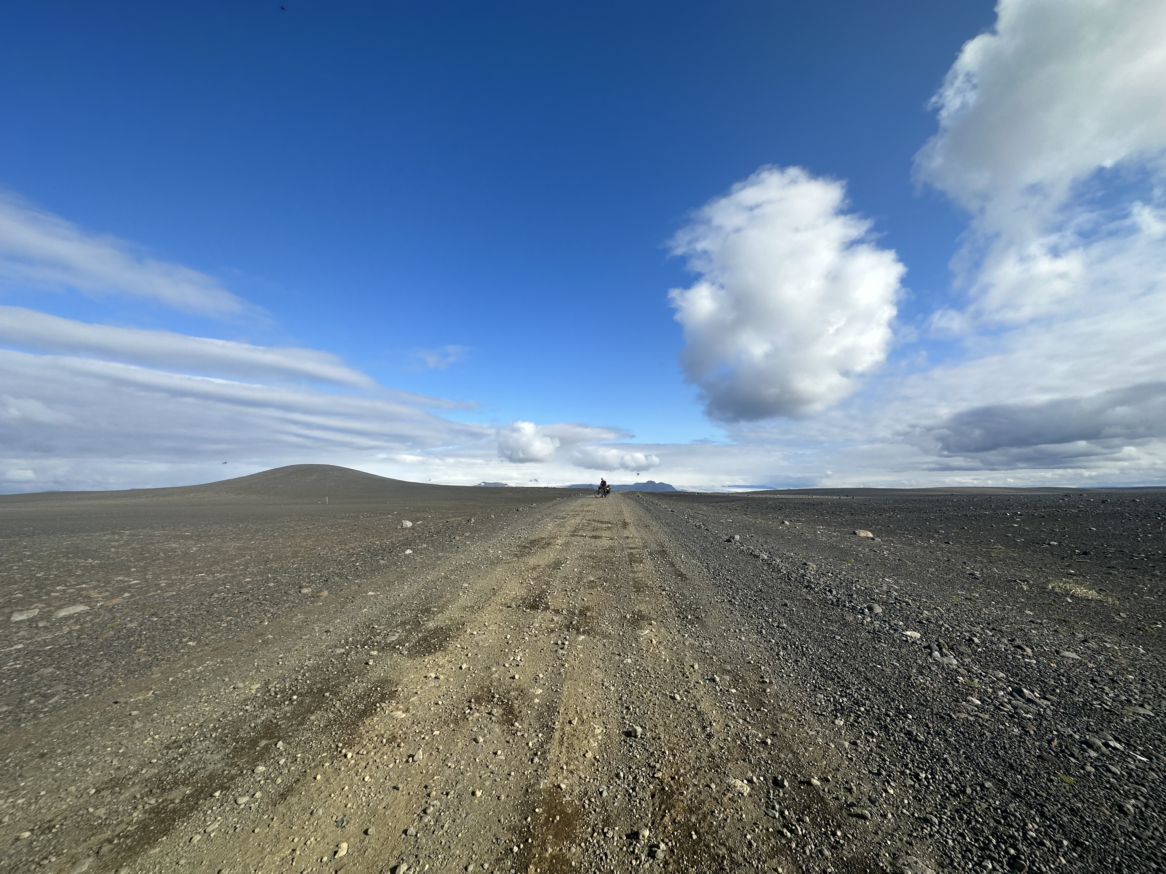
The lava fields with huge rocks were gradually turning into fields with smaller and smaller rocks until we reached the open desert with pretty much just conventional sand.
At some point, we also bumped into the French family of hikers we had encountered back at Botni. First was the young one, who was sunbathing as he was waiting for the other two to catch up with him. They had all reached that spot from a different direction to us, and they were heading towards…oh, wait. I didn’t ask. I left all the small talk to Josh.
The sand: first impressions
Now now…The desert. The sand. Volcanic sand, I suppose, and whatnot. The thing about sand in general is that it’s not conducive to a steady rolling of one’s wheels, obviously, and the efficacy of one’s effort can go to shit, if one’s rendered immobile at any given moment, or even worst, if one’s in constant anticipation of it. This was evident throughout the course of this day. But we were equipped with 2.8” tyres, ready to face precisely that kind of challenge, so it was mostly OK. Anyway, to begin with, it was fun. Hoohoo, haha, oh my god, I am stuck, I am gonna crash, no, I am OK, haha, and all that. We stopped, took photos, he used his drone, I posed; I enjoyed the incredible views, rethought of my life, then carried on. More about sand later, though.
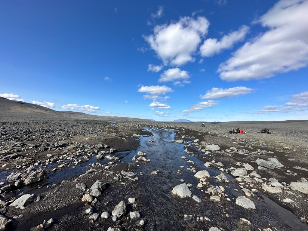
We had taken a risk by not carrying the maximum water we could have carried, as back at Botni hut there was a warning sign for water source shortages along the way, but conversely, we were also advised there might be a river en route (there was).
This early on our journey, we were at maximum load (most food was not eaten yet) and carrying an additional 8L of water in our collapsible bottles was a difficult decision to make. We knew though that when we’d get to the river/lake system after the Urðarháls area we wouldn’t need to be too cautious about how much we carried.
Famous last words of course, because it does not matter how much water I personally have with me: I am usually known for forgetting to eat or drink enough, so my friends have to attend to me at such trips, and keep reminding me to fend for myself.
Towards Dingjufell Hut and beyond
A few kilometres before Dingjufell hut we came across a small river whose stream was fast enough to make the water drinkable.
Gorgeous views, and great place to stop for a bit. In one of the rare encounters, 100 meters away, a hiker, sitting down, also enjoying the views. He waved, we waved back. We saw him later at the hut, had a lovely chat, I mean Josh did. He was walking for days, and…and… I think there were many more heroics to the story but you’d have to ask Josh, I suppose.
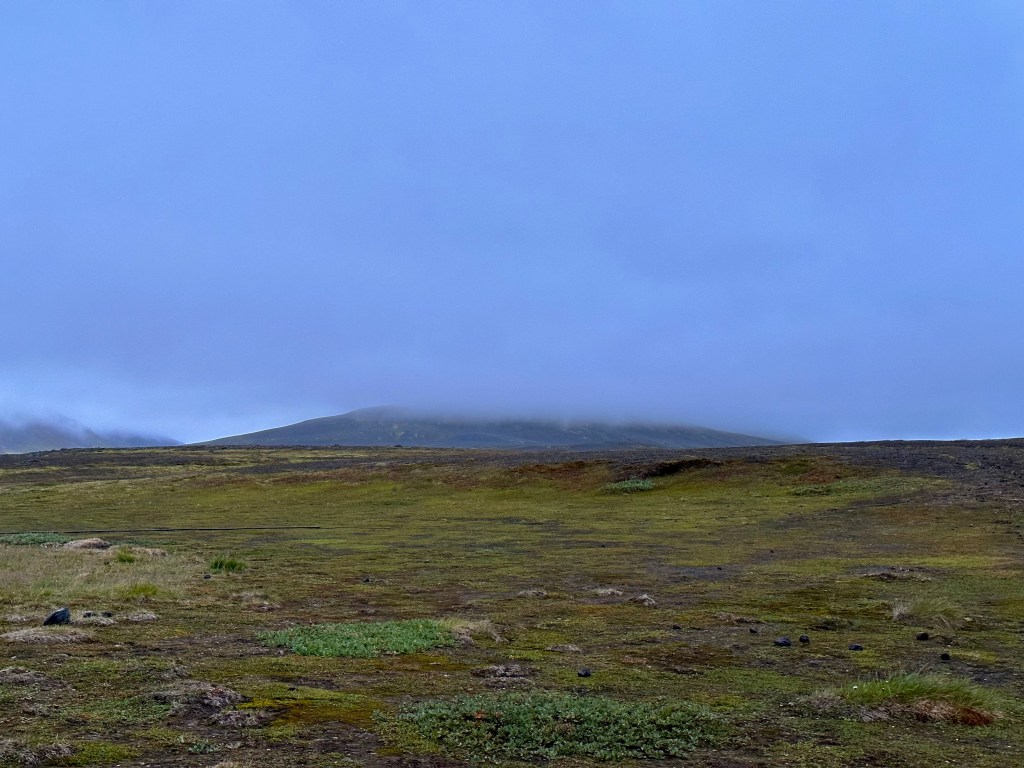
Just before the hut, I stayed alone for a bit and enjoyed the incredible scenery: surrounded by hills, in the middle of the desert, incredibly blue skies, the Dyngjufjöll mountains immediately to my left.
The best thing one can do whilst riding is to occasionally pause and enjoy the view of the places that have been left behind; and I purposefully spent some time doing just that. Josh went over to the hut and shouted at me over the radio to join him. There was a bit of a diversion, crossing a small stream and then going up a hill, so it took me a bit to decide, but I followed. It felt great that in this vast expanse we were to ourselves.
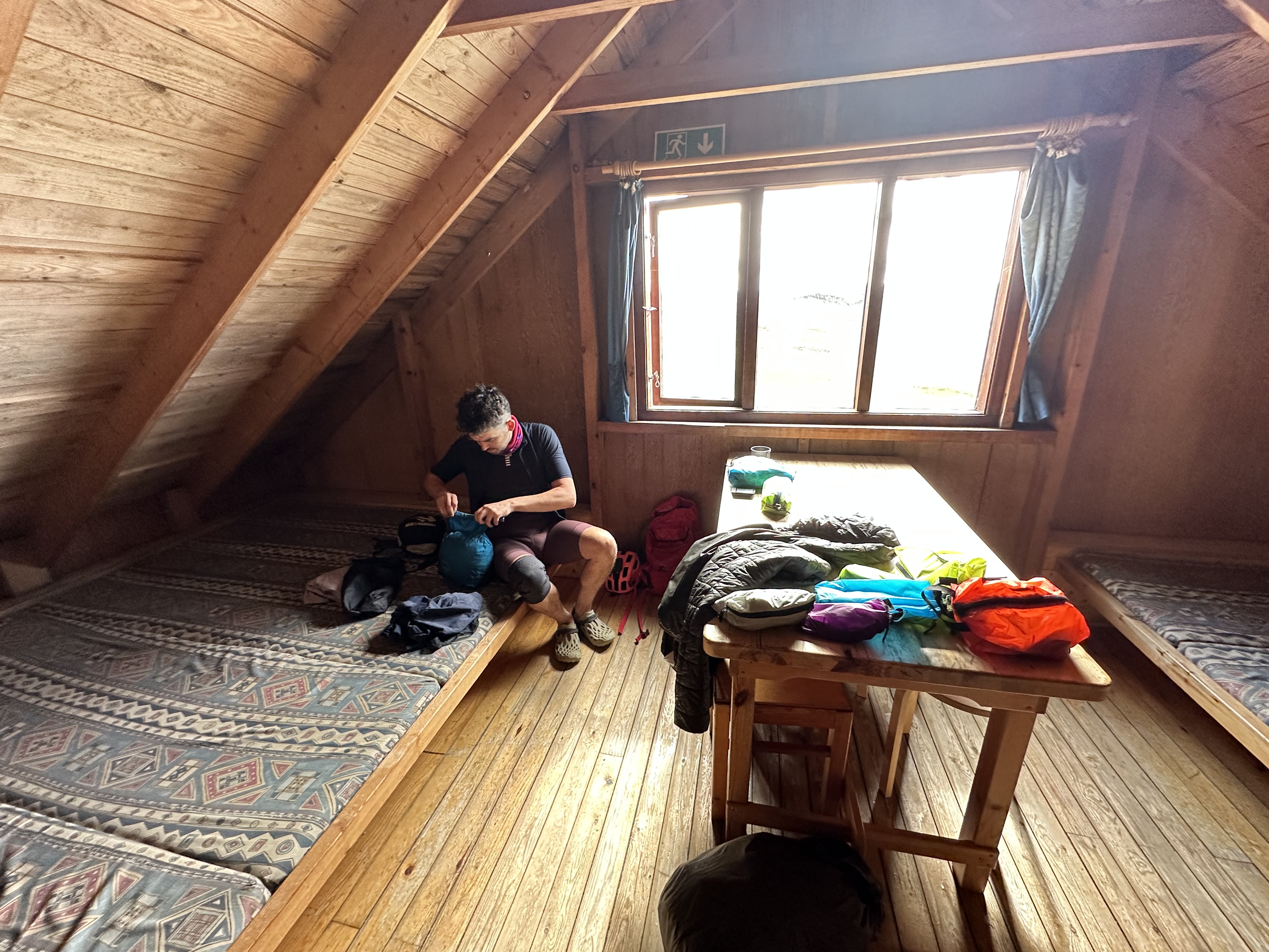
The hut was empty, and we stayed there for a bit. It was not in a great condition. The layout was also different from Botni, but essentially it had the same type of rooms: the kitchen, and the dormitory.
The views were great from the hut. Looking at the Dyngjufjöll mountains, I was trying to envision Askja volcano, which I thought it’s directly behind the mountains in front of me (it is actually towards the right of my peripheral vision), where Nasa’s astronauts from the Apollo program got trained. Iceland is situated across the active Mid-Atlantic Ridge, hence the hundreds of volcanoes. Considering its remoteness, Askja kinda surprised everyone when it erupted in 1875, and that eruption was what led to its discovery. Tephra from that explosion was found all the way to Poland, whilst evidence from a much older eruption was discovered in Romania. Unfortunately, the caldera(s) with the lake was really out of our way to get there and see it.
10km after we set off from Dyngjufell my bike had another flat. It had to be me again. I was paying for my sins, for that glorious schadenfreude feeling, when Josh realised back in Reykjavik he had not uploaded local maps on his GPS (as it is usually I who demonstrates absentmindedness). He got so bossy this time. He was like, “right, pick this up”, “what are you doing? Not this, THAT, turn it around, don’t do it like this”, etc, etc. I was smiling, but I got a bit stressed. Even when you think you know stuff, as in a classroom, and when the teacher is over your head and tells you off, you kinda get things muddled up. Anyway, this time it was the valve, meaning we had to change the tube, and considering we had only one left, we spent a lot of time to fix the issue with glue and patches, etc. We eventually conceded and used the last tube, and off we went.
Waiting for the glue to dry…
By now it was clear once more we couldn’t make it to our destination, Kistufell hut, so we decided to ride for as long as we can and find a good place to camp.
The sand: properly experienced
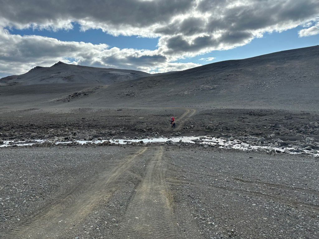
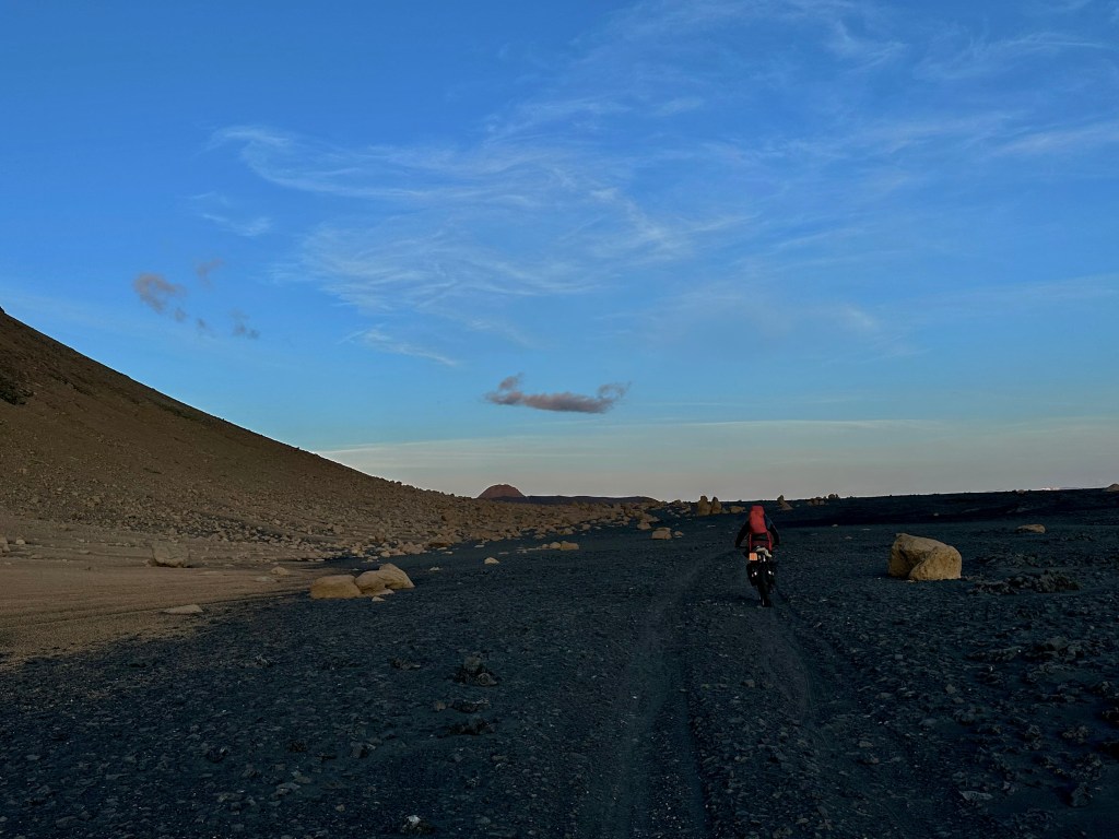
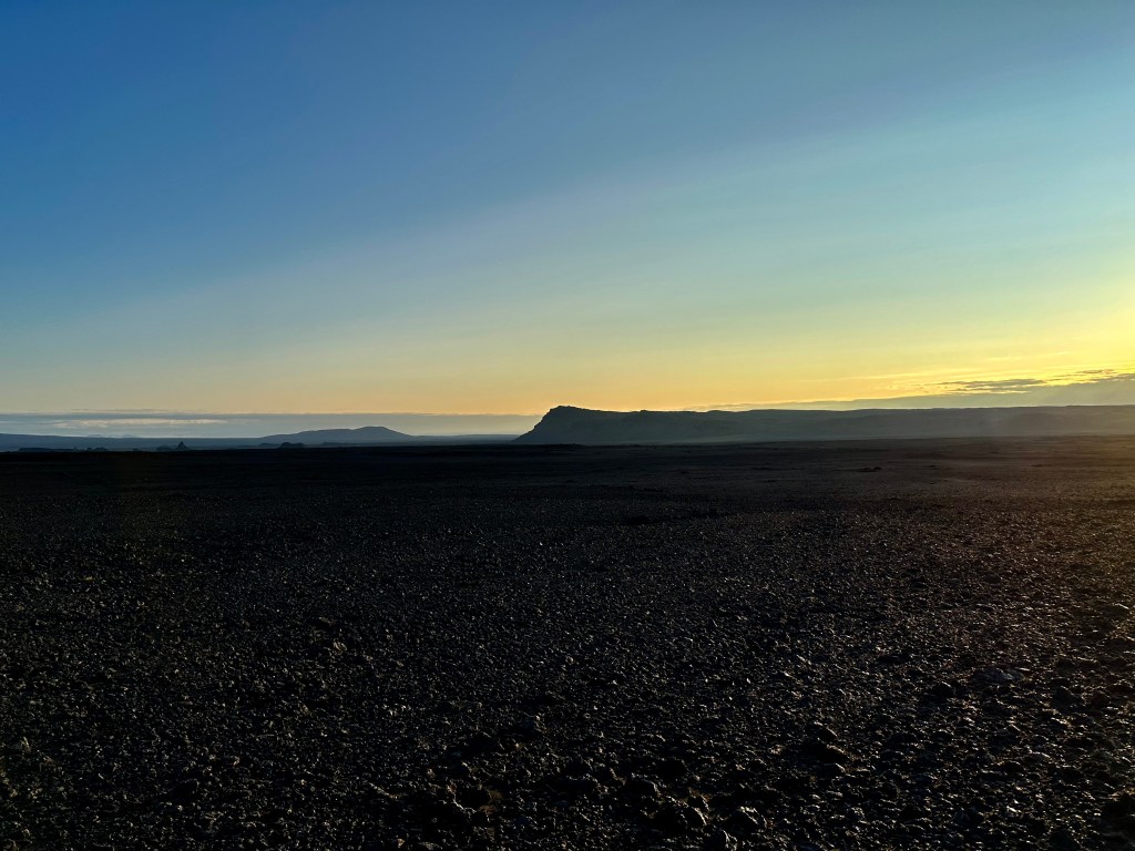
Ever since we had put the Dyngjufjöll mountains behind us, our view turned into a proper desert-type of a horizon: hugely open expanse, with Vatnajökull ice cap vaguely discernible at the back. As parts of this route also involved some twists and turns on an uneven ground, we got a much better taste of what it meant to ride on a sandy ground. In fact, we were pretty content with the possibility of a fall (thankfully, it didn’t happen). When we’re riding downhill or navigating through 90 degree turns, it was very hard to tell the depth of the sand on the patch we’re landing or turning, and sometimes our front wheel would just sink and/or lock. Although we had already experienced riding on sand due to the occasional patches along our route, on the way to Dingfell hut and beyond, sandy desert would be the norm.
Whilst during the lava fields choosing the right track to avoid hitting sharp big rocks was our predominant preoccupation and quite consequential when we weren’t getting it right, choosing the right path in the sand was trickier. At times, we couldn’t get to see how deep it was until it was too late: approaching it at speed, we would end up skidding or losing control; going slower, we would abruptly come to a standstill. Notwithstanding, the hardest part on that day was having to ride so well into the night, when visibility was not great even with our lights on. Oh, and those lights had to point sideways (!!!), due to the huge bag load in front of the handlebar preventing a proper mounting. Comically, every time we wanted to illuminate what’s in front of us, i.e. to check how deep the sand might be downhill, we had to abruptly turn the wheel sideways, so the lights might point to the front for a micro-second, before turning the wheel back as it was.
In general, we felt grateful for Iceland’s 18-19hrs “daylight” at this time of year, despite that “dusk” in the desert was not exactly glistering experience either. Looking up at the sky, it might still seem like there was light, but looking down in front of us, we could’t see jack shit.
This is very first time in my life I use this expression, and I felt compelled to research it, just now. Notwithstanding my aforementioned scatological references in the previous chapters, poor Jack‘s worth the effort, due to the interesting etymology. It started symbolising the “common man” back in the 1700, but mainly with negative associations, and since then, a few expressions came to light, jackass being one of them. Common man “Jack” has its roots in old English, and even further back, in medieval French: the aristocracy was referring to the peasantry as “Jacques”, hence the moniker Jacquirie revolt of the 1300s. Jack-shit though, might have originated in the US in the 1970s.
Ok. I think I’ve been carried away.
Anyway, somewhere above I wanted to mention, the iPhone camera captures enough light to make everything deceptively brighter.
That final 10km
Following our unintended pause in the desert to mend my bike we continued west towards Holuhraun, the lava fields from the 2015 eruption. We had agreed that we would crack on as fast as we could, and that we did, and when I reached my endurance limit deep into the night, feeling like I couldn’t go anymore, I said, ok, let’s find a place to camp. Usually the norm was that organically we would both come up with the time and place we needed to stop, if it weren’t close to our destination. Occasionally, one of us might ceremoniously declare it unexpectedly due to bonking. This was my time. I couldn’t possibly carry on. We needed to find a place. Immediately.
Ok. So it happened, that place was a whole fucking 10km away.
A straight line in the open desert through Gigöldur, with no obvious spots to allow us to make camp.
Although there were many fits of perseverance demonstrated against all odds, that last stretch on that day was truly one of the hardest things I had to endure, and it had nothing to do with technique or terrain. I was just cooked, and I was on autopilot. Paradoxically, this monotony of riding a 10km-straight line, in the dark, with no need to having to pay particular attention to any obstacles on our way, was shifting our focus towards all kinds of twilight colours progressively dying down over the horizon.
Some serious psychoanalysis
It was truly one of the most extraordinary hours of the whole journey, when wildly contrasting feelings were manifesting at the same time, battling each other for prominence. On one side, the acute disappointment of missing our goal once more (our destination), my anxiety about Josh’s psychology and how he might had felt about the situation, and the almost unbearable tiredness for having crashed the bonk and having to carry on regardless. All those negative feelings were pitted against some equally strong sense of solidarity with Josh, ever my kindred spirit, which, although in this instance was rooted in our mutual experience of precariousness and pain, it was somehow not only compensating for it, but making everything worthwhile – like brothers in arms, however corny that may sounds.
And then we had the horizon. How often one gets to stare at the horizon for that long, observe the gradual stages of dimming light in all that colour, in the crispy cold, with only the sound of the wheels turning against the sand? Anyway, I am not sure if I am just embellishing as I am reflecting on it, or this is how exactly I felt back then, but it is what it is.
What else could possibly go wrong?
We reached some rocks at the edge of Vatnajökull, good enough to shield us from the winds, and stopped to make camp. As I was removing the tent from the bag to set it up, Josh said “Goodnight!”
What?
He already had set up his tent, brushed his teeth, and quite possibly wrapped himself up inside his sleeping bag, whilst I was just about starting to think I need to get my shit together. Because this is what he does, preacher of self-reliance, ever the expeditious and headstrong.
Eventually, my tent was also set, and as I was going about my routine to bring my valuables from the bike to the tent, I realised somehow I had lost my pouch with my passport, cards, keys and money. I went around the camp once more with the head-torch for good measure, yet nonetheless I went to sleep thinking how fucked up the situation was.
Tue 1st Aug, Foothills of Urðarháls to F910 crossroad (38km, 489m elevation)
Bad bad mood
In the morning, at the foothills of Urðarháls (Urdarhals), I looked around our camp once more in case I found the pouch, and then started making calls, away from Josh who woke up super-grumpy. Firstly, I called the lady from the authority that administrates the huts. She kinda left me with the impression that I won’t find my pouch. Due to signal sparsity in the highlands, she explained that it’d be hard to get hold of the people who were staying at the two huts (Botni and Dingjufell) the day after I had passed through, in the hope one of them might had found it. Nonetheless, I left my details in case I got lucky. Then I called my wife, who, once she managed to compose herself following the initial shock, started to express her familiarity with such feelings of disbelief with regard to my absent-mindedness. I had once put my iPad in the fridge overnight, after all. Then she started asking the obvious questions, what would happen to my trip back home, about money, etc.
Considering all my immediate concerns, i.e. how Josh might be feeling, the fact we were considerably behind our schedule, our hotel bookings whose cancellation deadlines had passed, etc, I said I could not worry about things I could not control for the time being. In the middle of the highlands, rejigging our entire plan and climbing the Urðarháls were my immediate concerns. I genuinely managed to push the business with the passport in the very back of my mind and hardly stress about it for the time being.
On another note, I also had reasons to feel optimistic as I thought I would get the pouch back eventually and this seemed like an entirely rational thought in Iceland. Everything about the country seemed utopian in terms of honesty and integrity, although I understood that this couldn’t be the whole story, all the time! Notwithstanding, I believed the only place I could have lost it was in one of the huts, and if anyone had found it, they would surely have made an effort to eventually hand it in. The most pertinent question therefore was: when and how the pouch might have made its way back to me, rather what if someone had made a run with it.
We set off in the most awkward mood, and thank fuck, the only time the mood was awkward in our tour. We hardly exchanged word for an hour. Truly the lowest we had been psychologically. There was no particularly reason to be annoyed with each other, but Josh became super stressed about the impending rides, understandably, and I speculated even more annoyed with me for not empathising enough; and that was before I even mentioned to him the situation about the passport.
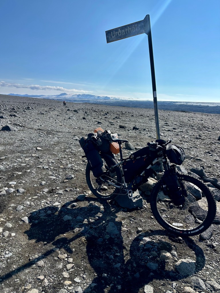
Towards Urðarháls
With some difficulty managing our feelings for the time being, I also had the time to rethink all the possibilities in terms of feasibility of our routes, making it to our car rental, our way back to Reykjavik and the corresponding hotel bookings. 3/4 of the entire plan had to change, effectively. All this whilst there were only tiny pockets of phone signal in a vast wasteland of a network.
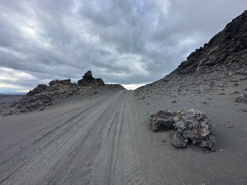
We started ascending the Urðarháls (Urdarhals) mountain through some different landscapes from what we had experienced before. Endless terrain, full of steep paths and spiky rocks of all sizes, reminiscing of the lava fields around Botni in terms of difficulty, only here the mountain was utterly barren and lunar. Having to push the bike over the steepest parts was also inevitable.
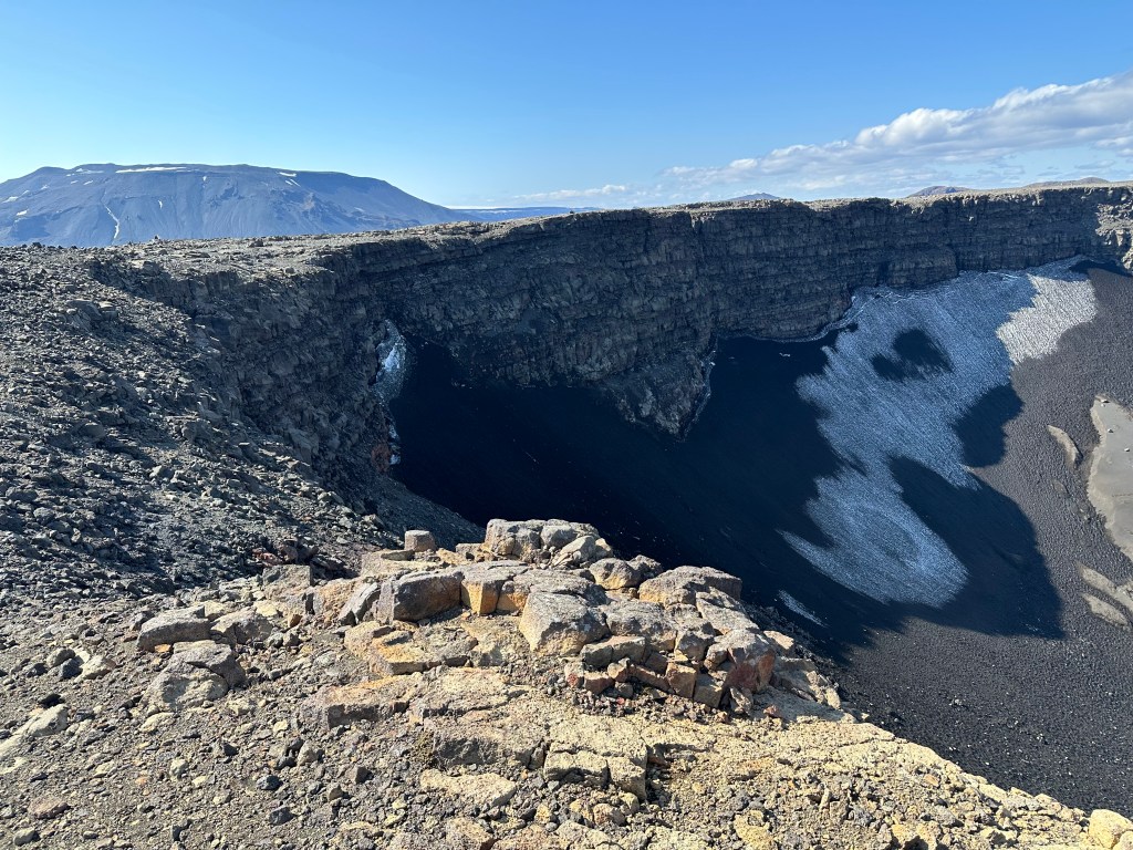
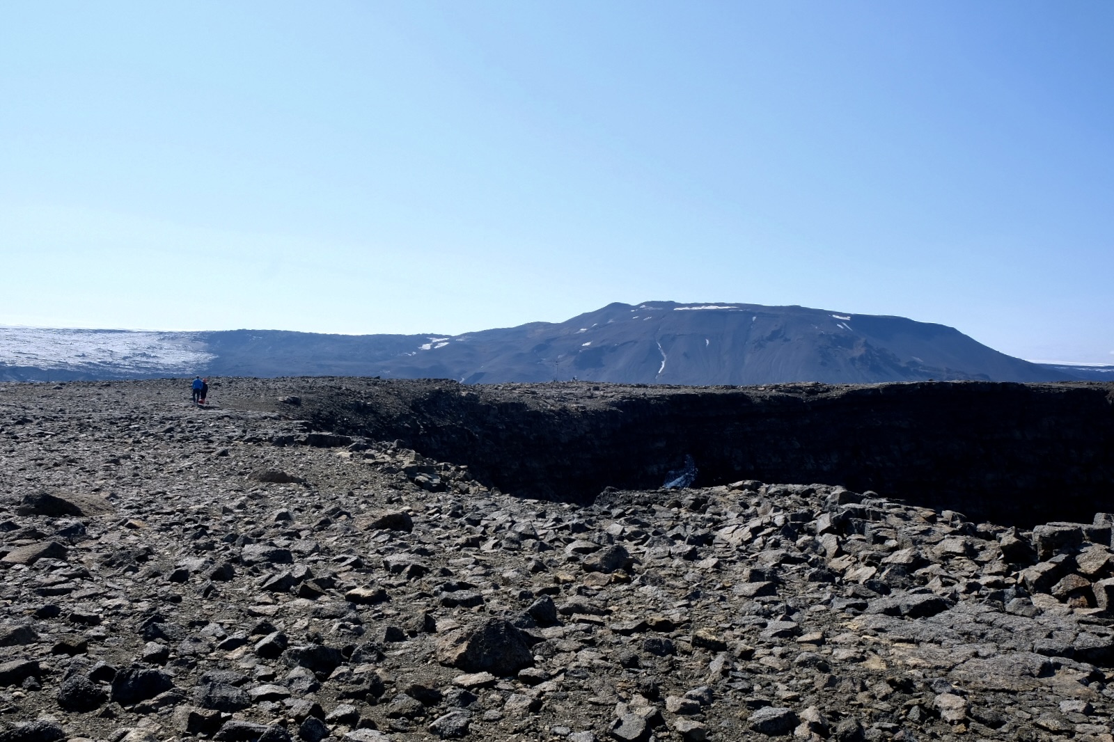
And then… At the summit, 1000m up, a huge open space, with an equally huge crater, 1100m long, 800m wide, and over 100m deep.
Obviously, this is just the edge of the crater. Why on earth didn’t I think to take a proper video of the crater, to capture a glimpse of its size?
Now; I did spend a good half hour to research all types of volcanoes and their formation, to accurately describe this one. Apparently, it’s an interglacial basaltic shield volcano (every time I go through this line, my brain always reads “intergalactic balsamic” something, which sounds like a fun dish from outer space more than a geological formation), and what looks like a caldera, it’s actually a pit crater, only a fucking humongous one. The ground consistency had been eroded by its glacial past, hence the surroundings appearing so different from all the previous terrains we had encountered. I wouldn’t know. But here it was. Now now. I think everyone should know the difference between a caldera, crater and pit crater, but I let you google that.
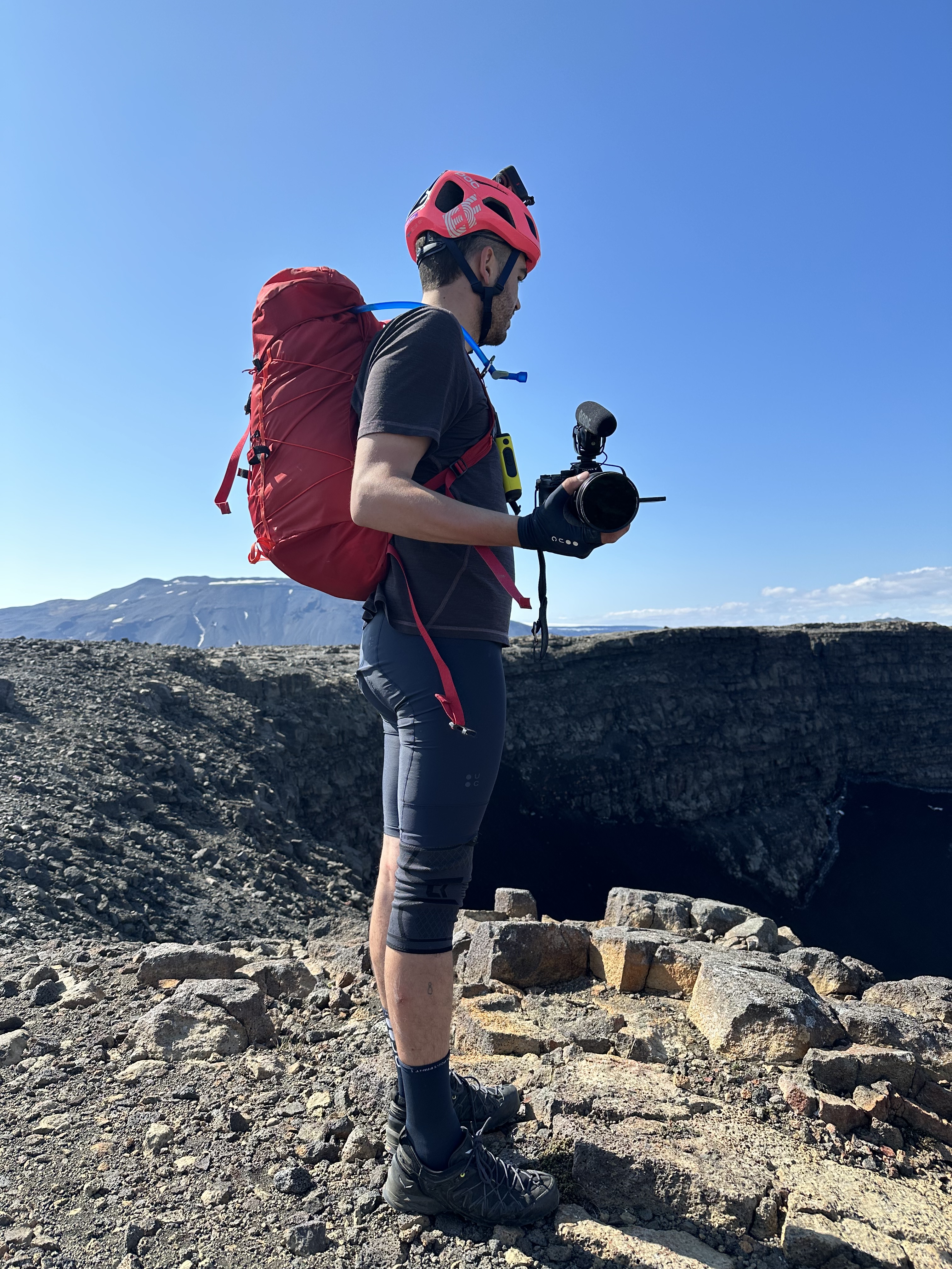
It was a rather windy day, and peering down from the edge took some guts. After marvelling for a while, I left Josh to socialise with some Netflix film crew who happened to reach the summit with their car at the same time as us, whilst I started making some calls to rearrange our forthcoming plans, and that I did, thankfully with no major issues. Needless to say thereafter, our mood was dramatically different, lifted by the spectacle of the huge crater, and from the reassurance of the new plans.
Beyond Urðarháls
Some steep ascents continued for a bit as we were heading west, around Vatnajökull; 6km further since we had left Urðarháls, we reached Kistufell hut.
This hill is not far from Kistufell hut.
Syntactically, “reached” is a verb that is too bare to make justice how hard it felt to get there, considering our exhaustion from the previous 10km since our camp. We “hyperventilated reaching” it? Oh, bear with me. Let me get the thesaurus. “Toiled?” “Knocked ourselves out?” “Worked our balls?” (and apparently, we “worked like a Trojan”. Why Trojan, Oxford American Writer’s Thesaurus? I didn’t know Trojans worked harder back in the day to get such linguistic honorific, as oppose to the rest of Bronze Age inhabitants of Asia/Europe, and even the Greeks? This is dubious). I have no photos of the area, not surprisingly, and I can only imagine why, as I was probably too knackered to bother. Anyway, when one approaches Kistufell may realises what I mean, because it involves climbing some hills, and considering all the trouble to get out of Urðarháls and through the lava fields, you kind have to stop and ponder: is it worth it?
It was worth it, in a sense; great place to stop, cook, eat and enjoy the view. Kistufell was nicer than Botni and definitely better than Dingjufell hut. And we didn’t only cooked there and ate….
Oh, don’t you start again, Toli
As a recently anointed veteran, I had no qualms this time using the loo. The tiny triangle toilet, all on its own, 100 meters away from the main hut, up in a hill, was facing the valley. Since it was pretty clear there was absolutely no one down there, I kept the door open this time.
Needless to say, i was not exactly sitting on the medieval plank seat, but crouching, yet nonetheless, having done the deed and cleaned the aftermath and as i was marvelling the view, naturally I ended up standing. Urðarháls volcano was right at the back in the east, whilst behind the hut and out of view was Kistufell mountain and Vatnajökull glacier. So, there I was, half naked, towering on top of Olympus near the stratosphere, with the breeze refreshingly airing all my bits, hands on the waist, marveling that huge array of a panorama longer than expected, longer than needed even, all that emptiness, the barren valley, the hills at the back, the movement of clouds in that infinite sky….
…it was probably the most iconic shit in the history of mankind.
And I bloody left my phone back at the hut. So, there is no evidence. Of the view I mean. (and now, hear me whispering: last time I talk about bodily functions, so please, don’t give up on me).
Squeaky mud
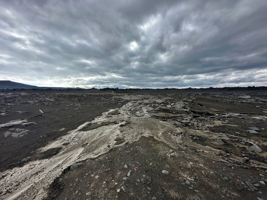
We carried on through some seriously open spaces and varied terrain, including lava fields from Iceland’s biggest shield volcano Trölladyngja, imposing in the north to our right. We did have to push the bike a couple of times, and crossed our first river of the day.
Most interestingly, we also encountered a huge area covered by rivers of mud which we had to ride through. If it were a rainy or hot day, it would have been interesting. Fortunately, it was mostly solidified yet squeaky so we carried on as normal, but it was quite unnerving at the start.
Our route took us slightly to the north, as we were heading around Tungnafellsjökull, the mini-glacier and volcano in between the two large ones, Hofjokull and Vatnajökull. Another nugget of information: most of glaciers in Iceland are concentrated in the south because of the increased precipitation which contributed to their formation during early stages.
On the aesthetics of such signs
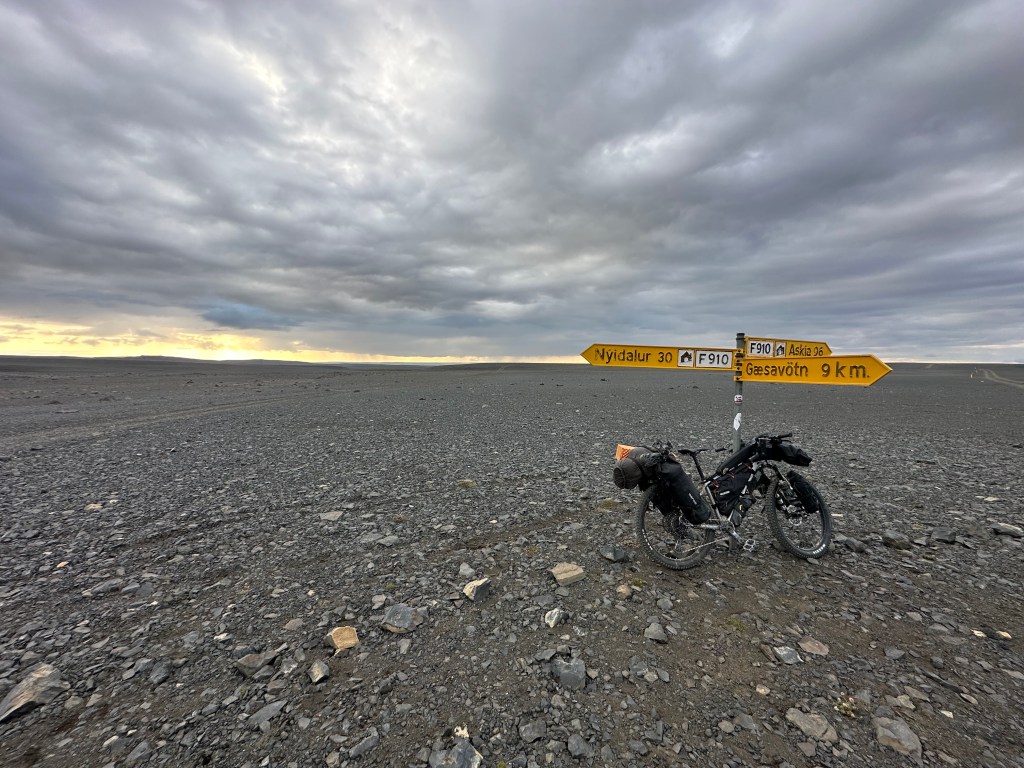
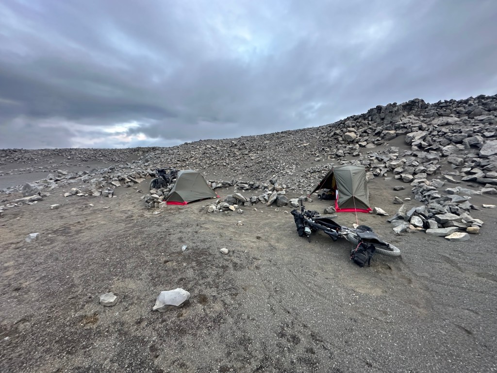
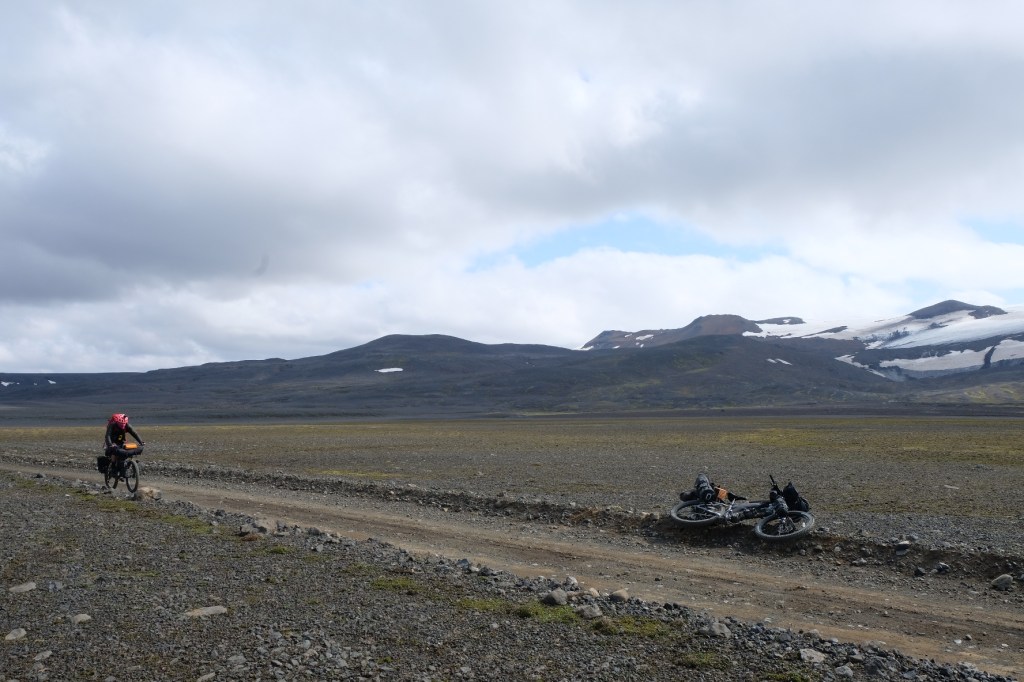
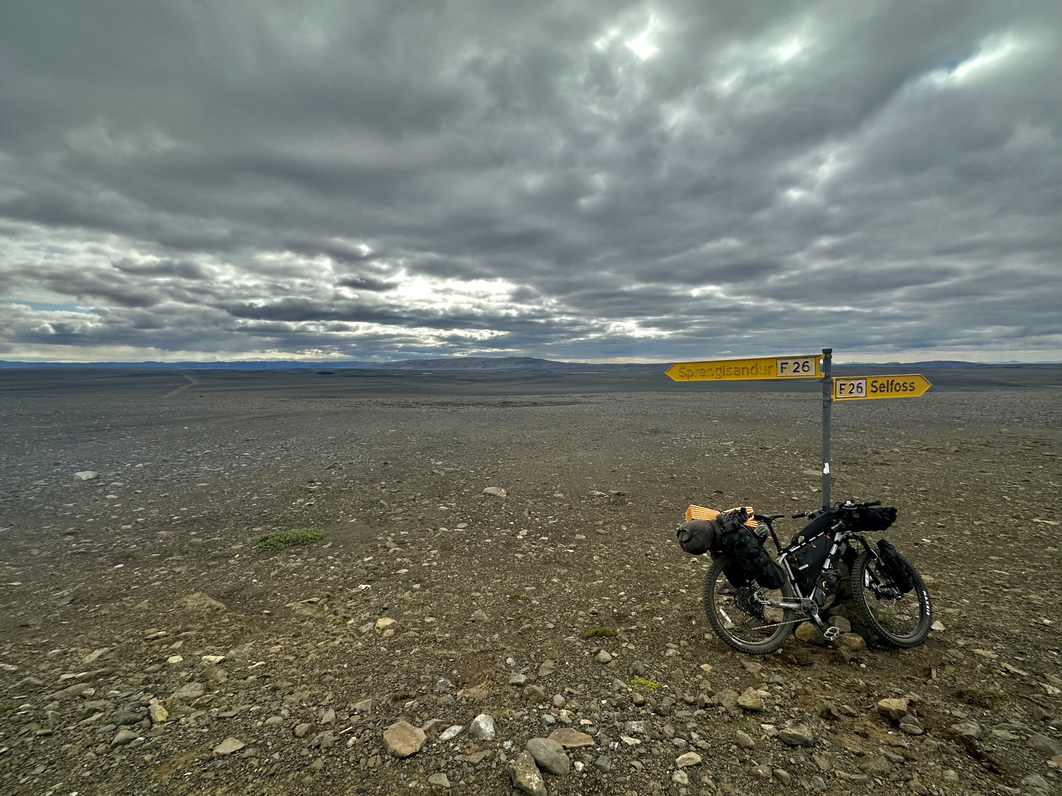
We made camp by Skjálfandafljót river, just after we reached the crossroad with F910. This was the same river we followed for a while and camped at the start of our journey, only this time there was hardly any green or anything that you would call a riverbank. There was a small patch of that road left for the following day before it would join the F26 which would eventually take us to Nýidalur.
I do like crossroad signs in the wilderness. Especially the multidirectional ones, possibly in yellow, routed in drought-beaten ground. I appreciate them, both in terms of the aesthetics, especially when there is fuck-all around them, positioned in the midst of a vast plain, but also due to the obvious psychological factor: all the GPSs and paper maps in the world can’t offer better reassurance than a big fuck-off yellow arrow with your destination written on. Then, add a sprinkle of desolation, evident by the crooked angle of the sign, possibly downtrodden by the winds, and the whole scenery is like a film-set and you, the trespasser.
Summoning the spirits
We looked for some specific rocks by a tiny hill which had been rearranged by previous campers to create a natural shield from the elements for future fellow campers to use. Josh found the place in a comment on Komoot.
The stones had been arranged as if the ancient tribes of old had tried to evoke the benign spirits of their ancestors; and then, when the malevolent ones duly responded, the living had made a run for it in terror, abandoning the artefacts behind. It was also the windiest day we had experienced in Iceland, but nothing dramatic – just annoying, setting up the tent. Not for Josh, obviously. He was in his sleeping bag, already preparing our dinner as I was still fighting with the unruly tent footprint which was assuredly giving in to the elements; or maybe the spirits.
Contrary to what you might have heard
In general, having experienced the unpredictability and occasional extremity of Icelandic climate during my previous visit in 2018 (it was November after all), we were kinda anticipating all kinds of weather permutations and had prepared well for them, even if it was summer. Concerning the wind, we got ourselves the best gear to resist it, i.e. clothing, tent, etc, and even conditioned ourselves mentally to fight off violent bloody storms. Hell, I was envisioning myself in my tent, alone and cut off due to the elements, and even worried, how would I keep myself occupied if that had come to pass.
During our entire trip in the highlands we thankfully experienced barely an hour of drizzle on day 6 and the wholly-expected nocturnal cold temperatures, which were nothing unbearable or dangerous. Wind was our main companion, yet not many headwinds. The sky was mostly clear for us, and the temperatures consistent with what one might had expected at the time of year we were visiting, adjusted only according to altitude. Nothing unpredictable, nothing extreme.
Wed 2nd Aug, F910 crossroad to Nýidalur Hut (28km, 364m elevation)
The rivers
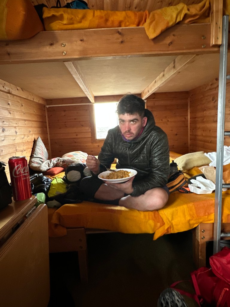
This day was probably one of the easiest, nicest and most reassuring for various reasons. Although we meant to reach Nýidalur Hut on Day 3, arriving early afternoon after a short, uneventful ride on Day 5, we found ourselves quite stoical about it. We decided to enjoy half-a-day’s worth of rest after our arrival there, and it turned out to be quite a treat. And oh my. The hut itself? I read about it being a bit different and well-equipped in comparison to the other three we visited, but this was more like 5 star experience.
But before we get to the hut….The rivers!
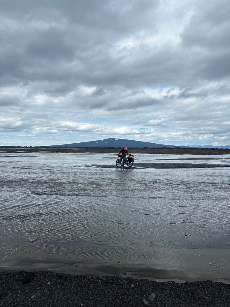
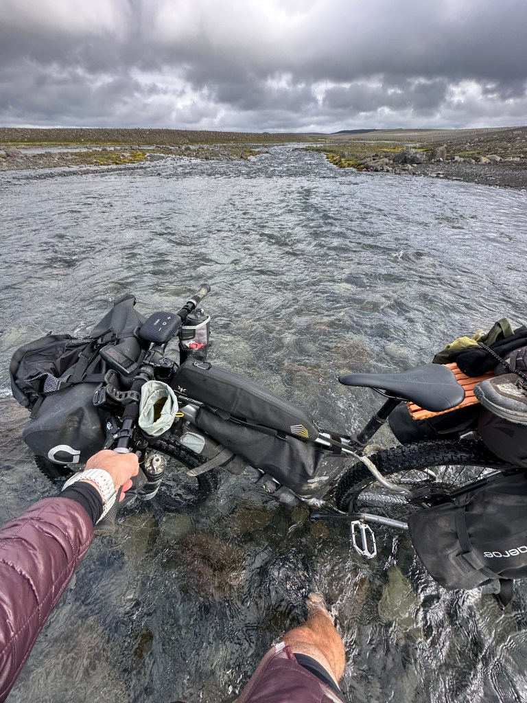
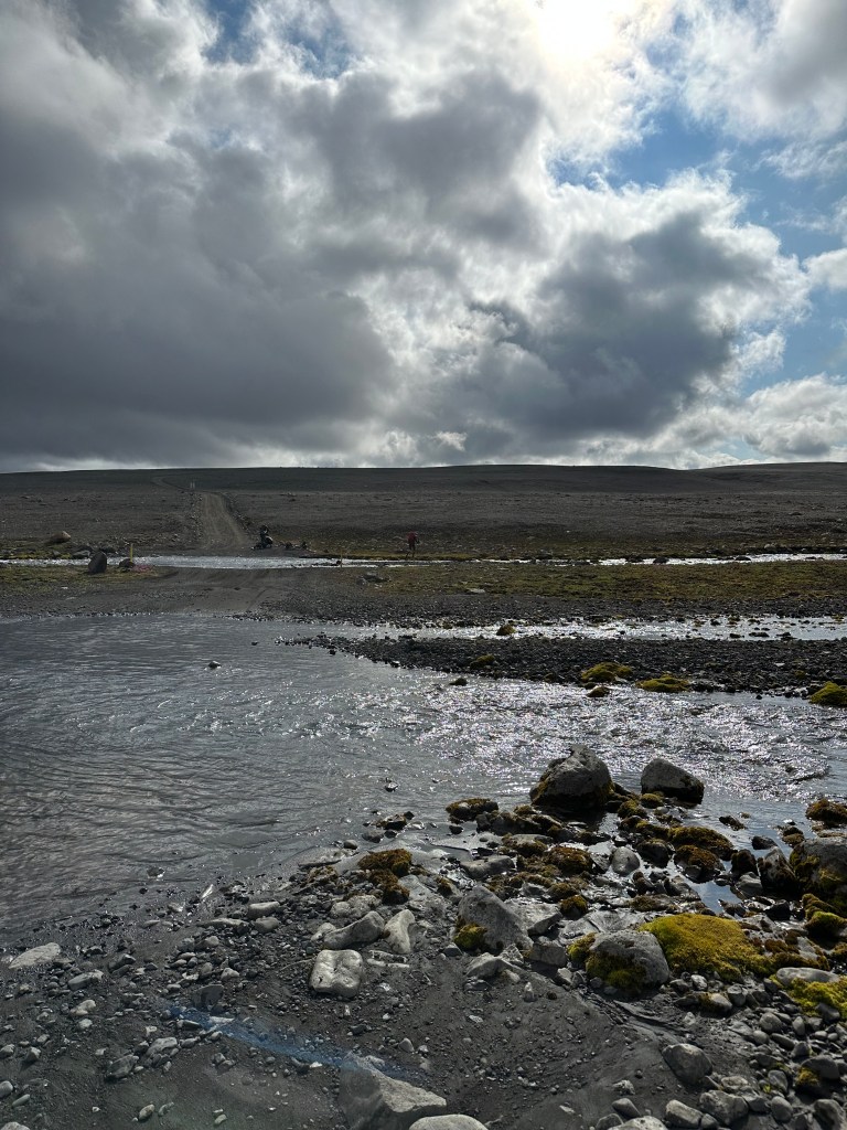
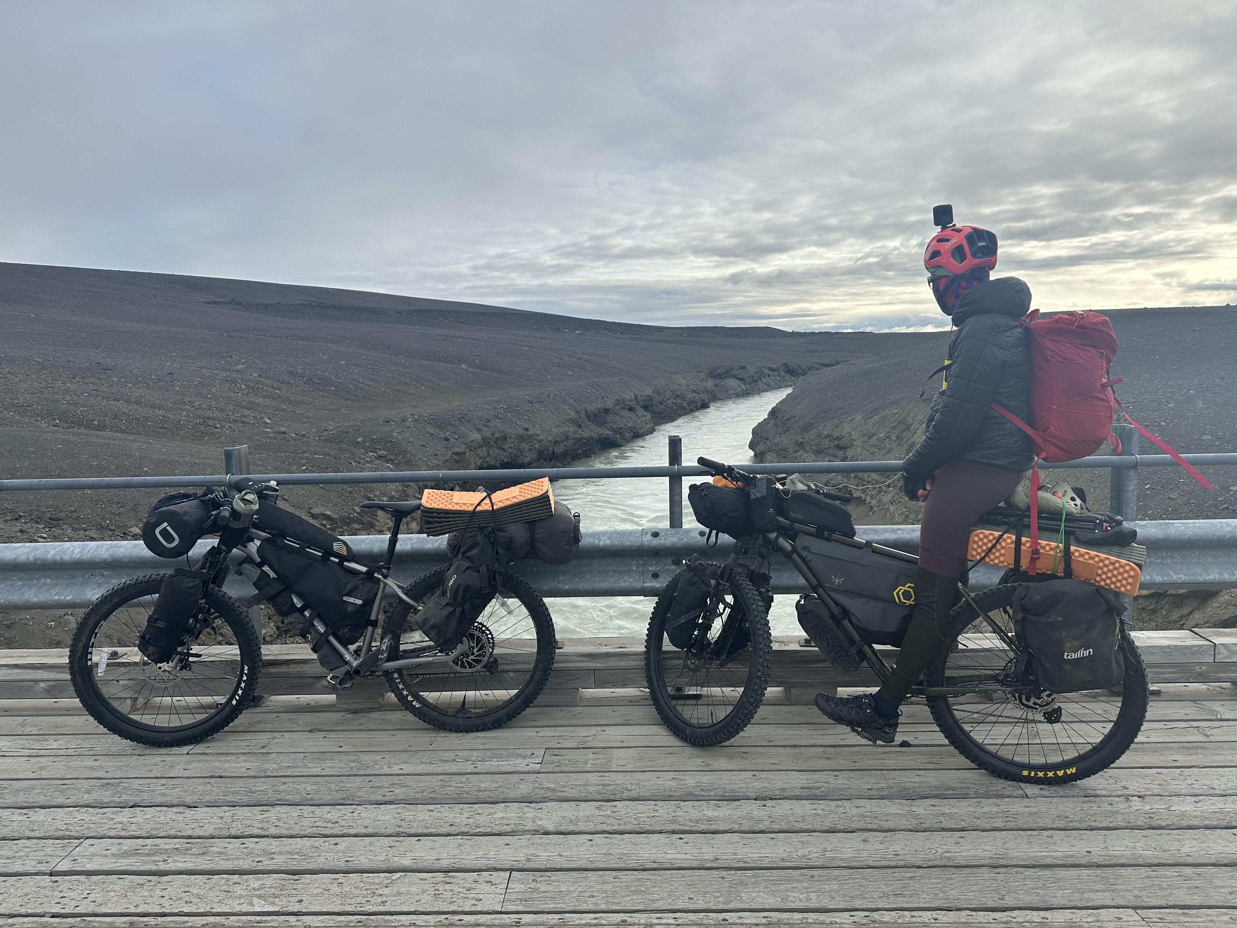
We set off from our camp, knowingly that we’d face some river crossings. In fact, reading all the blogs and watching some YouTube videos during our planning period, the river crossings were one of the three challenges I was a bit anxious about. Ok, in all honesty, I think I had nightmares about them leading up to our departure day. The other two anticipated challenges were, getting stuck in our tents for hours/days due to a violent storm and lastly, having serious unsolvable mechanical problems with our bikes.
Luckily, none of these came to pass. We were expecting some neck-deep river crossings, and what we got were waist-deep ones at worst, yet some with strong currents and super-fucking-freezing cold waters. In fact, I totally understood the description of the experience when someone in a website put it as “a burning sensation”, due to the waters being from the glaciers and all that. But all were manageable at the end.
We had a system. We did a good job by swapping our shoes and socks with our Merrels rubber sandals for the crossing, and then drying ourselves on the other side, and get on with it. And then sometimes after a small hill, 10min since we had left the water, we had to repeat everything again, as we had encountered yet another river. And then more hills and empty spaces and glaciers in the horizon.
Why don’t you just ride through then?
One thing one might wonder was why not just ride through, since some of the narrow rivers also seemed shallow enough to do so. We did that only in a couple of instances and with trepidation, mainly out of fear hitting some of the larger rocks which, being under the water, may deceptively look easier to tackle. It was not worth the risk breaking any of the spokes or fall into the water, especially if we were riding with our normal shoes. If you were to dismount just to change shoes/socks, then might as well push the bike, erring on the side caution, right?
One tip we got from our research was to avoid going against the current (obvious, but not necessarily the shorter path across), and walk towards the other side along with the current, even if it meant you are walking diagonally. On one occasion, the current was strong enough that my bike ended up floating, being totally flat on the surface of the water that is. As I was barely holding on to it rather than carrying it, it was leading me fast along with the current, so there was no fucking point resisting. Those were the times that our initial nervous laughter had morphed into some rather inventive profanity-laden outburst pretty swiftly. I took it in turns with Josh, waiting for one of us to start crossing and get to the middle, shout out any impressions (“fucking freezing, run for your life!”, or more rationally…”errr,…mate, maybe try another way, cause I am drowning here”), before the other followed with any necessary adjustments to his path.
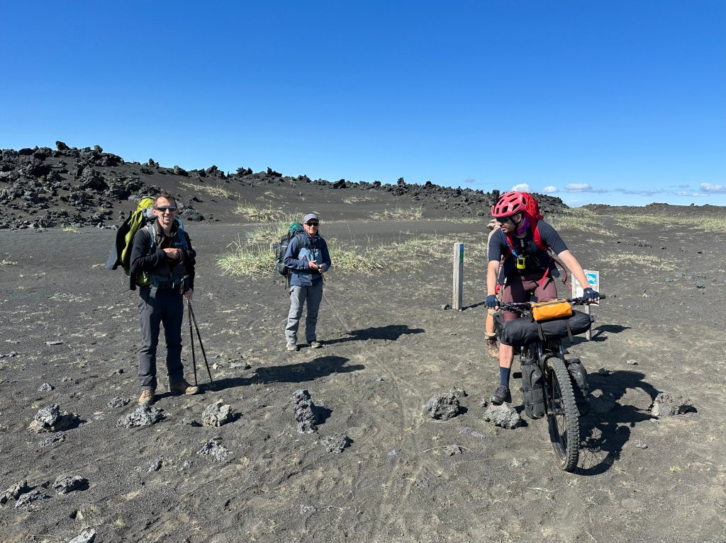
Anyhow, it was fun. ‘Cause the day was beautiful and all went well. We even encountered a couple of other cyclists we saw back at the hut or somewhere – a rare occasion – who were crossing the river similar time as us. We would notice them from afar later on our journey also.
More about volcanoes
Part of our route had taken us the nearest we could have been to the Bárðarbunga volcano in the north-west tip of Vatnajökull. We should all be familiar by now about this mouthful of a volcano. It’s a subglacial stratovolcano, more like what you would call a volcano if you saw one in a book drawing – conical. Conversely, shield volcanoes resemble mostly a shield due to their flatness, having formed from low-viscosity lava flow, whilst lava domes are like mini-volcanoes whose high-viscosity lava mostly remained close to the vent. To complicate things, cinder cone volcanoes are smaller than stratovolcanoes and their lava comes from a single opening at the top, as oppose from all different sides. We have all learned something about volcanoes today, and I am sure I will forget most of it by the time I have finished typing this very sentence.
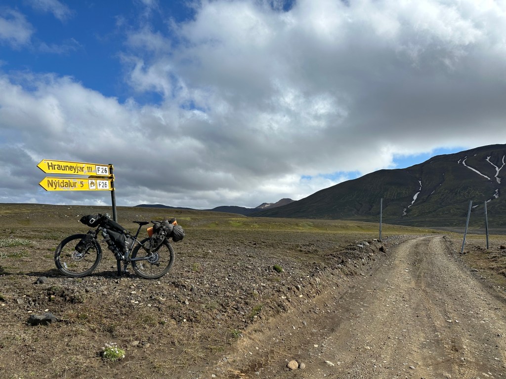
Pausing at the crossroads with the Nýidalur F26 sign, it felt nice. Any kind of sign usually helps in this type of venture. Not only for the obvious orientation, but for the psychological factors as well, sense of achievement, etc. But I have already mentioned this, haven’t I.
At 800m elevation, Nýidalur valley sits at the official borders between the Northeastern and Southern areas of Iceland and surrounded by glaciers: Hofsjokull to the West, Tungnafellsjökull immediately to the east, and further out, Vatnajökull. Come on, keep up.
In Nýidalur Hut
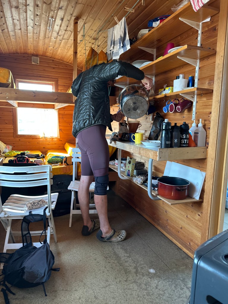
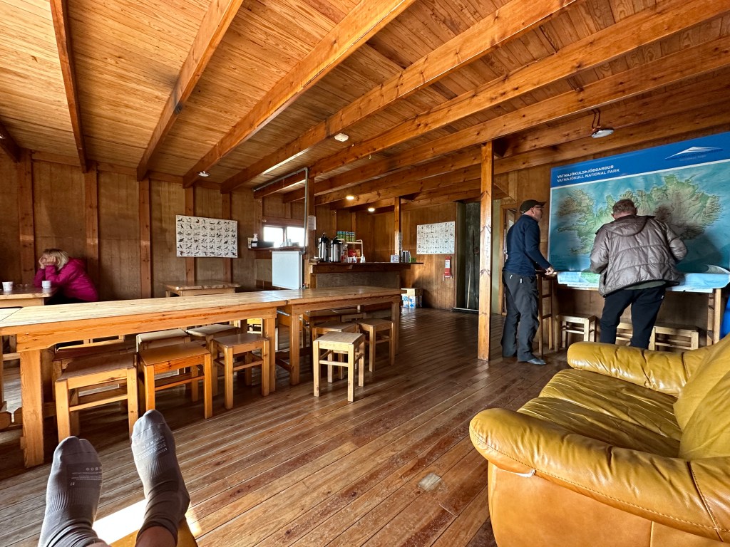
Nýidalur’s main building has a landing area, a warden’s office, a huge diner with a small counter that you can buy from a basic drink selection and snacks (yes, overpriced, but understandably so), and a well-equipped kitchen – all for self-service. On the top floor there were the equally huge dormitories. In a different building you could find some great showers and the toilets. First hot shower in 5 days then, and even got to do our laundry, although I did another boo-boo I need to mention.
Having finished with my shower, I realised I had forgotten my towel. What one to do, what to do, other than…I walked out of the showers, whose back door was thankfully facing at the fields and the mountains and the glaciers, and having first made sure that there was no one around (Josh was still in the shower), I stood outside in the cold breeze, naked, so I may dry. I even moved about to speed things up a bit. This does sound weird as I type it, but almost certainly it was not the weirdest thing I had done, notwithstanding I consider myself resourceful, under the circumstances.
I now feel you know everything.
We then relaxed at the diner, we even had a beer with our dinner! I did ask for a wine list, but there wasn’t any (kidding). Although there were not many people staying in the hut, there was kind of a buzz. There were hikers coming in and out, and a few sets of bikepackers. The ones we interacted with the most, Kevin and Stuart, were kind and super-knowledgable with the Iceland Divide and gave us some advice. They had top-notch gears and bikes, and a whole bikepacking life before them. As they had seemingly retired from their jobs early, they were living a comfortably peripatetic and affluent life.
Can I also proudly point out that I did more than just nod and smile when I met with people, as I unwittingly immersed myself in the uncharted territory of social interaction with strangers, even if it was for just half-hour, and mainly because during that brief time, I was separated with Josh, and ended up being approached and asked direct questions, which it kinda led to full blown engagement?
But what about our planned ride?
First and foremost, our biggest worry was Josh’s tendon injury which was more than just playing up. We were considering what it could have meant to carry on if it were to get worst. Secondly, our next ride to the Highland Centre Hotel was our longest planned, at 115km, a ride that everyone at the hut was trying to dissuade us from considering it, as apparently cyclists heading that way, usually split the ride in two days. And Kevin and Stuart were doing just that. Cheers people. Not that we’re brimming with confidence and optimism to begin with! Finally, as we had lost two days already, we essentially had used up our two back-up days we had planned for our Reykjavik stay, meaning, we would have to fly the day after we would have finished the rides, with no rest or celebratory time to ourselves.
Not ideal.
Anyway, back to our friendly bikepackers. They suggested to get out of this mindset of having to stick to the original plan and aim for the alternative route to finish the “divide” towards the west of Myrdalsjökull, thus ending it in Hella, rather than in Vik to the east. We did some soul searching, and went ahead and designed two new routes. What it meant was that, although we still had a tough next day ahead of us, at least we had gained back the two lost days: one because of purely diminished mileage, the other because our end destination was much closer to Reykjavik, and therefore easier to get to the car rental.
In your face, Shackleton
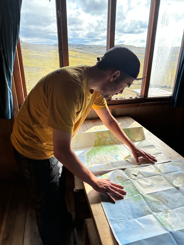
When we were at the diner, we approached the wonderful resident ranger who was freely giving advice to others (I wish I had asked more information about her remit and past experiences, or should I say, I wish I had asked Josh to ask the ranger). She subsequently also gave us some sound advice as to which road to take further south from Nýidalur, ‘cause there were more than one option.
It was something cool having someone as her, guiding us by running their index finger across a huge map on the wall, and subsequently, us, like explorers, going over our own maps and pencil our route going forward. I am saying this in a very naive way, I know, but I usually have fuck-all to do with maps and navigation in the wild, and neither had Josh. So, considering where we had been and where we were, this day in general felt really good.
On another note, to top this up, an Icelandic lady found my pouch with my passport which was left at Botni hut (from Day 2) and arranged with me to meet in Reykjavik at the end of the trip to get it back. And the weather continued to be fucking sunny throughout. All felt really good. Hurraaay!
Thu 3rd Aug, Nýidalur Hut to The Highland Centre Hotel (111km, 1157m elevation)
Out of Nýidalur valley
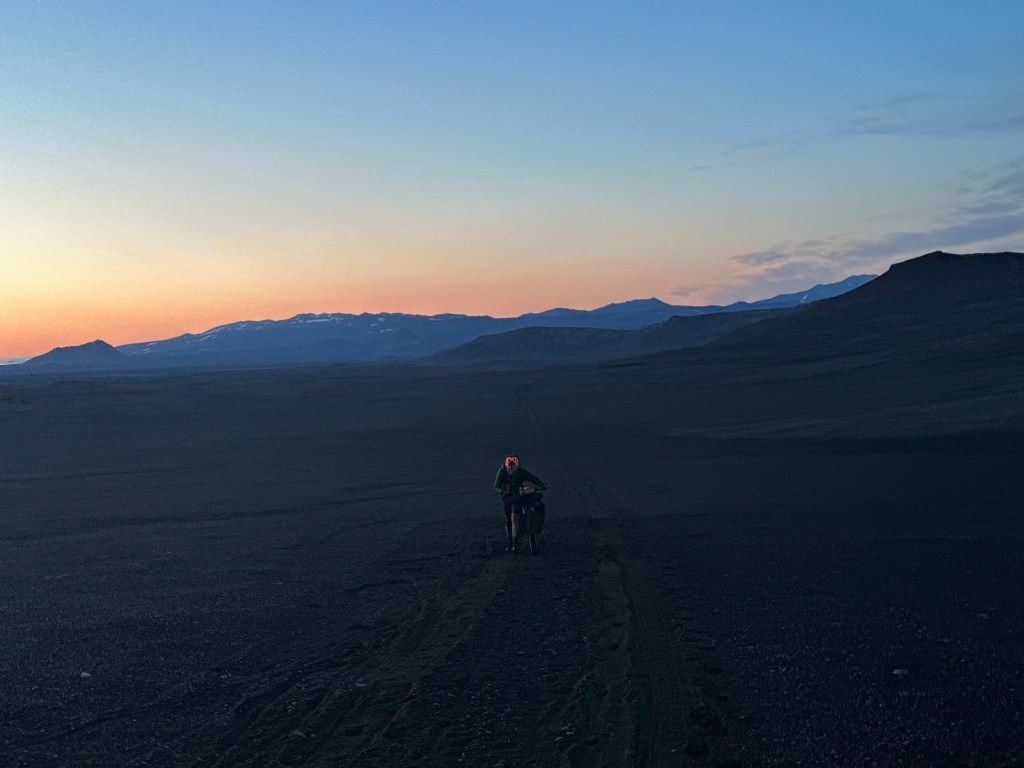
It was something like 4am when we set off from Nýidalur. We had absolutely zero sleep. Although we were pretty apprehensive about the mileage ahead of us, by now, having revised our plans so drastically and regained our two days stay in Reykjavik (secretly, I was exceedingly happy about this, cause our whole endeavour would not have been properly appreciated without some quality time in the capital, booze, great food and all that; conversely I was also irrationally upset for not sticking to our original route), it felt a huge weight had been lifted off our shoulders. And as Josh was back in excellent mood, subsequently, I was in an excellent mood also.
Yes, yes, this is actually taken around 4am…
To begin with, the deemed light in a cloudy sky and the wooden structures against the misty peaks as we were setting off were something out of a Nordic crime drama. Yes, it was also fucking freezing, and we were a bit nervous, yet this only had strengthened our resolve, and in itself, it made the day special.
Every ride during our tour thus far had some part that would be edged into my memory, through personal interpretation of our experiences or a bit of more straightforward reaction to the awesomeness of the natural beauty in front of us. My highlights therefore were a mixture of both: the lava fields around Botni on Day 2, however extraordinarily hard they were to cross; the reflective moments at the valley in front of Dingjufell mountain on Day 3; the torturous 10km ride in the twilight at the end of Day 3; the ascend to Urðarháls and the trophy pit crater on a windy, sunny day on Day 4; and chilling out in Nýidalur on Day 6.
Our penultimate ride though was kinda special throughout, although it was not all fun and games.
Glaciers
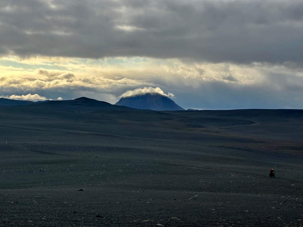
Soon, we had the sheer openness of space and the determination of getting this right. Music blasting, speed and efficiency at display. Gradually, the horizon started being subjected to various imposing manifestations of the glaciers. Hofsjökull to our right, and Vatnajökull to the left, were so awe-inspiring that they were worth all the effort to cross that enormous desert in between. We did spend some time taking photos and videos and enjoy the view.
The majority of glaciers in Iceland are of the ice-cap type (as oppose to small cirque and dome-shaped glaciers), meaning the glaciers are covering a flat area like a small-size ice sheet of the types found in polar regions. Vatnajökull is the largest by far in Europe and covers 8,300 km2. Its average thickness is half kilometre, albeit it is up to a whole kilometre in some parts.
The ice cap conceals volcanoes and mountains, including Iceland’s tallest mountain on the south side, Hvannadalshnjukur, whilst numerous glacier rivers flow out of it towards all directions, some of which we already had an intimate relationship with.
I can’t be sure, if this peak in the photo was Kistualda (767m) or its taller neighbour Nyrdhri-Haganga (1267m) as they were both to our left as we were heading south. This website is awesome for such investigations: https://peakery.com
Vatnajökull national park, which also includes the surrounding areas, is the 2nd biggest national park in Europe (Yugyd Va National Park in Russia is the biggest, apparently) and one in three Unesco World Heritage sites in the country, the other two being Surtsey Island and Þingvellir (Thingvellir) national park.
Music to my ears
As we were crossing this big stretch, as well as during many more parts before and after, we were relying a lot on our music to get through it. In our early riding days, I tried to emulate Josh with his wired earphones, expertly arranged around his attire and gear, like Lachlan, but it turned out to be not as conducive to safe travel for those with ADHD. It took me half-year to learn to keep my eyes on the road when I started cycling during lockdown, and coordinate that focus with any admiration for my surroundings without ending my life too. With a couple of trials, I discovered that by listening to music through earphones I was prone to losing myself, seemingly more so than others. As a safer alternative, I have accustomed myself to this incredible speaker attached to my handlebars (Tribit 2), which is not only good for blasting punk or alternative music, but also full-blown Mahlerian orchestration with little discernible distortion to the (cyclist’s) ear. And of course, listening to depressing Greek “art songs”, Hadjidakis et al., was a common occurrence during these days, allowing me to sing out loud, without any misgivings.
On the way to the hotel
Just before Lake Kvislavatn at 565m elevation we left F26 and turned west, around the lake before we connected back with F26. That detour was down to the advice of the ranger who said that this would be “easier” way to get to our destination, as the alternative road was apparently much harder. With the glaciers’ view firmly behind us, our landscape also changed concerning what we had experienced before. There were endless straight roads; but also we didn’t have to cross rivers carrying our bikes, as there were bridges! After the detour, and with lake Kvislavtn to our left, all we had in front of us were direct lines, up and down the hills, and beautiful skies and clouds and blue waters and, and, and….oh, you can look at the photos, I suppose.
Back at Nýidalur, those we ended up engaging with, added a perspective that made everything so much more sense. The south is “easier” to cross than the north, considering the latter’s inconsistent paths, various lava-fields and ever-present sand.
The route to the south was consisted mostly of dirt roads and occasional sandy paths, but it was more straight forward. Notwithstanding, there was one characteristic in some parts of the roads that made everything interesting: what one might characterise as “speed bumps”, but this was a considerate trial mostly for next day’s ride, so stay curious until then.
At some point we rejoined with the F26, 62km into our ride. At the crossroads, we had lunch which was consisted of Pringles and chocolate bought from the hut. Just before Krókslón lake the road turned into tarmac for 12km until the hotel. This part was super windy. So unfair, right? Looking forward swapping the gravel and speed bumps with some tarmac, only to unwittingly take the path of most resistance.
At the hotel, we had a humongous meal, our first proper one since Akureyri. Confusingly, there are two hotels near to each other owned by Highland Centre, and we arrived at the wrong one, but they kindly transferred the booking for us to the one whose reception desk was under my elbow, as my weary existence was still clinging on. I felt I would have chained myself at the lobby area like an environmental protestor, only without necessarily being smothered with crude oil, should they have insisted we needed to jump back on our bikes to get to the other hotel, however close that might have been (I still have no fucking clue where it was by the way).
For months during the planning process, we were in contact withone incredible GuðrúnMaría, the hotel’s employee, arranging for a parcel with supplies to be sent to us there in advance. What a saint! But what a palaver also! The confusion was that Icelandic postal services, having initially assured us they can deliver to the highlands, we belatedly discovered they could not. They never had. But the formidable Guðrún had arranged for someone from the hotel (her boss!) to pick the parcel from Hella on our behalf. And so the parcel was waiting for us there, upon arrival. Unbelievable. Incredible people at that hotel, throughout, as in most places in Iceland.
Fri 4th Aug, The Highland Centre Hotel to Hella (81km, 187m elevation)
Last ride commencing
At the hotel, we gladly used the sauna in the morning, had some cooked breakfast and nonchalantly prepared our bikes for the last time. We took our time, so it was already afternoon that we ended up setting off. We also caught up with Kevin and Stuart, our friendly bikepackers from Nýidalur, who had split their ride from the hut into two days, and were arriving at the Highland Hotel as we were setting off. It was amusing to hear them exclaiming “you made it!“, adding to it that they were wondering if we would’ve made it at all.
We did not inspire much confidence, I reckon?
We had the opportunity to throw away anything we didn’t need/want for our last journey, Josh mended his leg, and off we went. The last stretch was markedly different because we were moving away from the highlands and started seeing people, cars, etc, and not in a Six-Sense type of sense. Throughout the previous six days, it is not much of an exaggeration to say that when on the road, we had scarcely encountered living beings, aside from very few occasions.
In the entirety of our trip (when en route of course), we were riding the vast expanses on our own, sometimes in silence, sometimes with music, other times chatting. In general, the sound of our riding against the various surfaces, the occasional profanity (fuck fuck fuck fuck this hill) and our hyperventilating was the main disturbances of the eerie peace.
Radio silence
Cycling “alone” in silence is something I assume you get used to, albeit you’d need to be content with your inner voice. Is it stereotypical to say, introverts might fair better at it? I can go about for ever without music, sometimes without even noticing my surroundings, because that inner voice may end up narrating entire lifetimes, exploring spacetime and universe, and all this, just as an introduction to the main story it attempts to convey.
Where was I? Oh, yea. One thing to point out though is that I have aways wondered how pairs of cyclists, whenever we came across in any of our past rides, were riding next to each other all the fucking time, seemingly anyway.
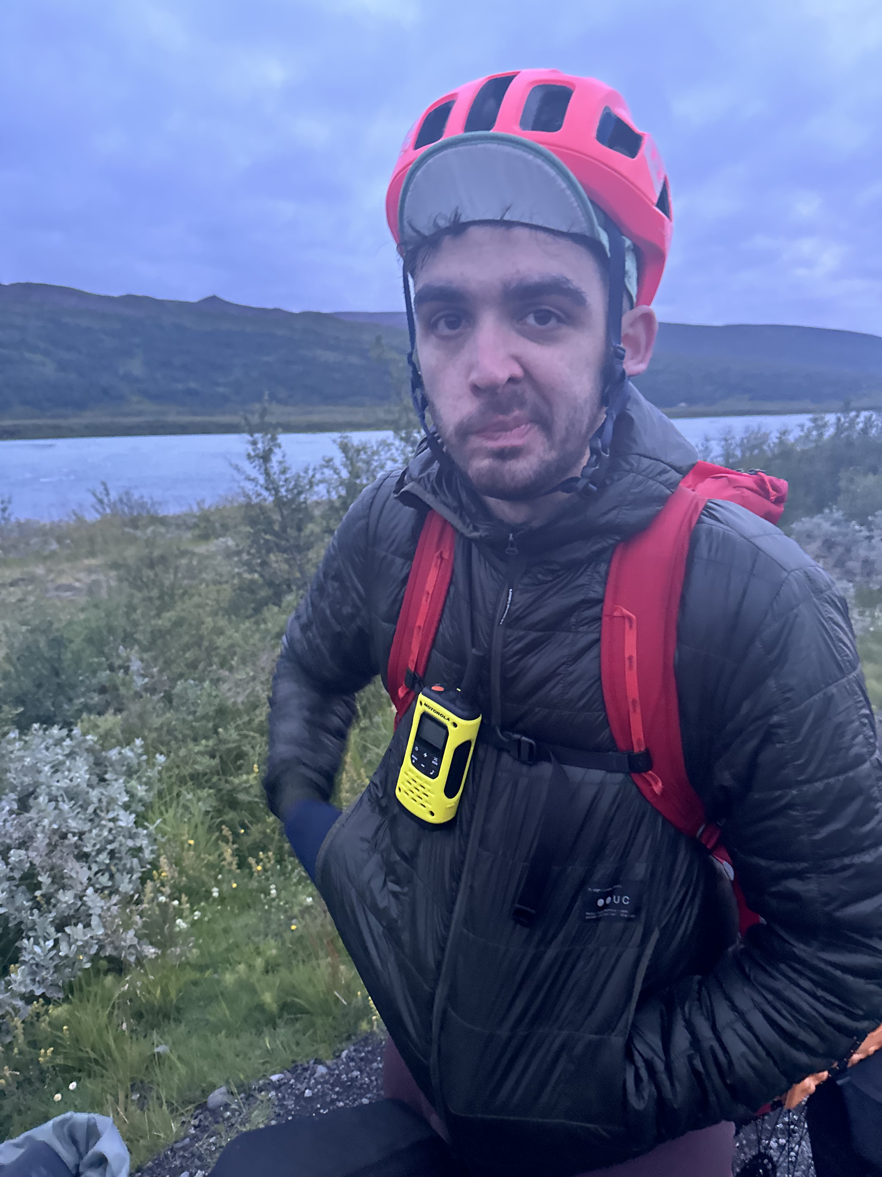
Josh and I, do enjoy our own separate time in these long rides, and I think it is very healthy, mentally. Besides, in Iceland we were equipped with radios, mainly in anticipation of not having any phone signal. They were incredibly useful to use to inform each other for any unplanned stops, or point towards a natural marvel or something. Josh also used it to give some directional commands when he was flying his drone or operating the fancy camera.
Nonetheless, the radios also allowed us to regulate our speed according to our endurance which would vary, depending on “mistakes” made on food/water intakes or just due to our mood levels at a particular time: sometimes Josh would be 1-2 km ahead, sometimes I would, and we would both “allow” this to happen without too many worries, even when we were lacking phone signal. In general, our endurance levels are similar indeed, notwithstanding I mind hills far less than he does, and on tarmac, he is certainly a speed junkie when riding downhill, in contrast to my overcautious approach.
What were those “speed bumps” after all, Toli?
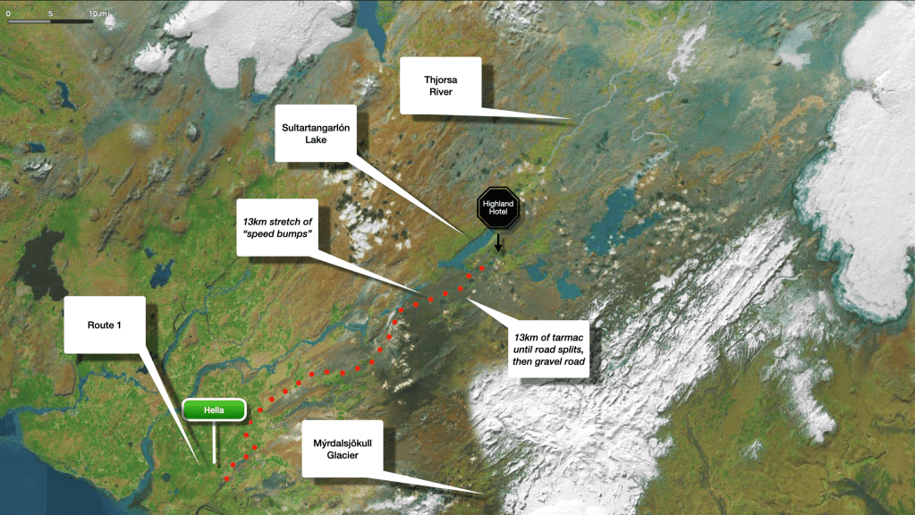
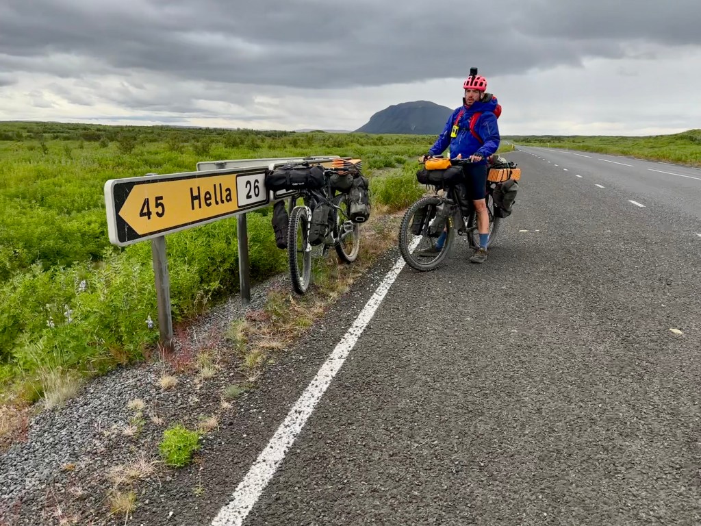
Soon after lake Sultartangarlón, 13km from the Highland Centre Hotel, the road splits. Turning to the west, route 32 and then 30 would have eventually taken us to R1 that swiftly leads to Selfoss and then Reykjavik. Further 15km into our ride, the road splits again, towards the east as per our initial plan from when we started the Divide. That would have taken us around Mýrdalsjökull and Karla volcano, for around another 174km until we would have reached Vik.
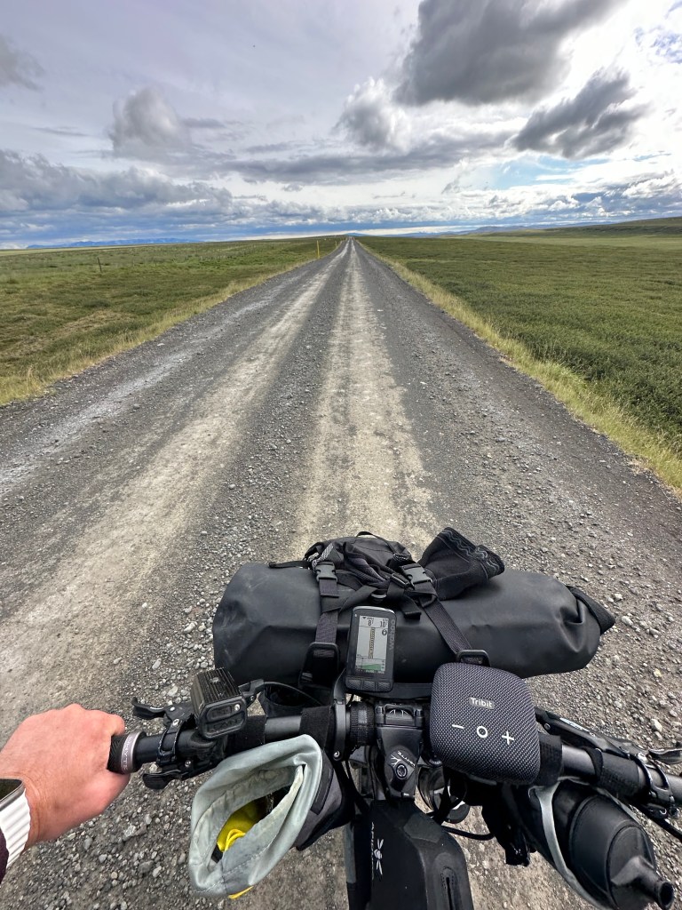
Instead we carried on straight, and with Mýrdalsjökull to the east, towards Hella. Since the 13km mark from the Highland Hotel the ride leads to a gravel road which had in accumulation the most pronounced “grooves”.
(Now now…It took me a while to put into words the experience riding on that road, so do appreciate it please)
By “grooves” I mean those unintended, inconsistent, yet ever present “speed bumps”; some bigger, some smaller, some fucking humongous, sometimes appearing across the middle of the road, some others unpredictably popping up everywhere on our path. Trying to avoid them can make one veer towards the edge of the road only to be met by sandy ground. As one can imagine, one may have the illusion that it can be OK to continue on sand (and sometimes, it can better in comparison), but conversely, the bike can also be suddenly rendered immobile or proceed to display some spectacularly skidding, as we had experienced numerous times on our tour. One may think we were lucky having a hardtail mountain bike, but…considering I still feel a bit traumatised by grappling with those groovy gravel roads, all I can recall is how we were continuously scouting ahead to assess the size of the bumps, then try to get through a tiny path in between them, or gradually move towards the sides again if all fails, only to start sinking in quick sand and then “fuck, fuck, fuck”, get back to the bumps and ride along the waves until the nauseating feeling pushing us yet again back to the sides. And don’t get me started on how my arse felt that day.
There is a reason why there is hardly any evidence of our experiences during those hours (except a couple of photos and one video); it was nigh-impossible to hold a heavy bike such as ours with one hand whilst trying to take a photo with the other as it was riding the waves. The video below is taken on an iPhone with excellent stabilising capabilities, so it does not do justice how much I was shaking holding it.
Where is the brass band?
40km off Hella, we crossed very near Hekla’s lava fields in south-east. This most unnecessary nugget of information is purely given because I like the name Hekla. Well done whoever named it.
Eventually, we arrived in Hella, and reconnected with Route 1 for the first time since we had left the outskirts of Akureyri. The crooked triangle sign and subsequent photo with my bike miserably leaning against it are quite unremarkable, but considering our state of mind, this might as well have been the universal sign for Earth, and we had just landed back from our trip to the Moon. The only thing that was missing to mark the significance of the occasion was a welcoming crowd for a ceremony, lively waving their tiny flags and holding “welcome” and “you made it” banners, and the mayor of Hella with their full civic regalia, robes, gold chain and all, givings us reluctant hugs, and a brass band, playing a transcription of “Eye of the Tiger” song, whilst unsmiley, hardened elderly people offering us home-made Icelandic cakes and hardball glasses with neat spirits. This ridiculous train of thought could have gone long way sill, but in truth, that imagery would have been quite proportional if it were real.
We were utterly exhausted and had convinced ourselves that we would get a room into a hotel, but unbelievably, every single one of them were fully booked. Honestly, there are more than a dozen hotels in that town, but no rooms were available in any of them that night. We were that desperate not to set camp, that after scrabbling about in the infinite corridors of the internet and having called some of the hotels, we would also go there and speak to the receptionists and see if begging would have made any difference. It would not. In summation, no welcoming committee, nowhere to crash, no feather beds to allow those enervated bodies to rest and the weary minds to unwind.
I mean, hadn’t the good people of Hella been told of our arrival?
Anyhow, our compromise was to end our tour in an organised camping, next to a fancy hotel with a restaurant, which we took full advantage for dinner that night and breakfast the following day. Should we have followed through with our plan, we would have gone to Bakki airport in the morning, closer to the coast, and that probably would have been the true end of the ride, as an alternative ending to Vik. However, the people from Hertz insisted getting the car to us rather than having to wait for us to cycle all the way to Bakki.
And that’’s that.
Here is our revised tour, from the beginning; cycling in red.
We then unceremoniously headed straight back to Reykjavik to expire, err, I mean celebrate. We had two days there, and took full advantage of them, but I won’t go into details. This blog was mostly about the wilderness.
See? I can be succinct and to the point if I wanted to. At least at the very end.